
Menu

 4
km
return
4
km
return
 90
mins
90
mins
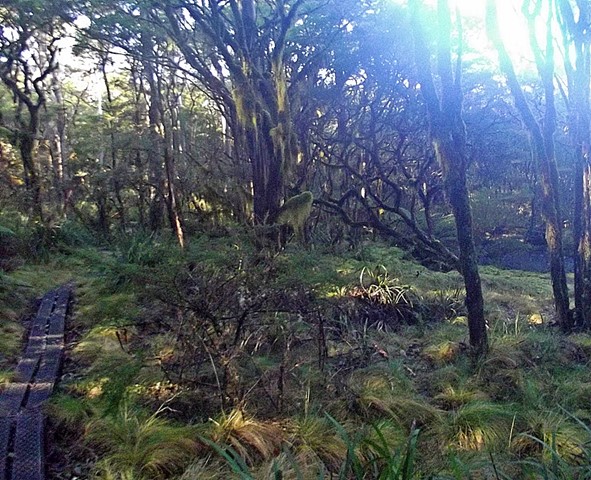
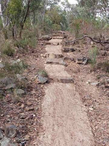
Tea Tree Falls Walk
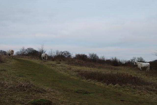
This one starts from the Thungutti camp area adjacent to the Styx river in the New England NP NSW. Listen out for the Honey Eaters amongst the Banksia and Tea Tree and walk through forests of Hanging and Sphagnum moss that form on the path you walk. A true walk back in time to Gondwana land. If time allows, you can continue to Point Lookout.
 10
km
return
4
hrs
10
km
return
4
hrs
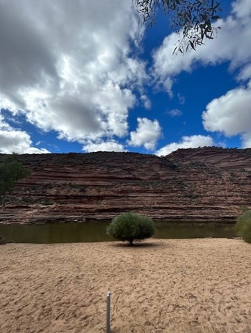
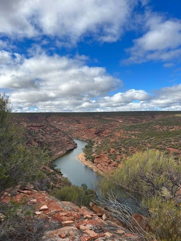
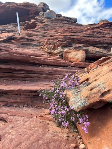
Kalbarri Loop Walk
Starting at the iconic Natures Window, follow the loop anticlockwise over the ridge, then into the gorge along the Murchison River. Monkey your way across some spots and keep an eye out for white markers to keep you on route.
The terrain is a mixture of rock, dirt and sand - you will get it all.
BRING PLENTY OF WATER EVEN IN WINTER. The rocks in the gorge emit so much heat even in mid-winter so ensure you bring more water than you think!!! I can't imagine doing this in the summer.
Bring swimmers for the many dip spots along the way.
 1000
km
77
days
1000
km
77
days
Bibbulum Track
This is a walk in planning for mid 2012 and I am looking for up to 3 walking partners. The pace will be gentle (I will be 57yo by then)and I have walked only 120km of the Alpine Track (Main Range and Jagungal)as experience. I am cautious in my expectations and will be well prepared. I am not, however, trying to break any records. I prefer people who are flexible in their attitudes, easy going, able to laugh at themselves and also able to leave any gung-ho male bravado at home!
 800
m
return
45
mins
800
m
return
45
mins
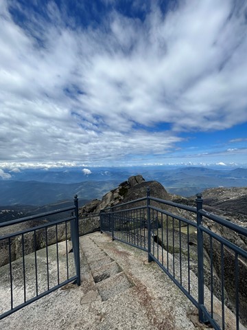
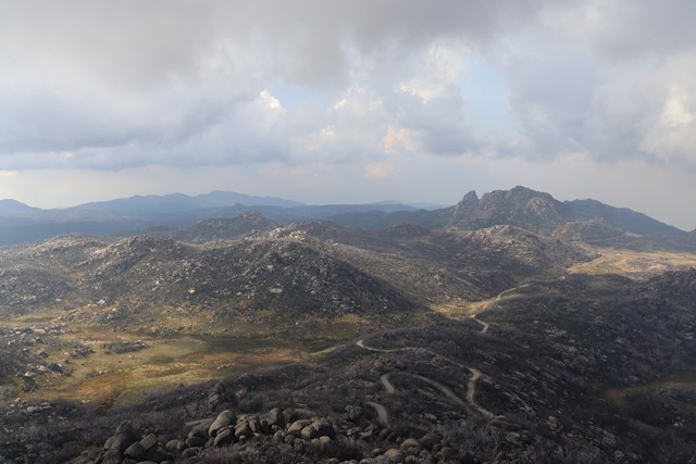
The Horn
Perched on top of granite cliffs at the edge of the Mount Buffalo plateau, The Horn is a unique landscape. Dotted here and there among the great boulders are the twisted, sun-bleached trunks of Snow Gums that have succumbed to bushfires over the years. A stone lookout shelter perched precariously atop the cliff overlooks all of this as well as the surrounding mountains far below. The Horn (1723m) is the most prominent peak of the Mount Buffalo plateau. A dirt road to The Horn picnic area which can be closed at times usually during Winter. Then the walk starts at the end of the paved road and carpark. Here, there are already magnificent views!
The walk itself is a steep ascent, narrow in places, with stairs and long hanging rock to limbo under.
Short in distance but you will work up a puff! Insane panoramic views from the top!
 100
m
return
10
mins
100
m
return
10
mins
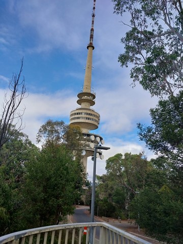
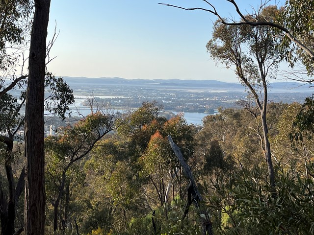
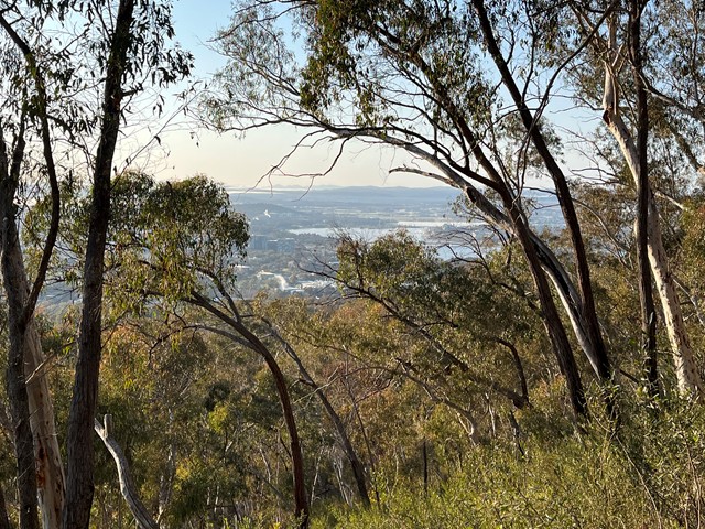
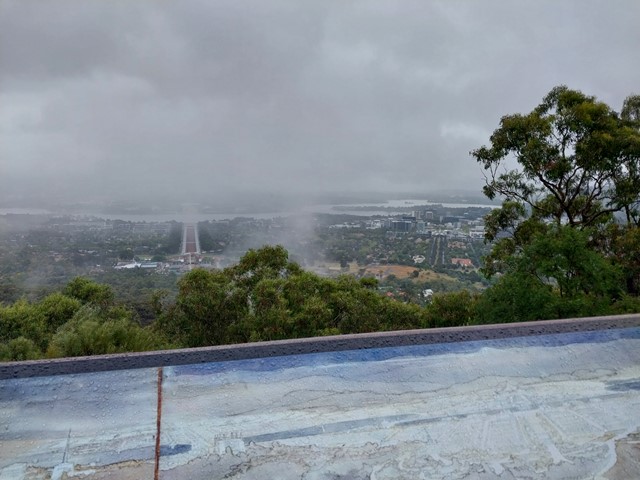
Mt Ainslie Lookout
Walk, cycle or drive to Mt Ainslie Lookout with spectacular views over Canberra.
 15
km
return
5
hrs
15
km
return
5
hrs
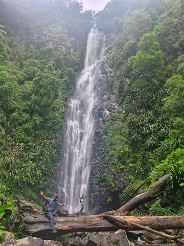
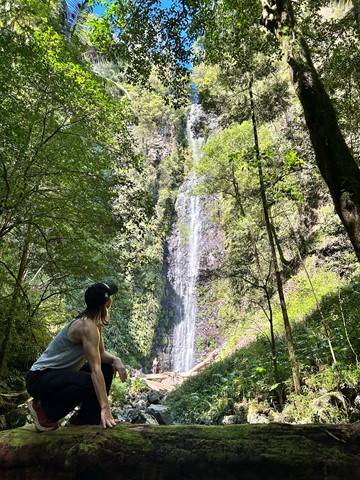
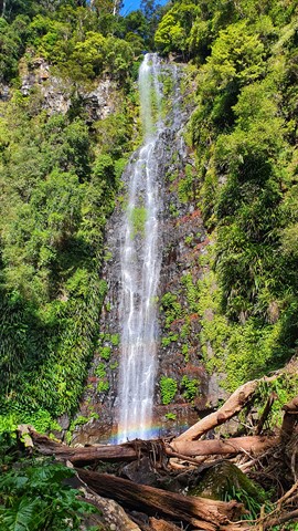
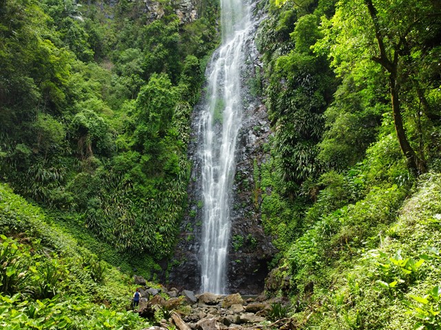
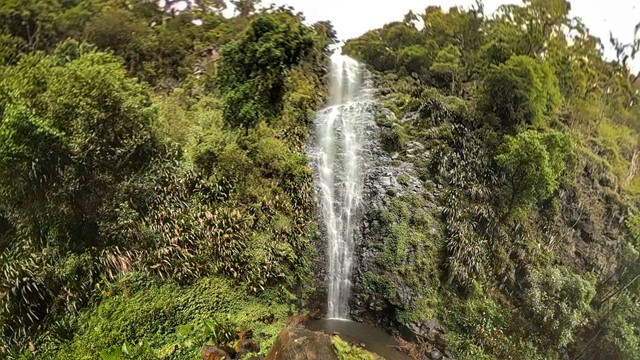
Larapinta Falls
This walk is an extension of the hike to Westray's Grave (see https://www.aussiebushwalking.com/qld/lamington/westray-s-grave-from-christmas-creek) along Christmas Creek. The other known walk on this route is to the Stinson crash site.
Without a word of hesitation I would recommend that if you go to Christmas Creek you must check out Larapinta Falls as they are absolutely spectacular and made even more special by the fact that you can swim right under the cascade which is over 30 metres high.
Absolutely worth doing, the falls are spectacular and there is nothing like swimming under such a large waterfall. Beautiful scenery though it is fairly well out in the sticks so be prepared.
 16.3
km
return
8
hrs
16.3
km
return
8
hrs
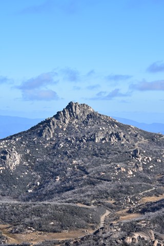
Mt Gudgenby
A full day bush bash and scramble to the picturesque summit of Mt Gudgenby - the 9th highest mountain in the ACT.
 3.6
km
return
1
hr
3.6
km
return
1
hr
Wetland Trail
Well signed trail through the wetland. Concrete surface/ gravel surface. Occasional seating areas. Partly wheel chair friendly.
 5
km
return
2
hrs
5
km
return
2
hrs
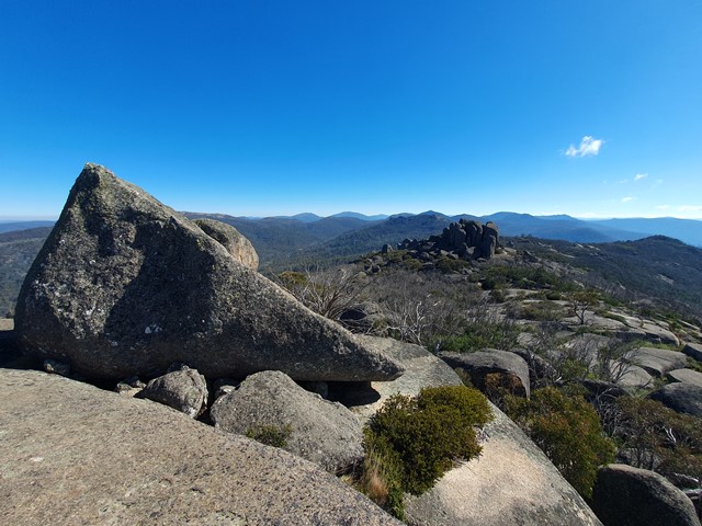
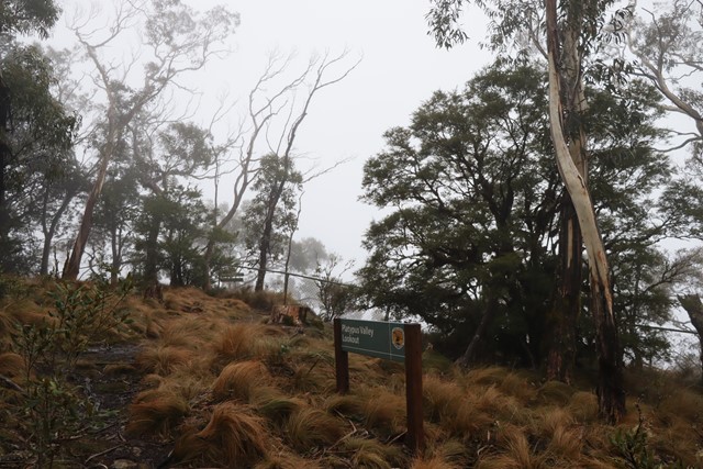
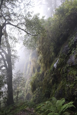
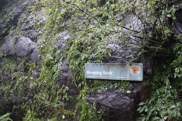
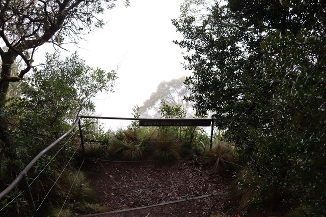
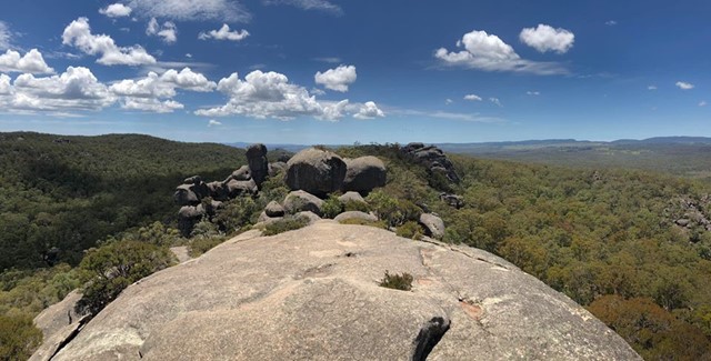
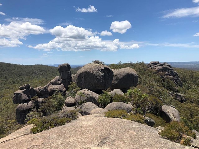
Eagles Nest Walking Track
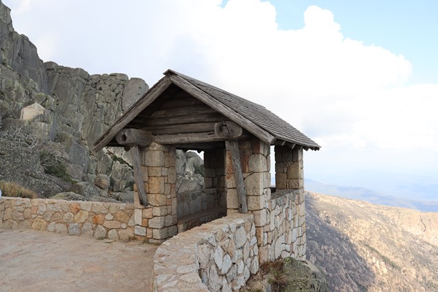
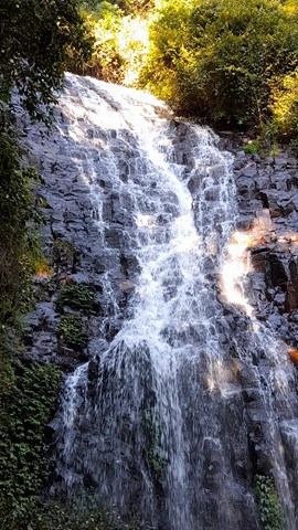
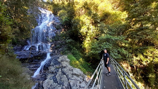
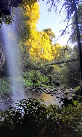
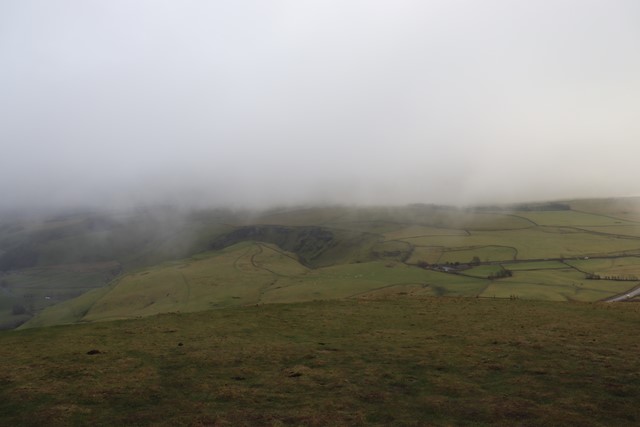
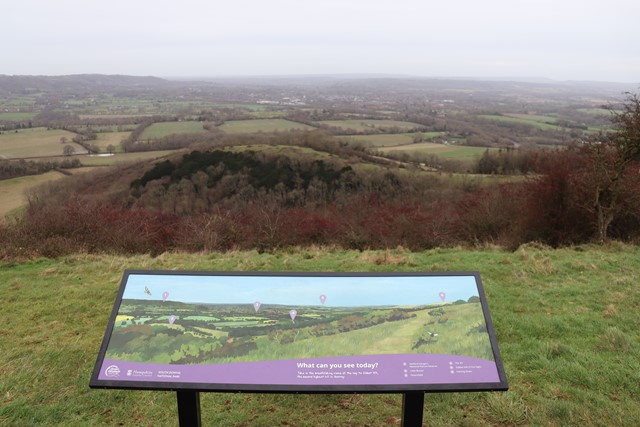
See the best that the park has to offer in just a few hours on the Eagles Nest walking track. Experience World Heritage rainforest, snow gum forest and outstanding views.
Eagles Nest walking track takes you on a journey though World Heritage rainforest and snow gum forest, with outstanding views along the way.
Climb down into the ageless world of Gondwana rainforest. Marvel at the huge mossy Antarctic beech trees covered in fungus and dotted with beech orchids. You’ll see water trickling from the rocks, often freezing and forming chandeliers of ice that glisten in the winter light.
Climb back up to the escarpment near Banksia Point and return to Point lookout through the snow gum woodland. Look out for the brilliantly coloured crimson rosellas as you wander through the forest. In spring, you’ll be treated to the beauty of snow gum woodland carpeted with snowgrass tussocks and colourful wildflowers.
Finish with the breathtaking views from Point lookout, knowing what incredible natural wonders lie in the wilderness below.
 20.8
km
return
8
hrs
20.8
km
return
8
hrs
Barokee to Native Dog Creek
Barokee to Native Dog Creek walk links Cathedral Rock National Park’s two campgrounds and takes in Woolpack Rocks and Cathedral Rock. The track follows the Snowy Range and is a moderate grade apart from when you climb the rock features. There are a number of options for tackling this track, which can be started from either Barokee campground or Native Dog campground. You might leave your vehicle at one end then camp the night at the other and retrace your steps the next day, car shuffle for a one-way day walk, or hike the return 20.8km in one go.
9.5
km
return
4
hrs
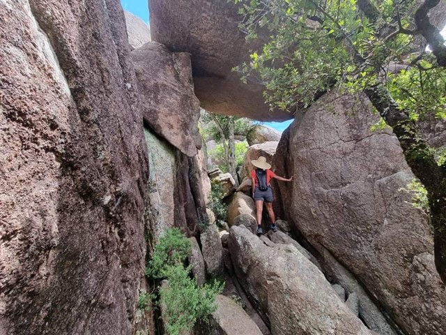
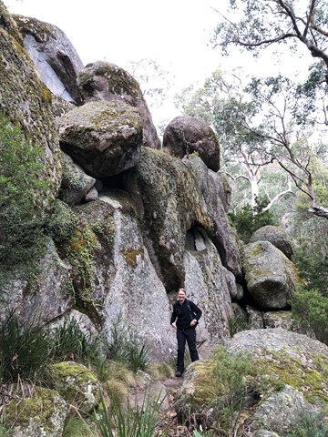
Woolpack Rocks
Barokee day use area to Woolpack Rocks and return. Trail leads along Cathedral Rock loop, than up the ridge through an impressive boulder field and towards the Woolpack Rocks with excellent views from the top.
 5.6
km
return
3
hrs
5.6
km
return
3
hrs
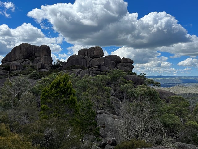
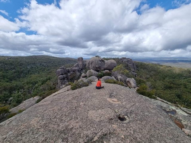
Cathedral Rock
The Barokee campground is the starting point for this walk. It is accessed via a rather rough unsealed road off the B78.
Cathedral Rock track is an exciting and challenging walk, near to Barokee campground and Round Mountain, offering scenic views across the New England Tablelands from the summit.
Hike up Cathedral Rock to sit on a natural throne perched on 100m of stacked boulders and survey your kingdom. The nearby Round Mountain is the highest point of the New England Tablelands, although only by a royal whisker at 1579m.
 6.6
km
return
2.5
hrs
6.6
km
return
2.5
hrs
The Wonga Walk
This rainforest walk is on a sealed track for its entire length, making it quite easy. However the track does descend to the bottom of the two waterfalls it passes before ascending to the start again. If following the track in a clockwise direction you will come to Tristania Falls which you pass in front of via a bridge. Crystal Shower falls is also seen from a bridge, and there is a track to walk behind these falls as well. The track can also incorporate the Walk with the Birds Boardwalk.
 2.8
km
return
2
hrs
2.8
km
return
2
hrs
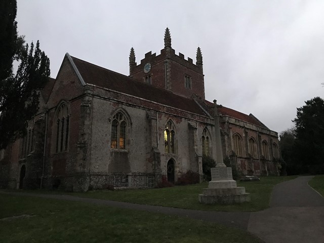
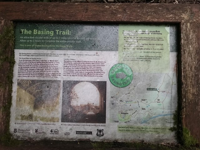
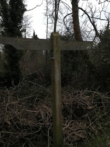
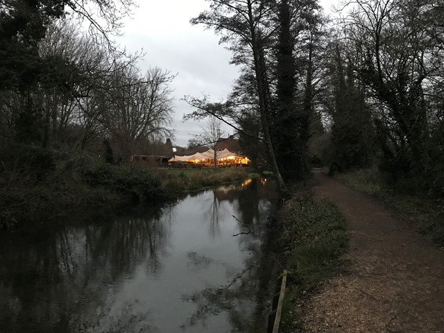
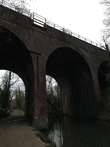
Old Basing Circular
The Old Basing Circular (2.8kms) is a shorter section of The Basing Trail (11.3kms) which features the highlights of the lovely Old Basing section. This walk features the historic Barton's Mill which is now a lovely pub where you can still view the mill wheels and water race, the River Loddon and the Railway Viaduct that crosses it, St. Mary's Church, Basingstoke Common and finally the historic collection at Basing House including The Great Barn & the ruins of Basing House itself and the older early 12th century motte and bailey castle's earthwork defences.
 7
km
return
3
hrs
7
km
return
3
hrs
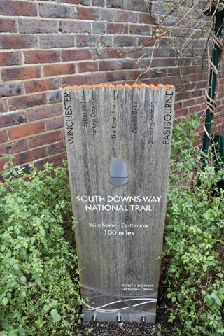
Winchester to Saint Catherine's Hill
Start in the heart of historic Winchester before following the first few hundred metres of the 160km Southern Downs Way along banks of the River Itchen before following the Itchen Navigation into the Southern Downs National Park at Saint Catherine's Hill (97m).
 7.9
km
return
3
hrs
7.9
km
return
3
hrs
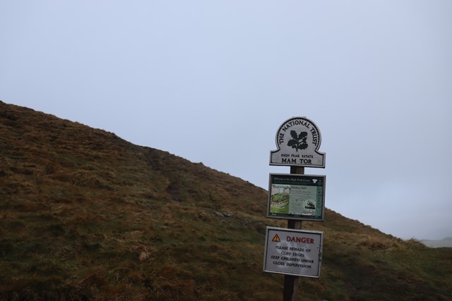
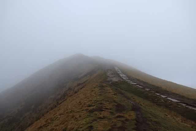
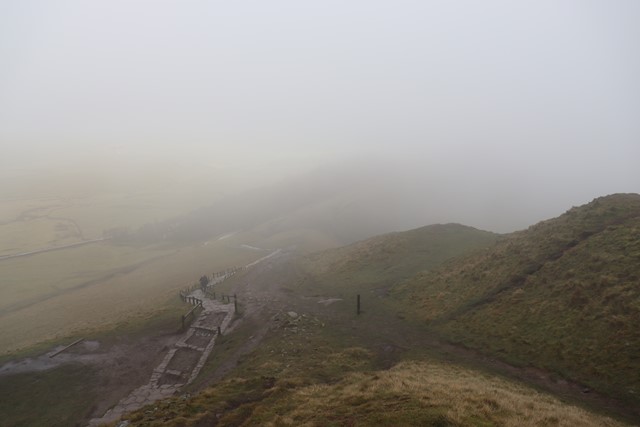
The Great Ridge: Mam Tor to Lose Hill
A classic walk in the Peak District National Park the pride of which is the iconic Mam Tor (516m).
 3.5
km
return
2
hrs
3.5
km
return
2
hrs
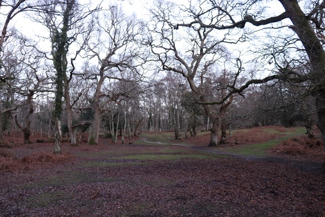
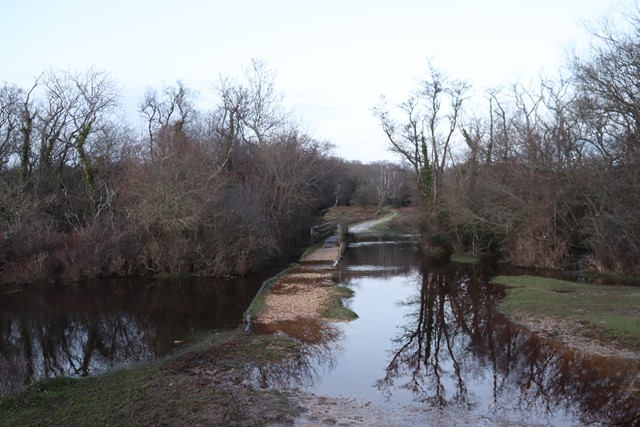
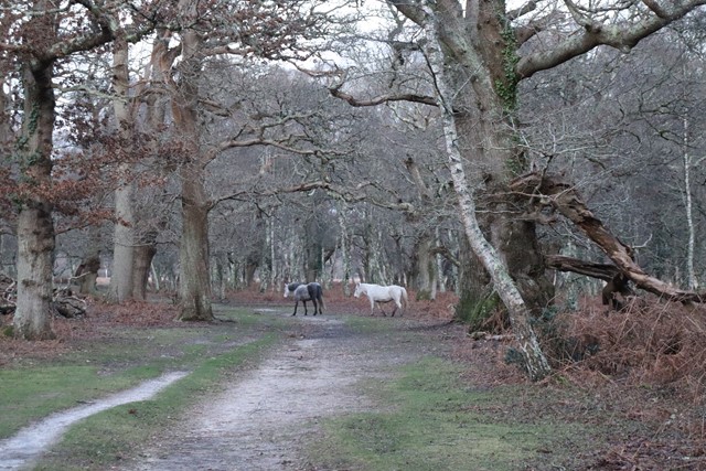
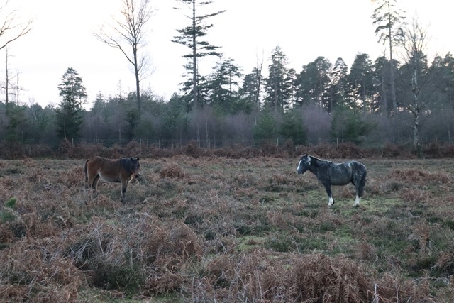
Pig Bush and Penny Moor
This short circular walk takes you through the Pig Bush and out onto the moor also passing over Shepton Water which can be quite boggy to cross over. A nice introductory walk to the New Forest National Park. Make sure to keep an eye out for New Forest Ponies.
 2
km
return
1
hr
2
km
return
1
hr
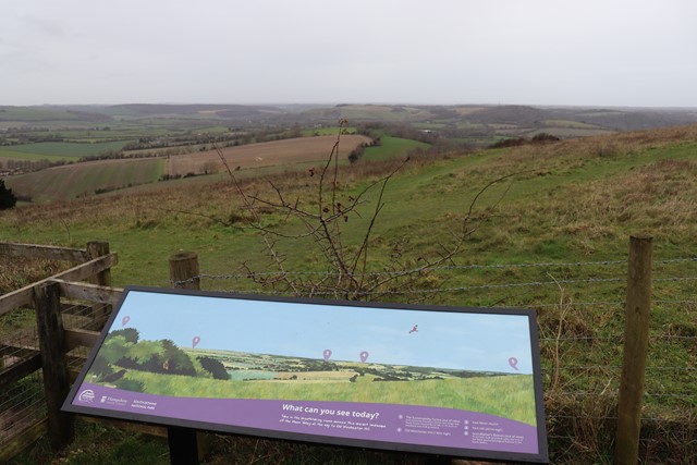
Butser Hill
Butser Hill at 271 metres classify's as a Marilyn (peaks and hills in Britain with at least 150m prominence) and is the second highest peak in the Southern Downs National Park.
 5
km
return
3
hrs
5
km
return
3
hrs
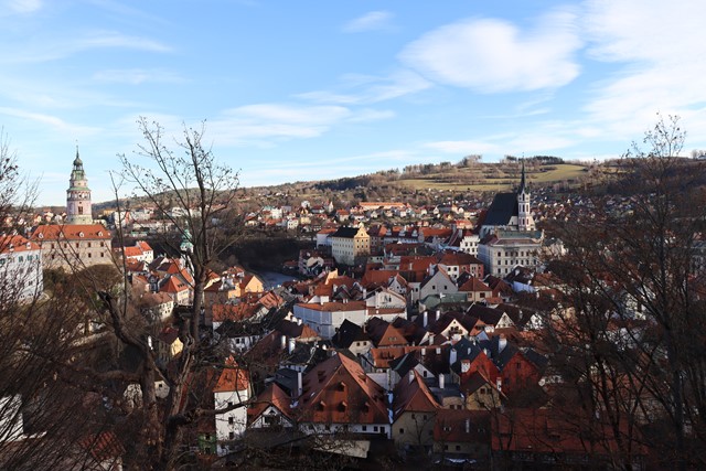
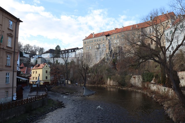
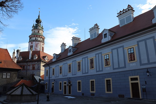
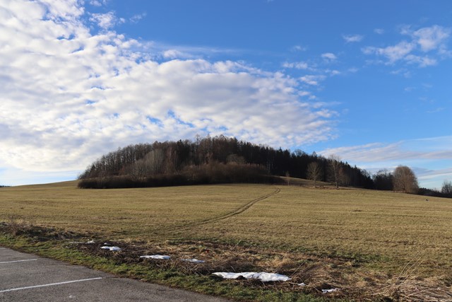
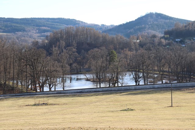
Český Krumlov & Ptačí Hrádek (Bird Castle) Loop
A loop around the scenic town of Český Krumlov and the surrounding countryside which includes the castle gardens, a pilgrimage route, Ptačí Hrádek (bird castle) a forested hill which hides a monument and historical water reservoir remains.