
Menu

 1.6
km
return
1.6
km
return
 1
hr
1
hr
Battery Hill
This hill first served as the Harbour Master’s signal point for shipping. Local militia units established the gun batteries and built the concrete fortifications that were completed in 1887. The bluestone powder magazine was built in 1860 to store explosives used in the construction of the river wall.
 500
m
return
30
mins
500
m
return
30
mins
Soldiers Memorial
Soldiers Memorial gives us time for reflexion as you gaze out over the town and inlet before heading out to Prady’s Lookout to view the Southern Ocean crashing in.
 1.5
m
return
1
hr
1.5
m
return
1
hr
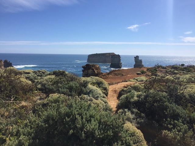
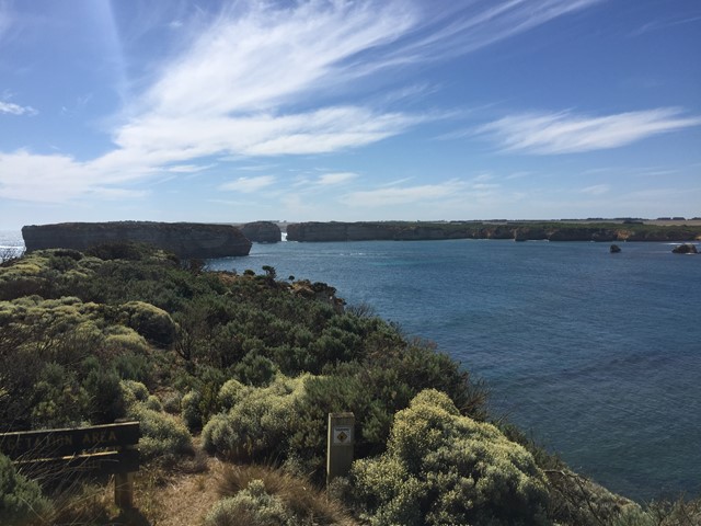
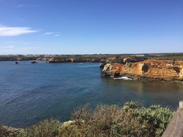
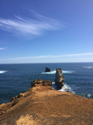
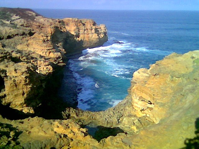
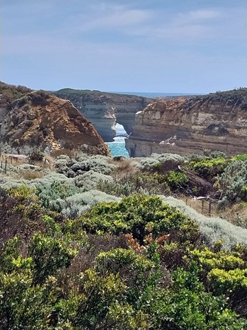
Bay of Islands
The wild Southern Ocean has carved a stunning collection of rock stacks and sheltered bays with clifftop walks, scenic lookouts and small beach coves.
Perhaps overshadowed by Port Campbell and the Twelve Apostles just down the road, the Bay of Islands offers an equally spectacular experience without the crowds.
 815
m
return
30
mins
815
m
return
30
mins
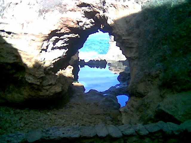
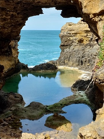
The Grotto
This weathered hollow limestone formation is one of the most evocative and intimate of the coastal formations of the Great Ocean Road. Part-blowhole, part-archway, part-cave, its serene rock pools and smooth boulders frame the sea views on offer.
 218
m
return
30
mins
218
m
return
30
mins
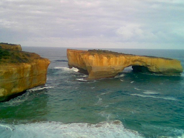
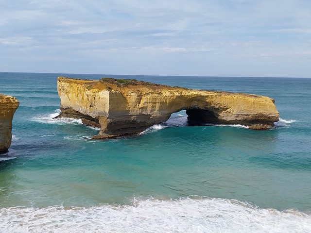
London Bridge
Originally a natural archway and tunnel, London Bridge collapsed on 15 January 1990 and became an isolated arch no longer connected to the mainland. Two tourists stranded on top of the remaining island had to be rescued by helicopter.
 1.7
km
return
45
mins
1.7
km
return
45
mins
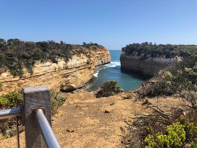
Loch Ard Gorge
Multiple walks around a spectacular beach which is the site of the Loch Ard Shipwreck in 1878 where only two teenagers survived.
 11.5
km
one-way
4
hrs
11.5
km
one-way
4
hrs
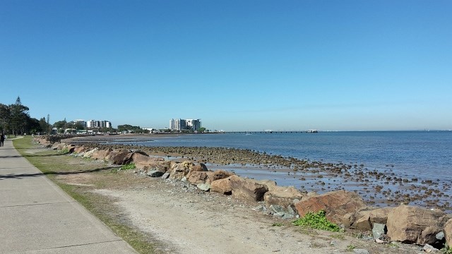
Moreton Bay Cycle Way (Woody Point to Scarborough section)
Coastal track along sheltered beaches with eye-popping ocean vistas and fascinating hertiage sites.
 11
km
one-way
4
hrs
11
km
one-way
4
hrs
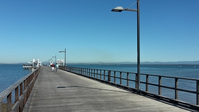
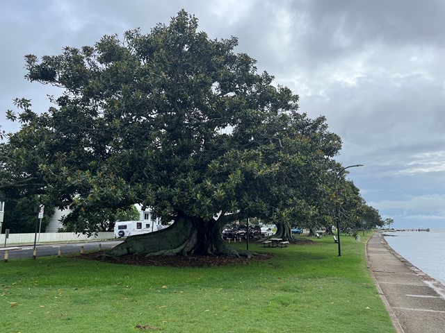
Moreton Bay Cycle Way (Shorncliffe to Woody Point section)
Enjoy the sea breeze while taking a stroll from the Frank Doyle Park (Shorncliffe) along the shoreline of Bramble Bay, across the Ted Smout Memorial Bridge and into Woody Point Pelican Park.
 4
km
return
1
hr
4
km
return
1
hr
Banksia Track
True to its name this track features a variety of banksia species. Visit in autumn when the banksias are in bloom. The track begins in Frog Hollow where wet heath provides rich habitat for 23 species of frog that call Karawatha Forest home then climbs through eucalypt forest to the crest of the hill and the sandstone boulders of Poet’s Rock. This track connects with the Dianella, Wallum and Dentata tracks for a longer walking experience.
 1.2
km
return
45
mins
1.2
km
return
45
mins
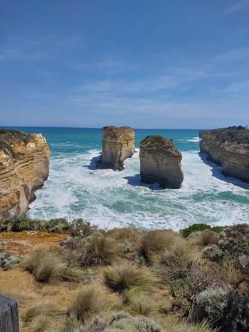
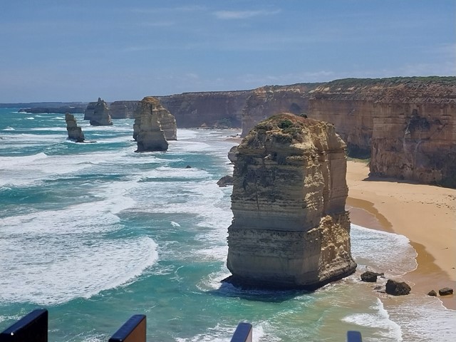
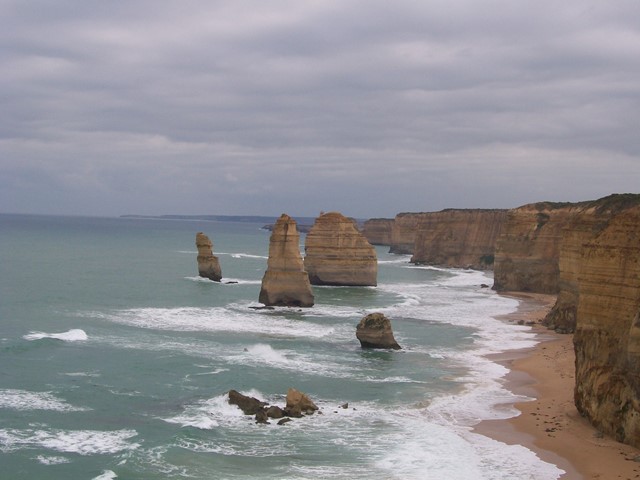
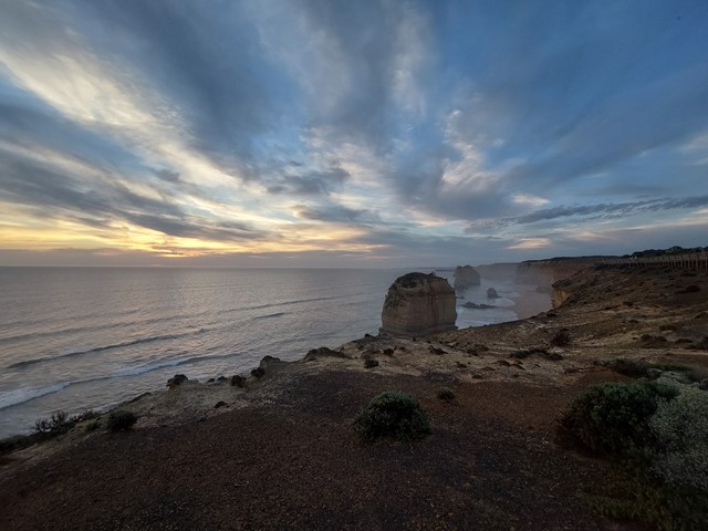
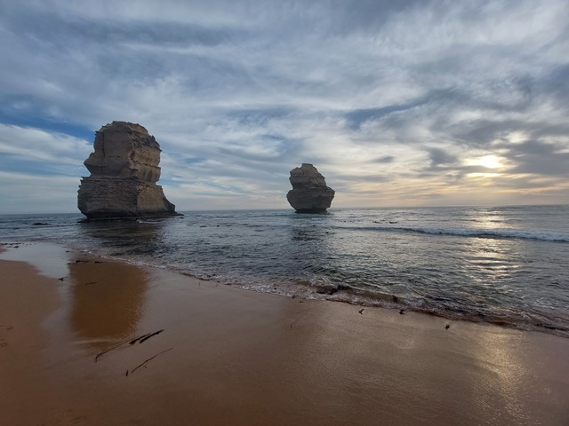
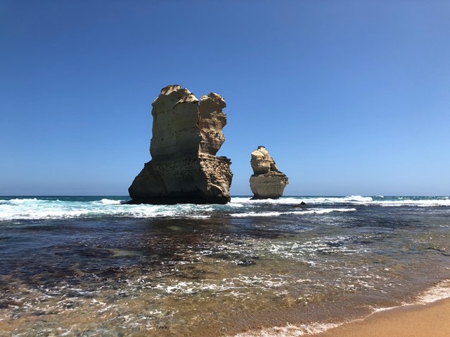
The Twelve Apostles
One of the most photographed places in Australia, this loop track taking you past a number of lookouts over the Twelve Apostles, a collection of limestone stacks on the Great Ocean Road.
 600
m
return
30
mins
600
m
return
30
mins
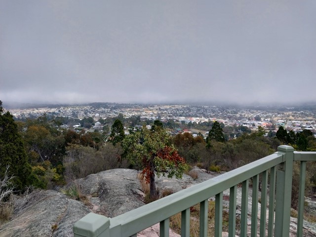
Mt Marlay Lookout & Summit Loop
A short loop walk from the lookout around the summit with views in each direction.
Gibson Steps and Gibson Steps Beach
A walk down the 89 Gibson Steps down to the beach with the opportunity to see the monoliths Gog and Magog up close.
 1
km
return
20
mins
1
km
return
20
mins
Waldheim Forest Walk
Waldheim and Weindorfers Forest Walk: a 20 minute circuit starting from the historic Waldheim Chalet. A glimpse into Gustav Weindorfers's pioneering life at Cradle can be seen at Waldheim Chalet.
 5
km
return
90
mins
5
km
return
90
mins
Cornubia Forest Park - Birdwing - Stupidty Happy - Birdwing
This walk is shared with the brave bike riders. The first half was winding down to the valleys bottom then winding back up to the top.
5
km
return
4.5
hrs
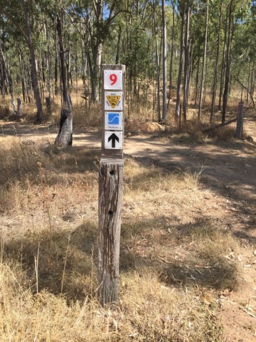
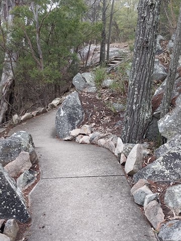
The Pinnacle
A must do very diverse day walk! Dramatic scenery from the Pinnacle! Crossing Stony Creek, following the gorge and canyon upwards to exit via steel steps and ladders, then following arrows on rock through eucalypt forest and bare rock towards a narrow crevasse exiting via a ladder. Then on towards the cliffs and the Pinnacle.
 5.6
km
return
2.5
hrs
5.6
km
return
2.5
hrs
Chatauqua Peak
Day walk. Start walk at caravan park in Halls Gap. Steady climb with several view points. Climbimg over rocks to reach the peak with 360 degrees views and Halls Gap below. Be prepared for all conditions.
 29
mins
29
mins
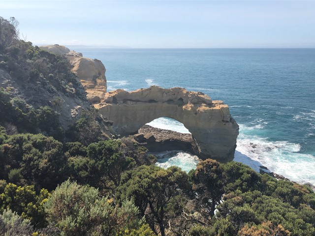
The Arch
NOTE: THIS WALK IS CURRENTLY CLOSED DUE TO DANGERIOUS EROSION OF THE TRACK (2024).
A short walk to a viewing area to see the rock formation The Arch
 1
km
return
30
mins
1
km
return
30
mins
Fingal Head Lighthouse Walk
Start at Dreamtime Beach carpark - a turn left as soon as you are on Lagoon Road.
Or actual LIghthouse carpark at end of Bamberry Rd
 600
m
return
30
mins
600
m
return
30
mins
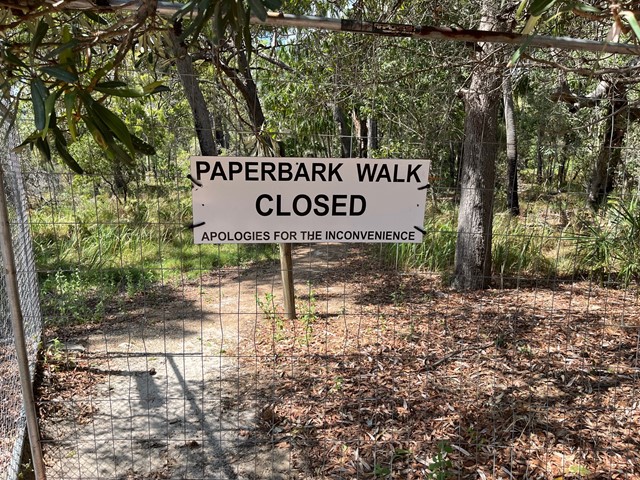
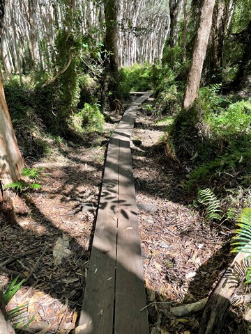
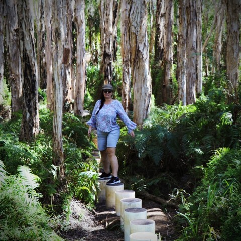
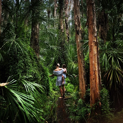
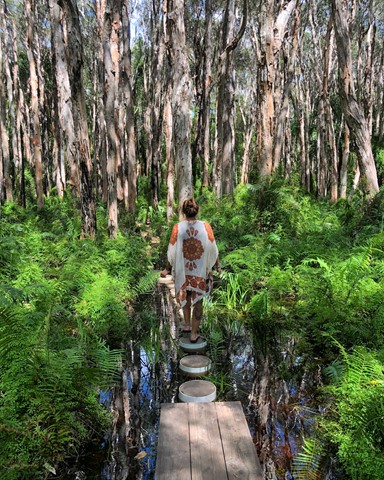
Paperbark Forest Boardwalk
*** The Paperbark Forest Walk is closed. Reedy Creek Reserve is a small conservation area which unfortunately become overwhelmed by visitors, to the point where the walk, the forest and wetlands were being damaged. Literally thousands of people were visiting the site, ignoring the signage and causing the walk, the road and car park to become a foot and vehicle traffic jam. Please do no attempt to access the boardwalk or enter the reserve. ***
This short trail is an exciting walk for all the family, with stepping stones, boardwalks and water crossings as you meander through a magnificent and picturesque Paperbark Forest.
 34
km
one-way
3
days
34
km
one-way
3
days
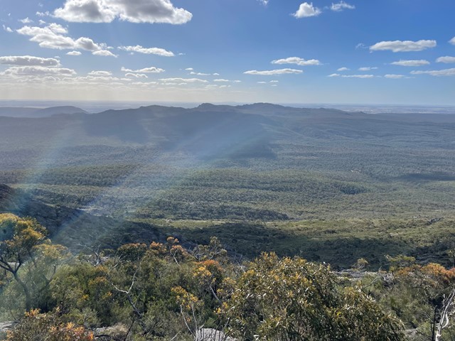
Gar and Werdug 3 day hike - Grampians Peak Trail
Along the Gar and Werdug 3-day hike, you'll witness seasonal waterfalls, mountain summits and clifftop camping. The track is an overall Grade 4 walk with steep terrain, suitable for fit and experienced hikers.
This section of the trail is particularly spectacular in winter, spring and after rain, when clifftop rockpools and seasonal waterfalls are at their best. Gar (meaning "big mountain") is the highest on the western side of the range, rewarding walkers with spectacular 360-degree views. Lake Wartook Lookout, at 829m, is one of the highest points on the eastern side of the Mount Difficult Range with sweeping 360-degree views of Gariwerd.