
Menu

 5.7
km
return
5.7
km
return
 90
mins
90
mins
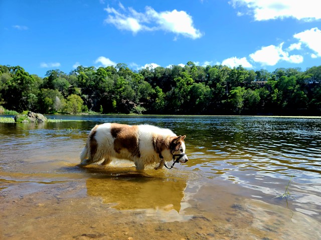
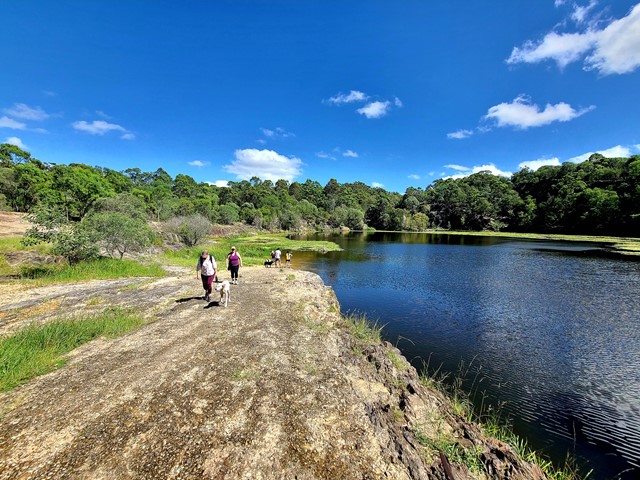
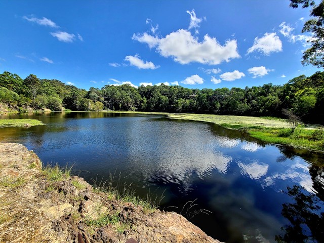
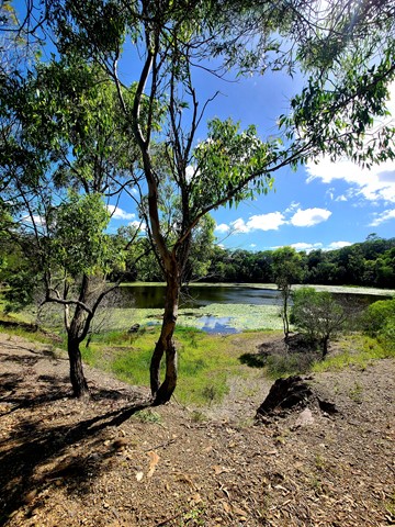
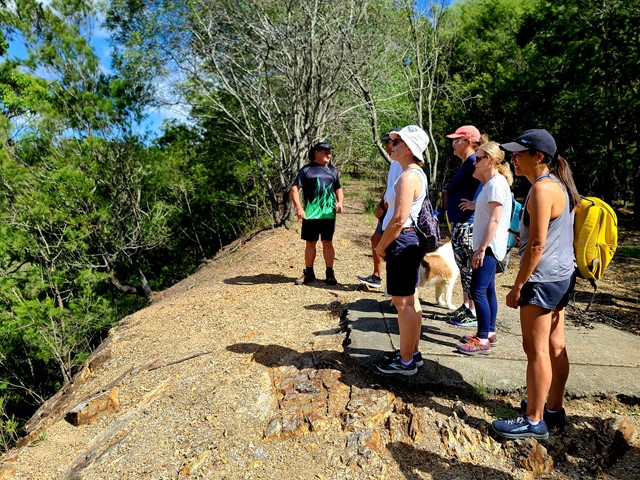
Stringybark Circuit to Daisy Hill Quarry
This is a well-rounded walk through the Daisy Hill Conservation Park bushland out to the Old Quarry. Note, this is a shared trail for walkers, bikes and horses. A pleasant walk with a few easy hills. From the car park at Daisy Hill Road the route follows mostly unsealed/gravel road until you reach the quarry.
 6
km
one-way
3
hrs
6
km
one-way
3
hrs
Shelley Head Camp Ground (From Angourie)
This campground is a lovely spot to walk to for a day picnic, swim and explore. It also has overnight walk in camps available if you wish to saty. You can access it from Angourie, heading south for 6km's or Lake Arragan, walking north for 7km's. This walk makes up part of the larger Yuraygir Coastal Walk.
 6.2
km
return
2.5
hrs
6.2
km
return
2.5
hrs
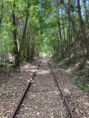
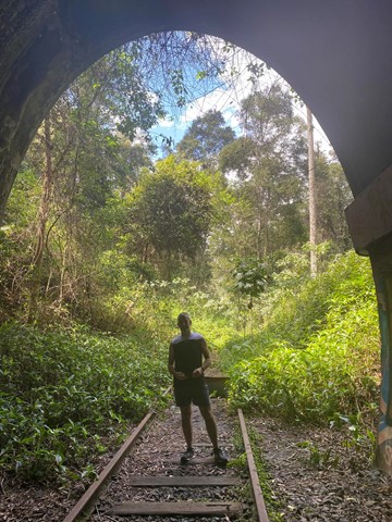
Burringbar Range Tunnel
A nice easy walk along the old abandoned Murwillumbah to Casino railway line (1894 to 2004) from Stokers Siding to the biggest tunnel (524m) on that line, with plenty of glow worms and some micro bats.
This section of the track is now contained within the Northern Rivers Rail Trail - Tweed Section (2023).
 2.1
km
return
45
mins
2.1
km
return
45
mins
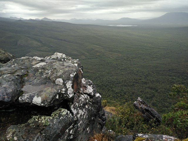
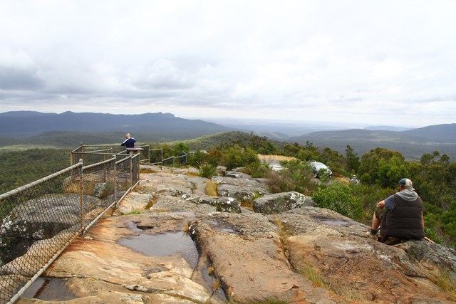
The Balconies
From the same car park as Reed’s Lookout you can walk to The Balconies for panoramic views of Victoria Valley and the surrounding ranges. The unusual rock formations that stick out of the mountain make this spot particularly unique. The Balconies are a great spot for fresh misty mornings and sunset views.
 367
m
return
15
mins
367
m
return
15
mins
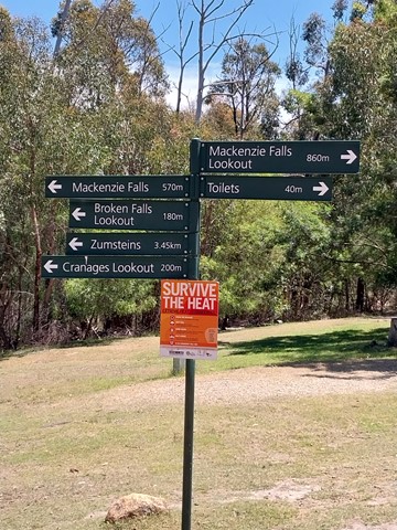
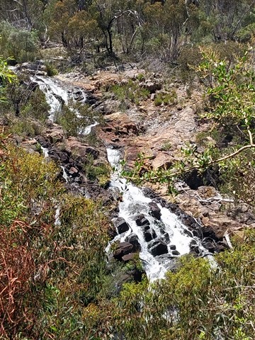
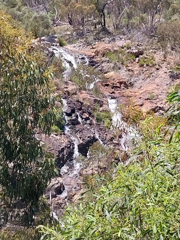
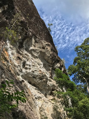
Broken Falls Lookout
Take in the sweeping views of the upper sections of MacKenzie Falls. The cantilevered lookout on the edge of the gorge offers sweeping views of the river tumbling over the wide, dissipated waterfall.
 508
m
return
30
mins
508
m
return
30
mins
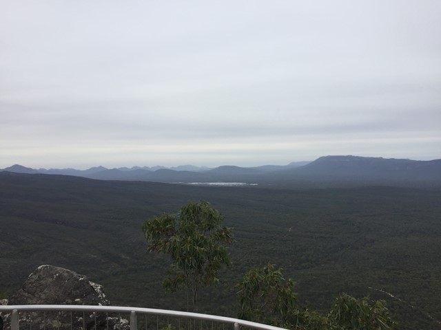
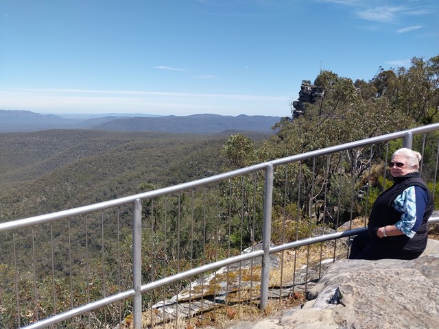
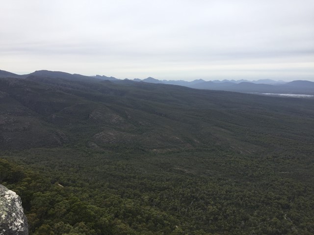
Reeds Lookout
From the summit of Reed’s Lookout you will enjoy stunning views over the entire Victoria Valley, Victoria Range, Serra Range, Lake Wartook and the Mt Difficult Range. The viewing platform is a popular spot to watch the sun set over the mountains.
 1.6
km
return
45
mins
1.6
km
return
45
mins
Silverband Falls
Break up your hiking adventure with an easy stroll to Silverband Falls in the Wonderland Range. Follow the fern-laden trail and keep an eye out for the colourful birdlife, from the cheeky yellow robin to majestic Wedge-tailed Eagles circling above.
 6.8
km
return
3
hrs
6.8
km
return
3
hrs
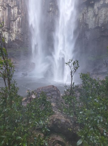
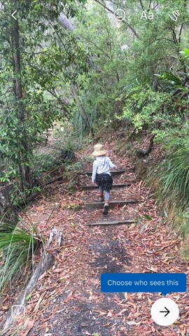
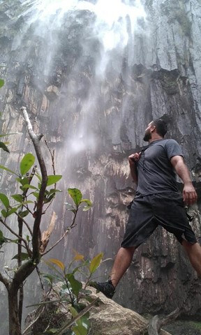
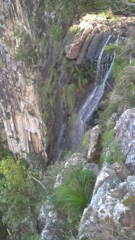
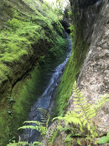
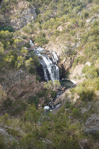
Minyon Falls Loop
The Minyon Falls is a plunge waterfall on the Repentance Creek in the Northern Rivers region of New South Wales, Australia. The waterfall descends more than 100 metres over the huge rhyolite cliffs which were once part of the Tweed Volcano.
Walk down to the base of the falls; a very pretty interesting walk. After the rain the water gushes past you.
 6
km
2.5
hrs
6
km
2.5
hrs
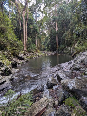
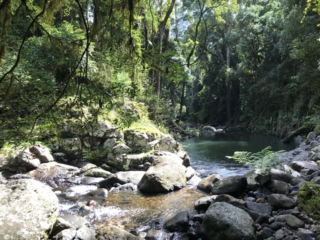
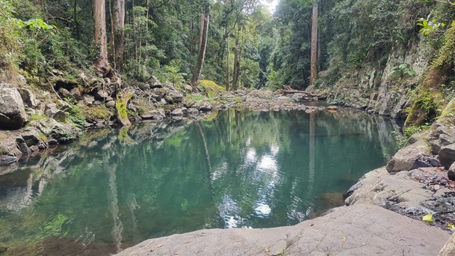
Gwongoorool Rock Pools
This track branches off the Illinbah circuit and descends through open forest and rainforest to Gwongoorool Pool on the Coomera River. Return via same track. (Illinbah circuit commences at the car park near the information centre).
 1.9
km
return
40
mins
1.9
km
return
40
mins
MacKenzie Falls Lookout
The Bluff Lookout provides sweeping views of MacKenzie Falls and the MacKenzie River from high above the gorge. The lookout provides the only opportunity to capture the multiple cascades of the MacKenzie River as it flows through the gorge, including a wonderful view of MacKenzie Falls. If you can’t make it to the base of the falls, this is the best alternative.
Bluff Lookout is accessed via a gently undulating, sealed walking track that wanders through a sheltered woodland. It is suitable for wheelchairs.
For the most spectacular view approach the viewing platform from the right-hand fork of the track.
 45
km
return
4.5
days
45
km
return
4.5
days
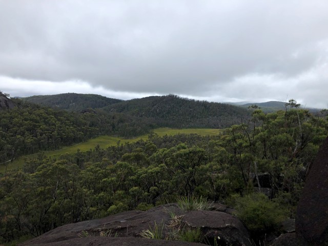
World Heritage Walk
The heritage loop walk can be joined and exited at numerous points along its length. A range of flora from sub alpine to temperate rainforest and heath. Wildflowers displays are prolific. Reptiles are numerous. Many granite outcrops to explore with the Haystack and Dandahra Crags being two of the best. The distance stated does not include side trips. Plenty of creeks and swimming holes.
 6
km
2.5
hrs
6
km
2.5
hrs
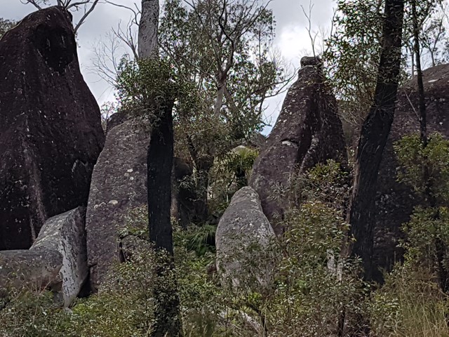
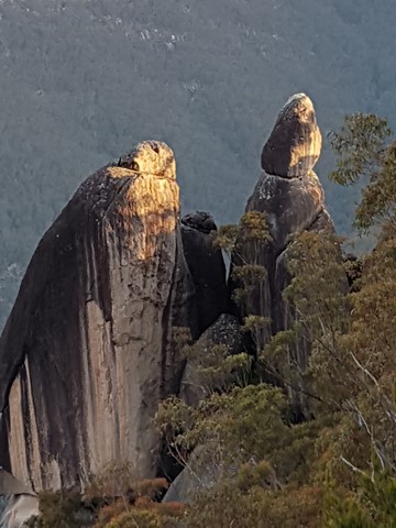
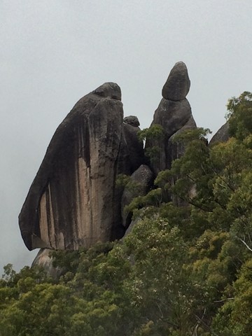
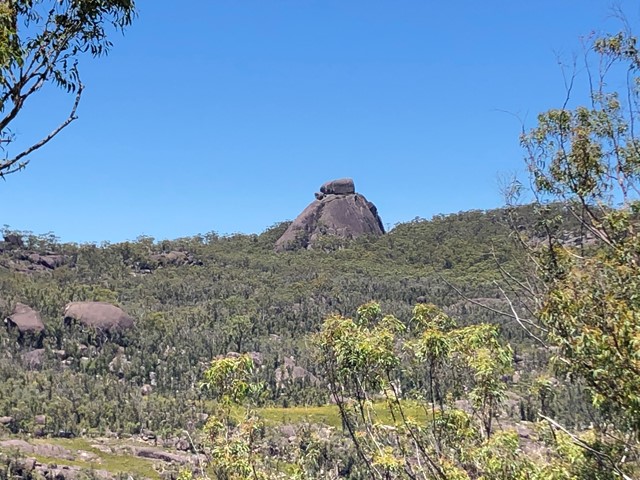
The Needles Walk
Look out over six spectacular granite columns rising out of Dandahra Gorge.
 13
km
return
4
hrs
13
km
return
4
hrs
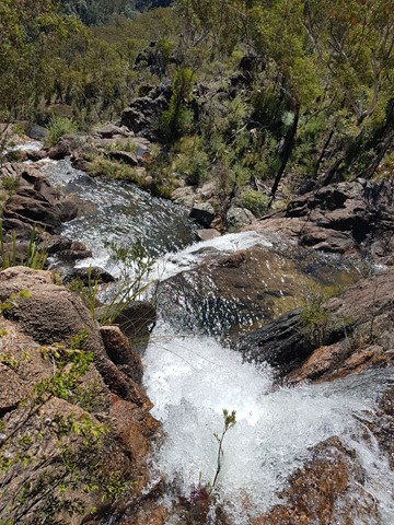
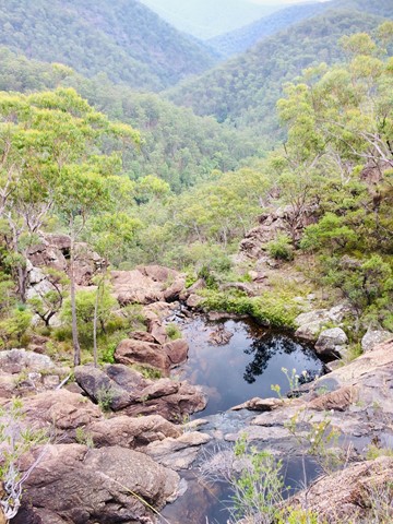
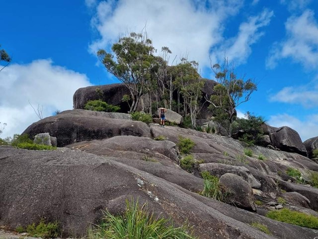
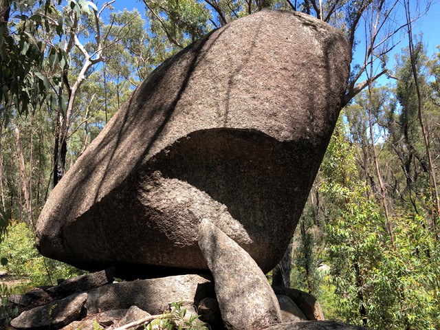
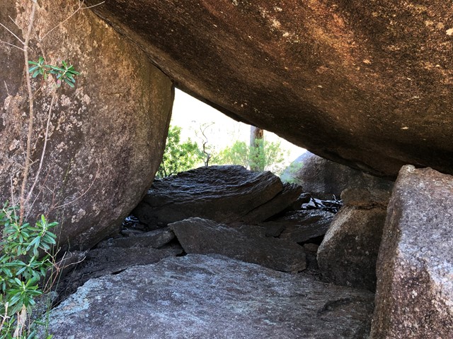
Little Dandahra Creek Walk
13km relatively easy return walk (Grade 3). Can be started at the Dandahra picnic area car park, or drive on to Mulligan's campground and start the walk from there. We parked at the Dandahra picnic area which is just off the highway. This is a lovely track which follows the beautiful flowing Dandahra Creek. Plenty of spots to dip your toes in. Bring a hat on this walk as there isn't much tree cover, this area has been affected by bush-fires last year and is regenerating. There are interesting boulder formations along the way. This walk is largely flat with only a few steeper sections, overall it is an easy 13km return. Mulligan's campground is a great spot for lunch.
From Parks NSW website; "Little Dandahra Creek walking track is the ideal way to get acquainted with the landscape of Gibraltar Range National Park. This superb walking track leads you past enormous granite outcrops, through montane heathlands and alongside pristine waterways. Take a break and soak in the cool running waters and natural pools of Little Dandahra Creek, where you’ll feel dwarfed by the magnificent rocky landscape. Keep your binoculars close for birdwatching, there are many birds that feed and breed in the area.
This track is great for those looking to go hiking for the first time as it is quite an easy day’s trek. Mulligans campground awaits you at the other end where you can set up a tent and put the billy on to boil."
 6
km
return
2.5
hrs
6
km
return
2.5
hrs
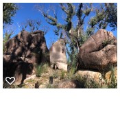
Dandahra Crags Walk
With its crags and swamps, Dandahra Crags walking track is a unique track within Gibraltar Range National Park. Through spring and summer, the wildflowers are on display around Surveyors Swamp, which the track skirts. In winter, get up early and watch the sun rise over the frost-covered swamp from the top of the crags. You’ll be rewarded for your efforts. Bring your camera along to record the experience. The area, with its montane swamps, huge granite outcrops and wildflowers, is quite a photographer’s paradise. Binoculars will also come in handy for birdwatching.
Dandahra Crags walking track is great for people looking for a moderately-challenging hike with a bit of a climb at the end. Pack a picnic lunch and enjoy the scenic views out towards Raspberry lookout and Mann River Valley from the top of the crags.
 4
km
return
2
hrs
4
km
return
2
hrs
Anvil Rock Walk
Anvil Rock walking track, in Gibraltar Range National Park, is a hiking route with scenic views and exploring the granite landscape surrounding
 4.2
km
return
90
mins
4.2
km
return
90
mins
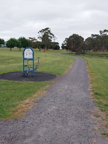
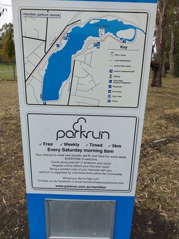
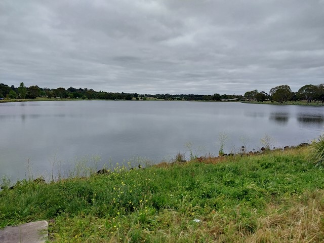
Lake Hamilton
Lake Hamilton is located at the eastern end of Hamilton and is surrounded by 25 hectares of parkland.
An attractive landscaped manmade lake used for various water-based activities featuring an excellent walking/bike track of 4.2km.
 276
m
return
15
mins
276
m
return
15
mins
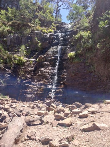
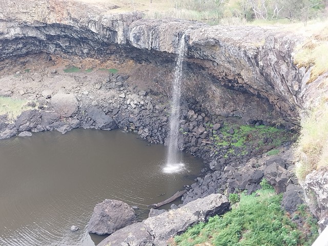
Wannon Falls
The Wannon Falls are a punchbowl waterfall located in the Southern Grampians and fed by the Wannon River that has its head waters in the Grampians mountains.
 488
m
return
15
mins
488
m
return
15
mins
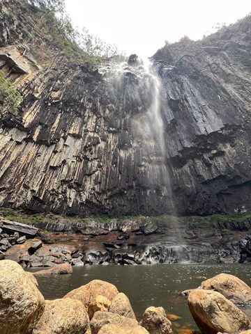
Nigretta Falls
Nigretta Falls is a small waterfall set in outstanding scenery. The waterfall is considered more spectacular than Wannon Falls, due to its clearer features.
 400
m
return
40
mins
400
m
return
40
mins
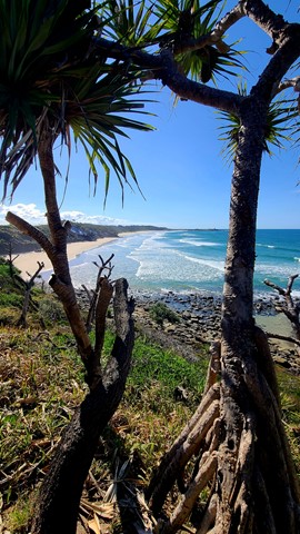
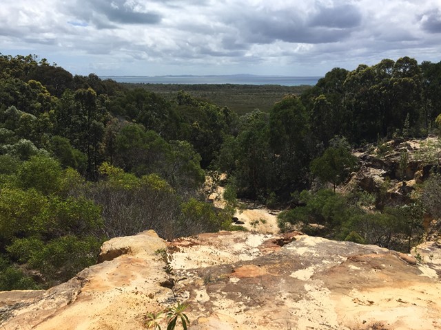
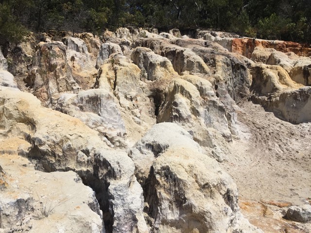
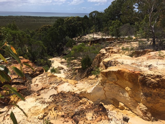
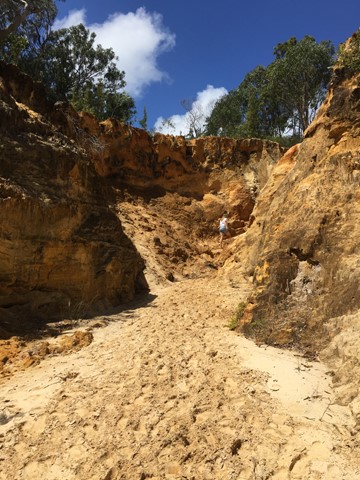
North Stradbroke Island Sand Cliffs
A short walk through some interesting coloured sand cliffs. Follow the path and then go up the gorge on the left hand side up to the maze like area which has views out to the water.
 2.9
km
return
1
hr
2.9
km
return
1
hr
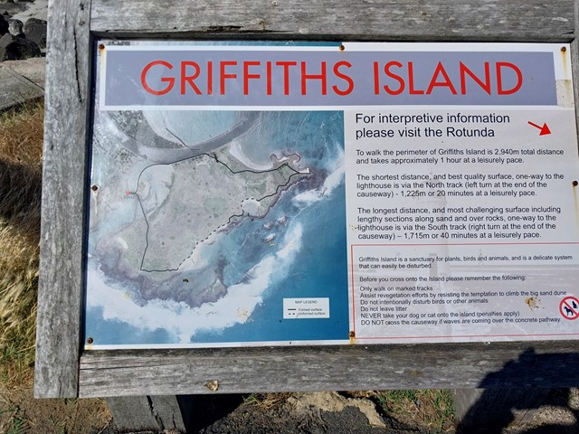
Griffiths Island
Griffiths Island with its colony of shearwater seabirds, winding pathways and the spectacular lighthouse at the eastern tip, it is a great place to explore.
The Island supports a number of native animals including a small mob of swamp wallabies. It is also the site of one of Australia’s most accessible breeding colonies of short tailed shearwaters or mutton-birds.