
South Cape Bay Track
Southwest National Park


Menu

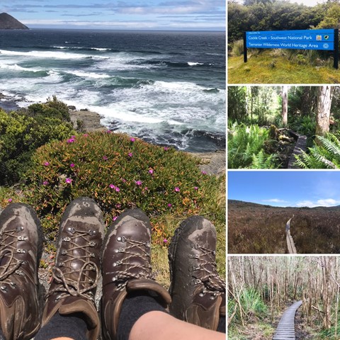
This is a 16km return walk from Cockle Creek to South Cape Bay. This walk is the most southerly day walk you can do in Australia! When you arrive at the rocky headland, you are looking south to Antarctica but it is still many kilometres south. About 4,000 kms in fact.

Getting there
From Hobart, head south on the Southern Outlet (A6) for 10km. Take the right hand lane at the Kingston Bypass and continue on for 2km before taking the 4th exit to Channel Highway (B68) at the roundabout. Continue through Huonville on the Huon Highway for 70km to Hastings Caves Road (C635). Following this road for an additional 22km to get to Cockle Creek. The start of the walk is well sign posted at Cockle Creek behind the Ranger's Station.
n.b. allow 2 hours to travel to Cockle Creek from Hobart. The last15 or so km's is on an unsealed road - suitable for 2WD but be cautious of animals and large potholes.
Maps
https://parks.tas.gov.au/explore-our-parks/southwest-national-park/south-cape-bay
Route/Trail notes
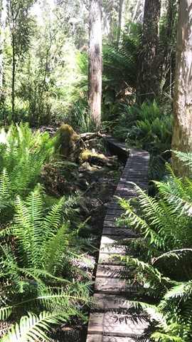
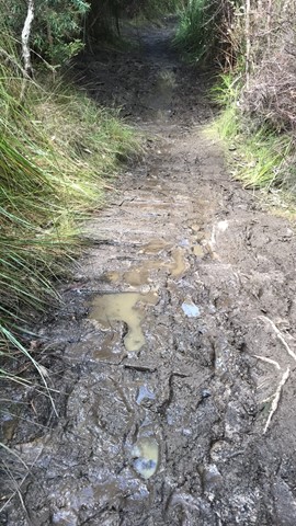
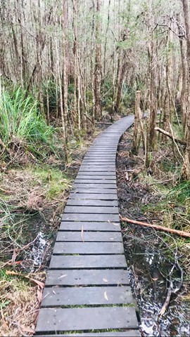
From the carpark the trail first skirts Cockle Creek, meeting the walker’s registration box soon after. For the next 3km the trail scrabbles over the gentle rocky slopes of Moulders Hill before opening up onto duck boarded marshlands. Thanks to the duck boards, the walking here is easy and the next few kilometres are quickly covered. The trail then climbs along several gentle hills, emerging onto the rugged dark cliff top surrounding South Cape Bay.
This cliff top section of the trail is enticingly beautiful and eerie all at once. The barren grey rock stands in stark contrast to the lush forest recently departed. From here incredible views of South Cape, Lion Rock and the turbulent ocean occasionally packed with surfers are offered.
Continuing down onto South Cape Beach is highly recommended via the staircase provided on the far side of the cliffs. Toilets and campgrounds can be found inland near the creek leading onto the beach. Return via the same route.
Permits/Costs
No additional cost apart from your National Parks Pass
Other References
How can I find more info? Any guide books?
GPS Tracks
- No GPS available for this walk yet.
 16
16 5
5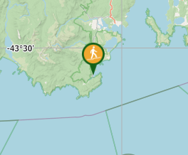
Comments