
Dip Falls Lookout
Dip River Regional Reserve


Menu
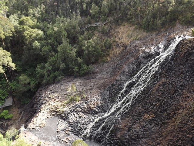
A quick walk to a lookout over dip falls.
Waterfalls
Lookouts
Picnic Facilities
Toilets
Rainforest

Getting there
Dip falls is 26.2km down Mawbanna Rd which is between Cowrie Point and Black River on the Bass Highway
Maps
Which maps cover the area?
Route/Trail notes
The Dip Falls lookout is over the other side of the bridge from the dip falls walk.
Permits/Costs
There is no cost
Other References
How can I find more info? Any guide books?
GPS Tracks
- No GPS available for this walk yet.
 100
100 10
10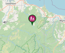
Comments