
Menu
Suggested searches
Your search found 2418 results...

 13.22
km
return
13.22
km
return
 3.75
hrs
3.75
hrs
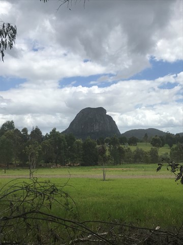
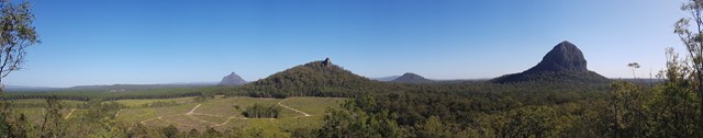
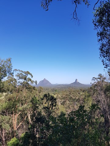
Beerburrum to Trachyte and Tibrogragan Circuits
Glass House Mountains National Park
Walk from Beerburrum to the Returned Servicemans memorial Track to Trachyte Circuit to Tibrogargan Circuit to Steve Irwin Way
 10
km
return
4
hrs
10
km
return
4
hrs
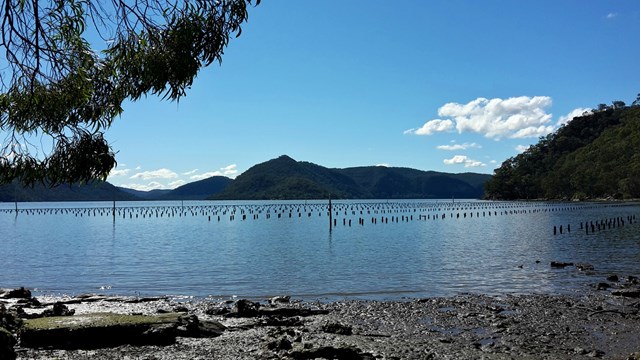
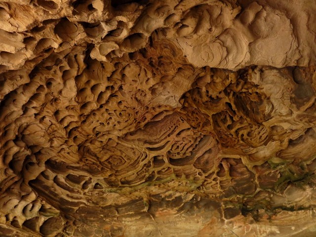
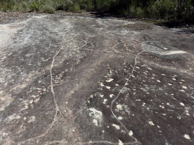
Peats Bight
New South Wales
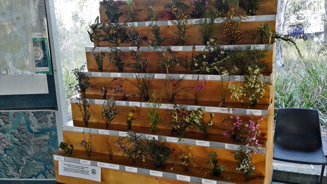
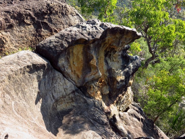
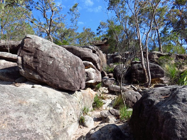
Enjoy the early European history of Muogamarra Nature Reserve and admire the interesting geological features of Peats Bight, including Hawkesbury sandstone and impressive volcanic pipes filled with solidified magma. This tour takes you down Peats Ferry Road over historic road works into Peats Crater, and continues through lush rainforest and mangrove environments on the northern outskirts of Sydney.
Muogamarra Nature Reserve is only open to the public on selected weekends during the year to reduce disturbance to, and maintain the plants and animals calling it home.
 6
km
return
2.5
hrs
6
km
return
2.5
hrs
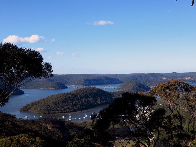
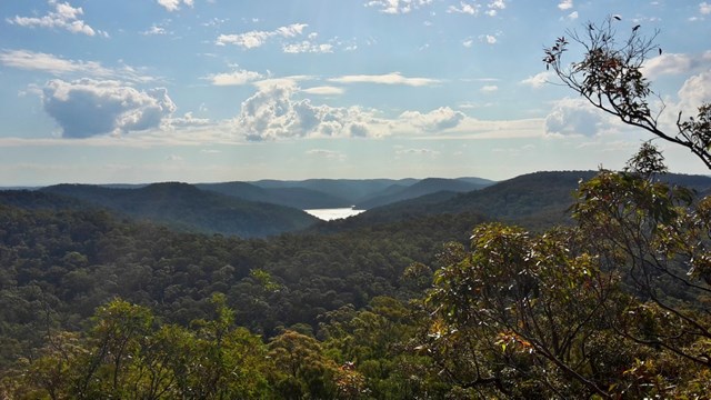
Deerubbin Lookover
New South Wales
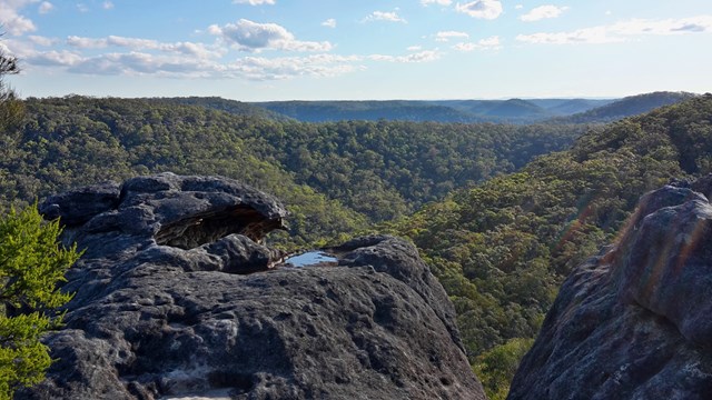
The walk follows an historic road past rock formations to a rocky platform above the Hawkesbury River, with outstanding views.
 500
m
return
30
mins
500
m
return
30
mins
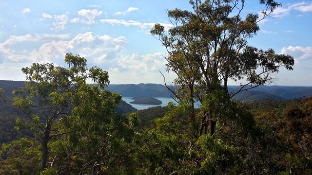
JD Tipper Loop
New South Wales
An easy walk to the lookout named after the founder of Muogamarra Nature Reserve with views over Brooklyn.
 4
km
return
2
hrs
4
km
return
2
hrs
Lloyd Trig
New South Wales
A short walk along an old convict road before climbing up a short rock scramble to Lloyd Trig cairn. Enjoy the panoramic views with landmarks such as the Hawkesbury River and Barrenjoey Lighthouse.
 2
km
return
1
hr
2
km
return
1
hr
Point Loop
New South Wales
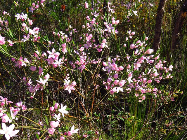
A short walk past a variety of plants to a rocky platform with views over Peats Crater and the Hawkesbury River
 16
km
return
5
hrs
16
km
return
5
hrs
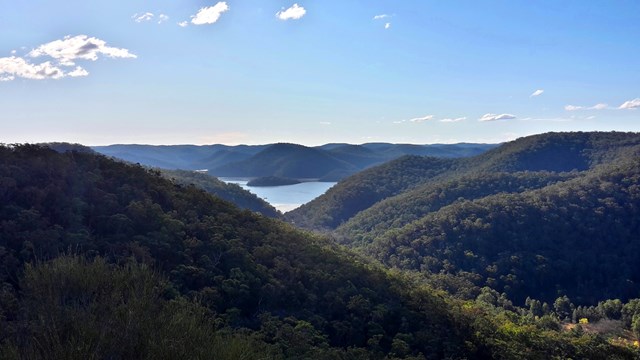
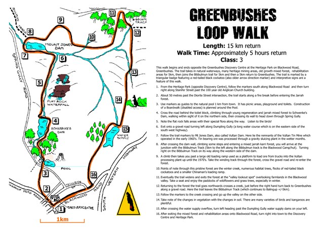
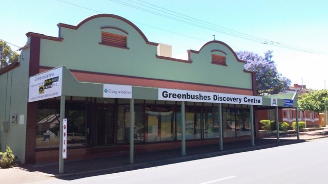
Greenbushes Loop
Western Australia
Located 2.5 hours south of Perth on the South West Highway, the Greenbushes Loop is a rewarding 16km trail (4-6 hours approx) that is worth checking out on your next trip to the area. Setting off from the Greenbushes Discovery Centre in the heart of town, the trail visits several historic town sites such as Schwenke's Dam, remnant of the old Vultan Tin Mine and Mt Jones Dam.
Included on the loop is a section of the world famous Bibbulmun Track that takes in the beautiful forest and sweeping views of the Blackwood farming valley. After leaving the Bibbulmun Track, the trail makes its way back to the town of Greenbushes where you can reward yourself with a tasty treat from the cake shop or a well earned drink from one of the two pubs in town. This trail won’t disappoint and is well worth the detour if you are planning a holiday in the South West.
 14
km
one-way
4
hrs
14
km
one-way
4
hrs
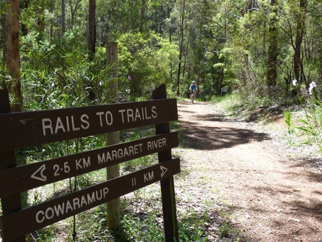
Rails to Trails Cowaramup to Margaret River
Western Australia
The trail was once a part of the old railway network that was built during the timber boom. The trail begins or ends (depending where you start) at Cowaramup and finishes at Margaret River. Approximately 13.5km of trail has been developed as a multi-use trail for walking, cycling and horse riding. The trail is wide enough for two horses to walk comfortably side by side. The trail follows the alignment of the Discontinued Busselton-Flinders Bay Railway line
Along the 5 kilometres north of Margaret River there are numerous bridges crossing a major river and creeks and streams of varying sizes. The trail is easy to navigate with picnic areas along the way. The spectacular birdlife includes yellow robins, parrots and blue wrens and the wildflowers are stunning in Spring (September to December). As it was a railway, the gradient is relatively flat, and the terrain is generally gentle.
 17
km
return
10
hrs
17
km
return
10
hrs
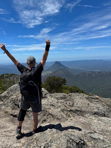
Mt Barney - East Peak - South Ridge
Mt Barney National Park
South Ridge is the easiest track up Mt Barney (but it's NOT easy!). Sometimes referred to as Peasants' Ridge (a dig that only Peasants would take such a boring route up the mountain), South Ridge is an excellent choice for a first ascent of Barney. The track has triangular trail markers but there are still opportunities for navigational difficulties if you're inexperienced.
You MUST start early in the day. Expected time is 8-10 hours with almost 1200m of climbing from the carpark. Make sure to leave early to allow time for any mishaps and be prepared to turn back if necessary.
 12
km
one-way
3
hrs
12
km
one-way
3
hrs
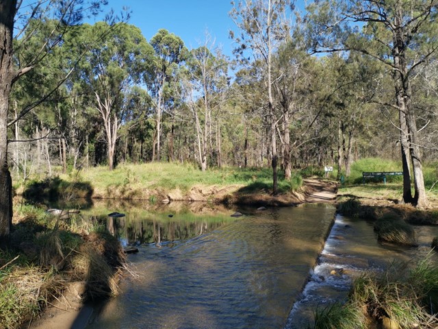
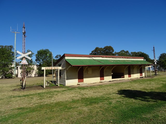
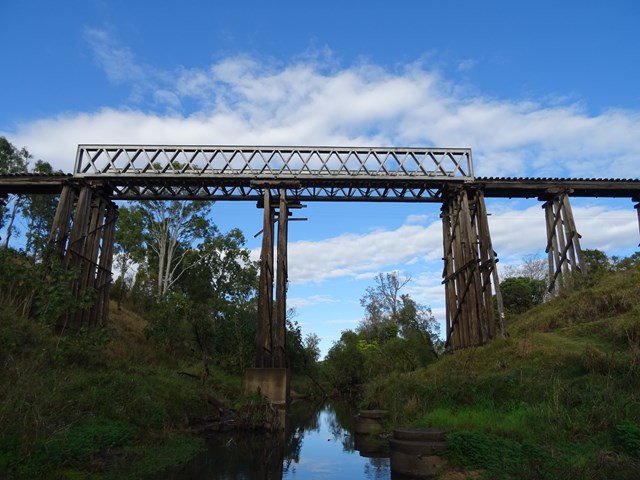
Lowood to Coominya Rail Trail
South East Queensland
This walk is part of the Brisbane Valley Rail Trail, starts and finishes at the railway station. Coominya is a small town but has all services. A large and impressive rail bridge along the track but not accessible, a lower river crossing. The walk passes through farm lands so plenty of gates to open and shut but not a walk to complete in Summer months. The trail is well marked so maps are not required. Lowood is accessible after a turnoff at Fernvale which is situated on the Brisbane Valley Highway. Public amenities and car parking at both ends of the walk. No permits or costs for the walk.