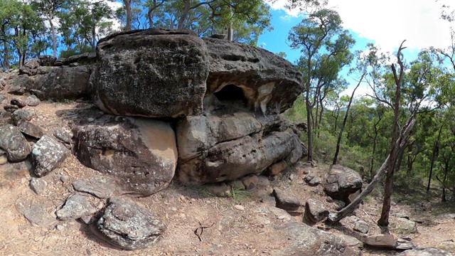
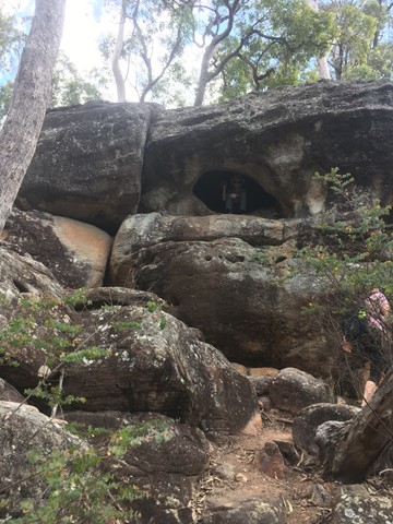
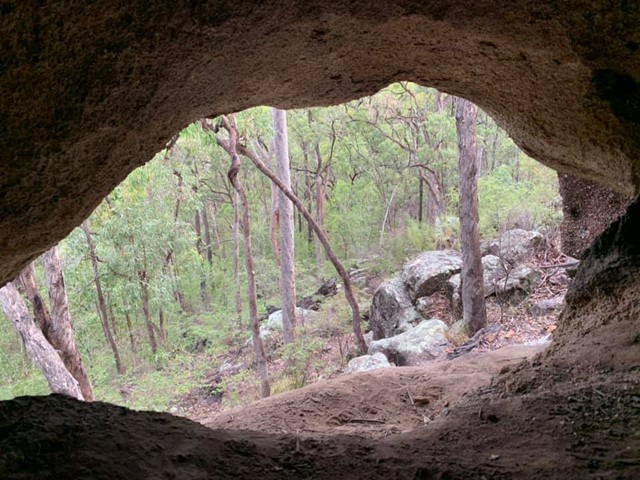
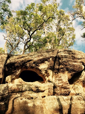
Small Cave (Plunkett Conservation Park)

South East Queensland

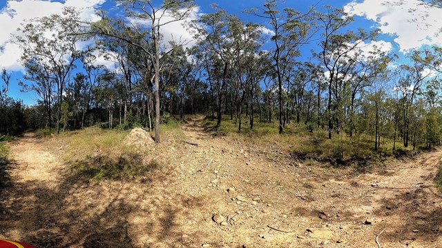
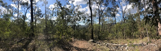
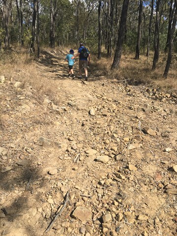
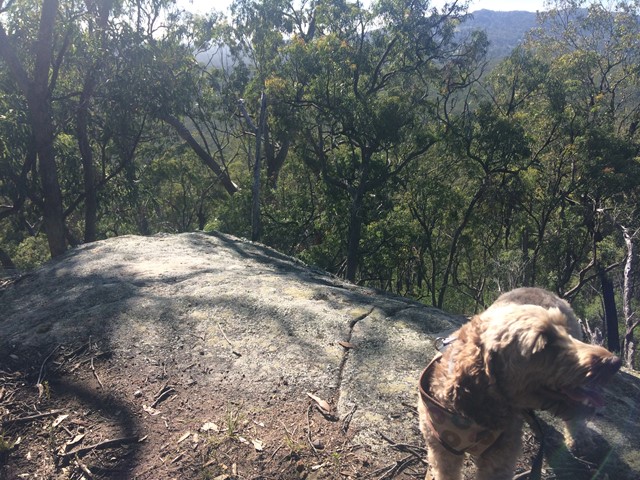
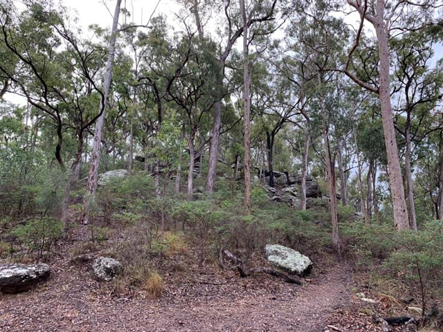
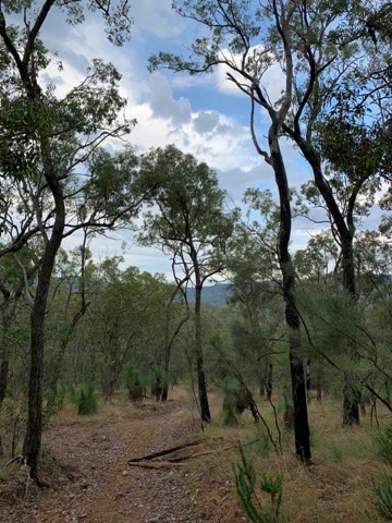
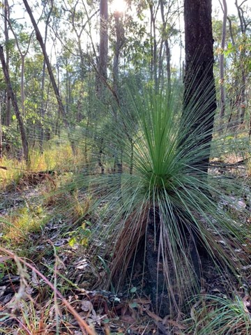
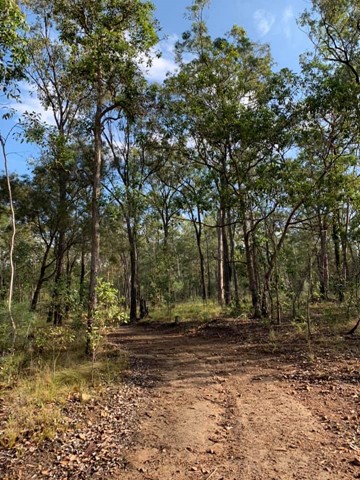
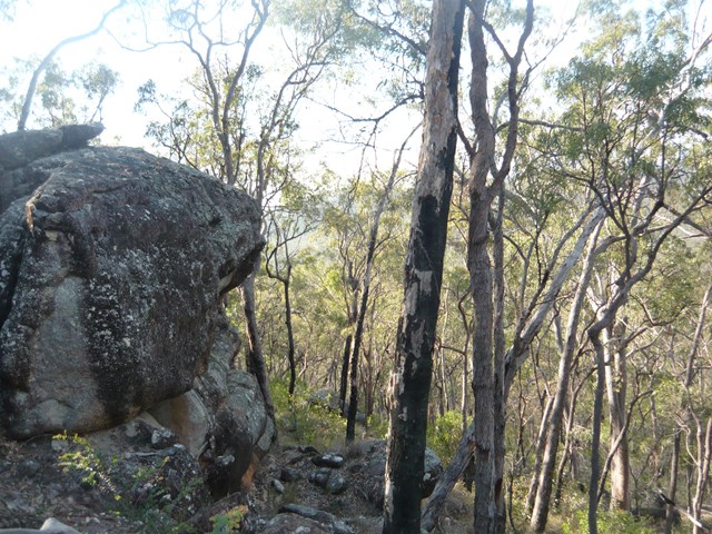
This walk takes you through fairly open bushland, up an incline to a conglomerate rock outcrop with views of the Cedar Creek Valley.The paths in this reserve are mostly wide enough to fit a ranger's car but are quite rocky and steep in some places. You are able to cycle, horseride and walk your dog here (but no motorbikes).
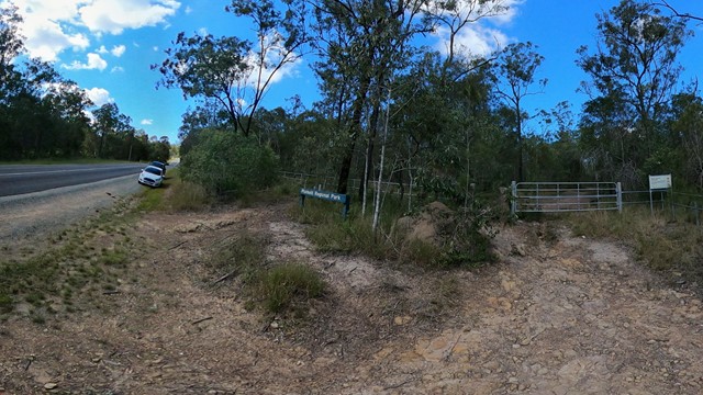
Lookouts
Dogs Permitted
Eucalypt Forest
150m
Maximum Elevation
200m
Total Climb

Getting there

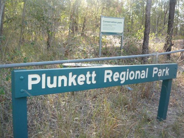
Take the Chardon Bridge Rd exit off Beaudesert-Beenleigh Rd. Follow until you go just past Garden Rd, you will see the reserve entrance on your left. 

Route/Trail notes

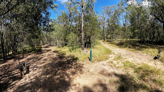
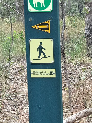
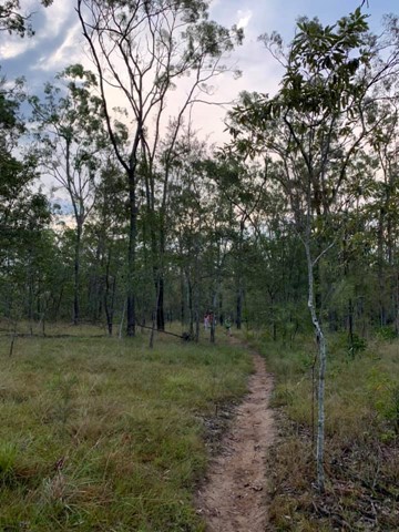
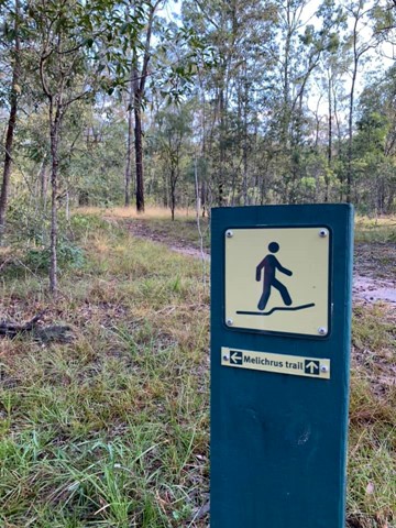
Starting at the Chardon Bridge Road entrance slip rail at Plunkett Regional Park (which is aproximately 70 meters North of the Garden Rd), follow the management track 900m up a decent hill and down again. You will come to a cross roads of sorts. Go left then immediately veer right opposite a bench seat up a very narrow trail (this is part of the Melichrus Trail).

Follow this until you eventually reach a T intersection at a management track again. Go Right here. Follow several hundred meters until you come to a high point on the trail at another intersection and go Left. Follow this up a steep incline, until you reach the top of the climb.

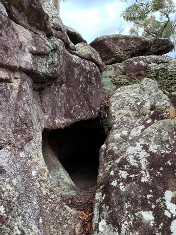
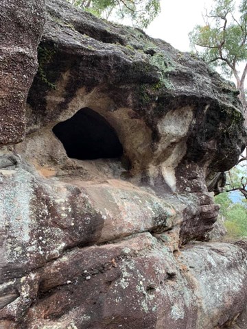
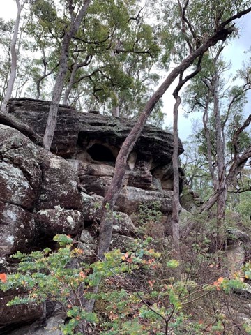
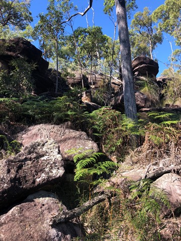
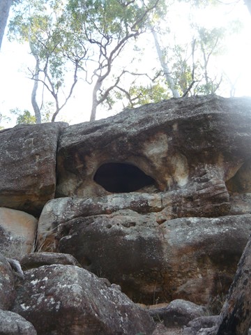
From here keep following the trail along a ridge  a couple of hundered meters until you will see some rocky country in front and to your right. The track veers left here.  Ignore this trail to the left and walk off track to your right contouring around the hill about 50 meters and look up at the rocky ridge for a small cave.  It might take 5 minutes or so to locate.

Permits/Costs

NIL

GPS Tracks

Comments

Very nice walk, easy path to walk at brisk pace. I'd like to mention that the conservation park does have a lot of somewhat labyrinth-style looking intersections - meaning every one looks pretty much identical to the last one & without taking note, it's easy to head along the wrong one. On a positive note, we got to see more than we anticipated of the park ;) Loved the cave & all the rocky outcrops at the summit.

petalani on 5 Aug, 2017

This was our first walk as new bush walkers. We found it to be a nice walk, relatively easy, and the path was exactly as stated in the description. We managed to do the walk and get back within 1 hour.

Nicola Ruru on 17 Apr, 2017

We combined this with the Wickham Peak walk in this park.

A pretty easy walk up fire access roads to locate some rocks and a small cave. The walk wasn't really worth it alone so we walked all the way across to the Wickham Peak to see some more scenery.

Juiced Pixels on 12 Mar, 2017

Good walk if you only have a couple hours. Moderately steep in sections and loose surface. Spent some time at the top just taking in the view and exploring the rocky area. Took a wrong turn on the way back to the car but it only took an extra 20 minutes or so.

MarkDub on 31 Jul, 2016

Loved this walk and didn't expect to see this sort of rocky country this close to Brisbane. The uphill was a bit of a slog but well worth the effort. Lot's more to explore past the cave also by following the track a bit further. Lots more rock pavement and heath country to see. Will be back again to explore more. Check out this blog for more ideas - blog.neilennis.com/index/php/cavemen/ or friendsofplunkett.org.au

ian on 10 Feb, 2016

Went exploring for a bushwalk close to our home, found this one online. Unfortunately I think we started from the wrong entrance and couldn't find the cave at all. Will have to come again another time. Nice walk, highly enjoyable. Some parts of the wide track (road?) were quite steep.

Troy on 27 Sep, 2015

Where

Click here to load this map.

Nearby Walks

Done this walk?

This walk has been ticked 59 times

Aussie Bushwalking can keep track of your bushwalks.

Login/signup to tick this walk off.

Tick walks to keep track of where you've been. You must Login to tick walks. Accounts are 100% free so sign up if you don't have one.