
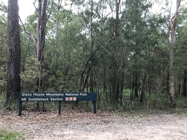
Mt Elimbah (The Saddleback)
Glass House Mountains National Park


Menu
GPS Tracks
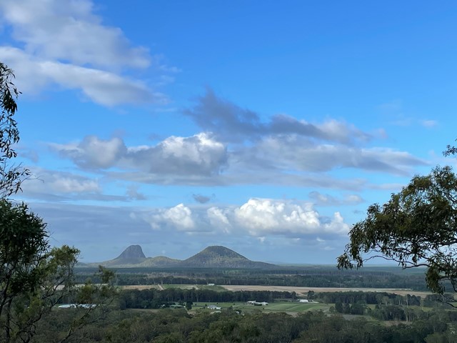
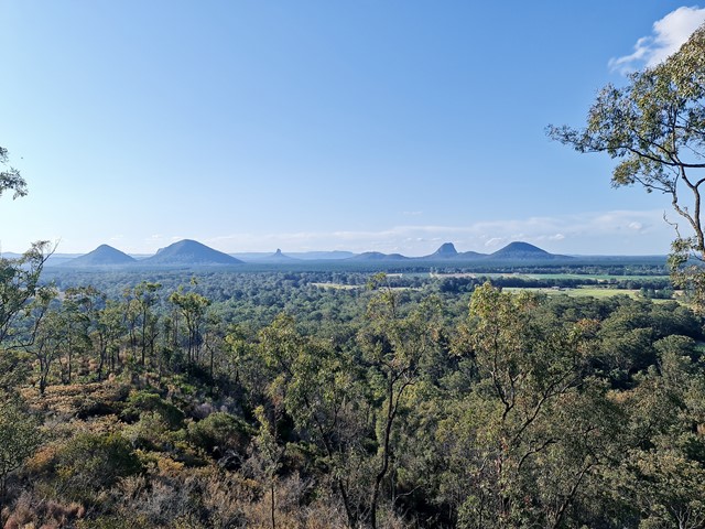
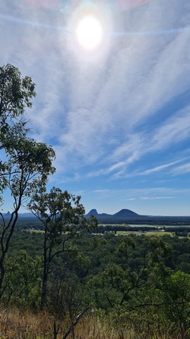
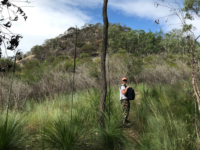

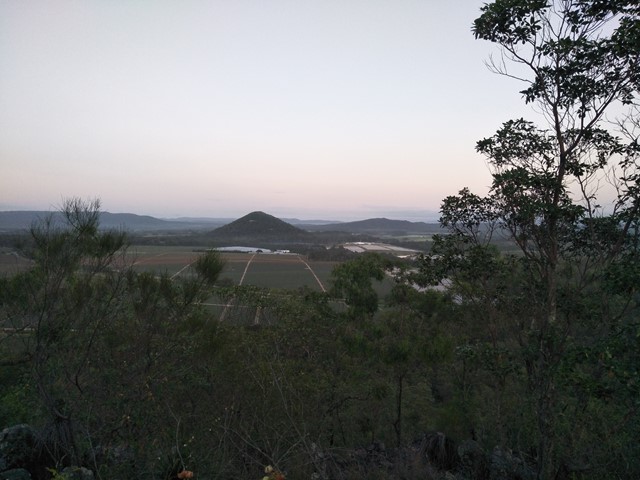


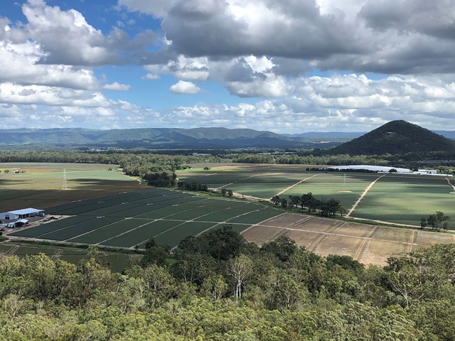

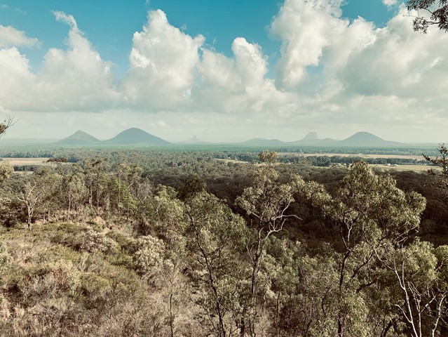
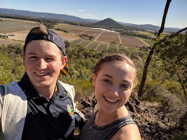
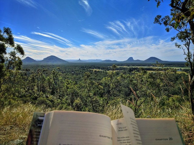

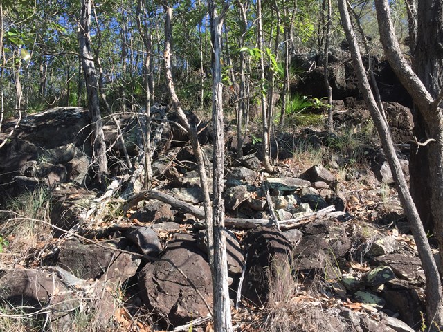
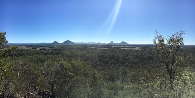
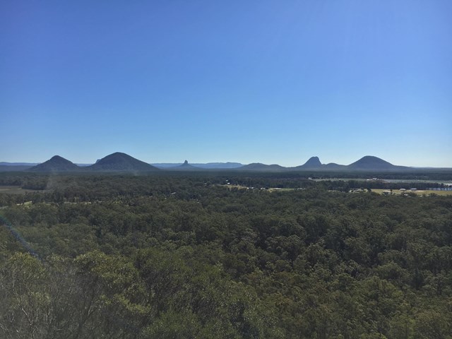
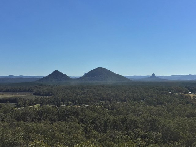
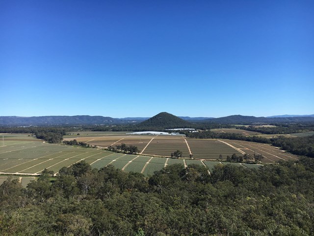
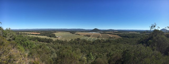
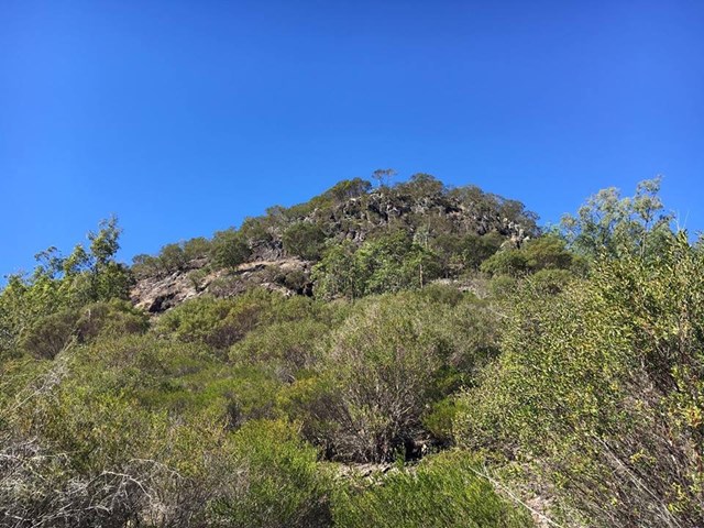
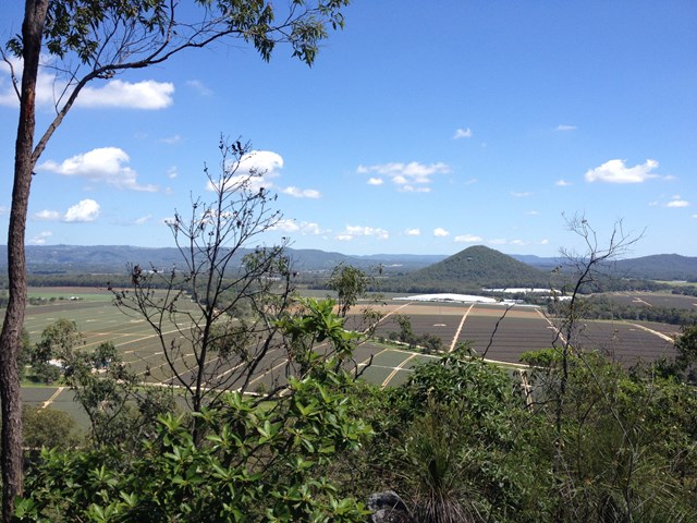
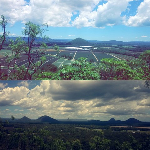
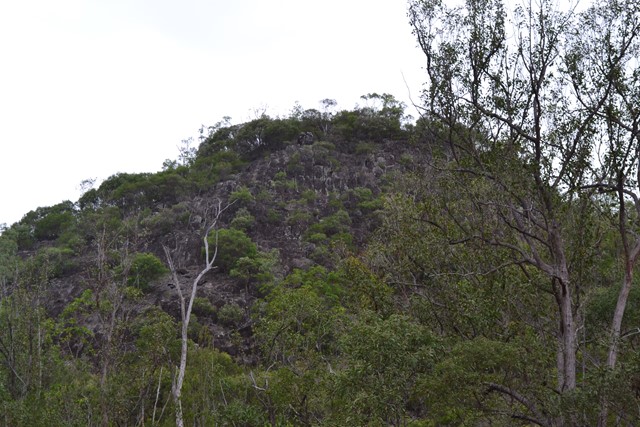
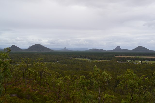
At only 120m high this is an easy climb to the top of one of the two most southerly of the Glass House Mountains. The terrain is mostly rocks with grass or dense bush but has a surprisingly good 360° view from the top.

Getting there:
Take the Steve Irwin Way from the Bruce Highway to the Beerburrum. Take the Beerburrum Road south to Elimbah, where you turn right into Smiths Road, then right into Old Gympie Road. At approx number 799 Old Gympie Road is a small entrance to the right into the National Park car park. National Park sign is off the road, tend to spot it as you drive past, if you get to the unsealed road you've gone too far. Map to the car park
Maps:
None found.
Route/Trail notes:
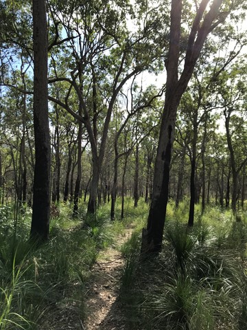
From the car park gate the trail winds around towards the mountain for 100 metres to a fork in the track which goes either way around the mountain. However, neither of these tracks go all the way around. You then have two options:
Take the left hand track (2.8km return) and followed it for about 600m crossing two creeks/gullies. Just beyond this the track turns sharp left and it is from here you head right through the open grass area towards the mountain. There are heaps of Wallaby tracks, but no defined walking tracks, so the best way is to head straight to the summit and work out the best way as you go.
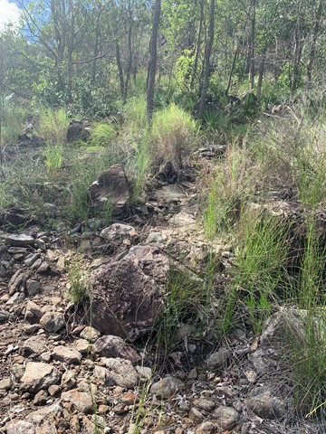
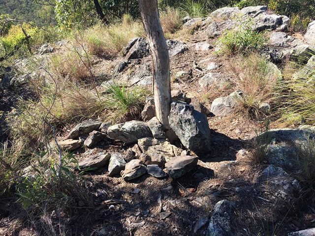
Take the right hand track (1.7km return) and after 400m you will see the 'pink flagged' (also a white arrow on a tree) entrance to the ascent. This track is now well marked and defined and takes you directly to the top.
In both cases there is a requirement to negotiate the boulders and rocks and would require great care when wet.
Additional note June 2020: I'm leaving the description of two options from respect for whoever first wrote it, maybe it was a while ago and the area has become overgrown since. However I agree with various comments that the left hand track is of no use. It leads firstly to a locked gate, from which a pair of wheel tracks to the right follow a barbed wire fence to end at another locked gate. I saw no open grass areas and no view of the mountain to aim for. Take the right hand track, it is a clear path to the top.
Permits/Costs:
None.
Other References/Comments:
Kill two birds with one stone and climb Mt Miketeebumulgrai on the same day as it is just 6km up the road.
 126 Mt Elimbah Down (GPX)
 1.7
1.7 75
75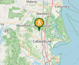
Comments