
Mount Wongawallan
Gold Coast


Menu
GPS Tracks
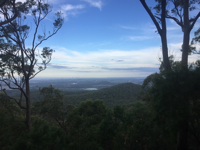
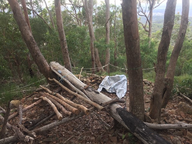
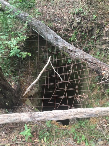
With multiple entrances to the reserve, it's your choice if you want a long or short walk either way there will be steep gradients. Once reaching the top of Mt Wongawallan you can find a deep hole, (assumed to be an old mine shaft) and a bit beyond that a wonderful lookout looking towards the Gold Coast Skyline.

Getting there
There are multiple entrances to the forest/reserve, all accessible by car (paved road).
1. End of Wongawallan Drive; Wongawallan. Here you have to walk a few meters down someones driveway before reaching the nature reserve fence.
2. End of Crystal Creek Rd; Willow Vale. Starting through Crystal Creek Reserve.
3. End of Blacks Rd; Willow Vale {to be confirmed, looks like someones driveway}
Maps
Which maps cover the area?
Map of Wongawallan
Route/Trail notes
1. From the end of Wongawallan Drive. (1.5km return, 124m total ascent). Walk along the driveway to the nature reserve. From here follow the 4wd track along the ridge before climbing up a single track to the summit area where there is the deep hole (old mine shaft). The track then forks, right takes you to the lookout; left goes further downhill for more fire trails. No looping fire trail so return the way you came.
2. From the end of Crystal Creek Rd. (4km return, 300m total ascent). Track starts near the Crystal Creek Reserve Sign. From here you'll continue to follow a fire trail all the way to the top. There are several step and rocky sections. When you come to a T intersection turn left for the final ascent. Once at the top there are some pink ribbions guiding to the mineshaft, or you can follow the overgown (grass) path towards the lookout. You should be able to find the mineshaft/lookout by continuing in either direction. Return back the same way you came.
3. From the end of Blacks Rd. (#km return, ###m total ascent). ...
Permits/Costs
Free
Other References
How can I find more info? Any guide books?
 Mount Wongawallan (GPX)
 1.4
1.4 30
30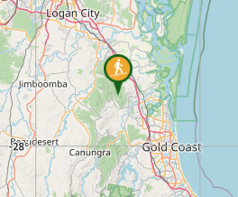
Comments