
Menu
Popular Walks
-
Wheel of Fire walk
(26 ticks) -
Sky Window Circuit
(23 ticks) -
Honeyeater Lookout
(21 ticks) -
Mt Rooper/ Swamp Bay
(19 ticks) -
Rainforest Discovery Circuit
(17 ticks)
Popular Walks
-
Wheel of Fire walk
(26 ticks) -
Sky Window Circuit
(23 ticks) -
Honeyeater Lookout
(21 ticks) -
Mt Rooper/ Swamp Bay
(19 ticks) -
Rainforest Discovery Circuit
(17 ticks)
History
Any interesting history for the region?
Features
What are the standout bushwalking features?
Access
How do you get there? Include all access points if there are many?
Maps
Which maps cover the region?
Accommodation
Where can I stay there? or near there?
Camping
Council Areas:
- Isaac Regional
- Mackay Regional
- Whitsunday Regional
- Livingstone Shire
Contact details
Contact details for National Park offices or similar...
Walks in Mackay, Isaac and Whitsunday

 12
km
return
12
km
return
 3
hrs
3
hrs
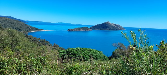
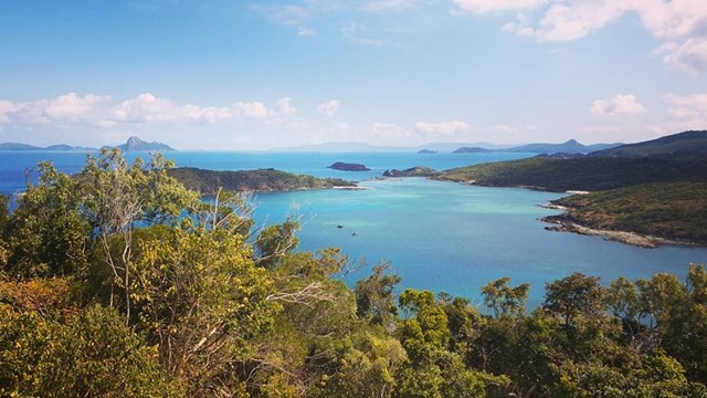
Spion Kop & Mt Jeffreys from Sandy Bay
A Spectacular walk with breathtaking views of the Whitsundays from every direction
 2.6
km
return
2
hrs
2.6
km
return
2
hrs
The Leap
2.5km return walk taking you to The Leap Lookout with spectacular views over Mackay to the ocean. It's a short but intense out and back walk starting in rainforest along a creek line before transitioning to a unique grass-tree ecosystem as you arrive at the summit. It contains some very steep sections and requires a bit of rock scrambling, and can be quite slippery after rain. Plenty of markers to guide you to your destination.
Parking is minimal at the base - you may have to park down the street a little bit, or, alternatively, park at the pub and walk from there, and have a relaxing meal and drink when you finish.
4.2
km
2
hrs
Wheel of Fire walk
Walk through rainforest and beautiful cascades through Finch Hatton Gorge. Track to Araluen cascades also joins on here. Excellent and popular waterholes - water is beautiful blue and crystal clear!
 2
km
return
1
hr
2
km
return
1
hr
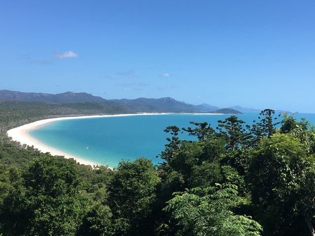
Whitehaven Lookout
Whitehaven lookout has some stunning views once you make it to the top. The track is roughly 2kms long with lots of stairs. Track is very clearly marked, so you can't get lost. Once at the top you get views all the way to hill inlet and beyond, on the opposite side of the island you can see Chance bay and beyond. One other note is its the only place on the island that has full reception.
 4.2
km
return
4
hrs
4.2
km
return
4
hrs
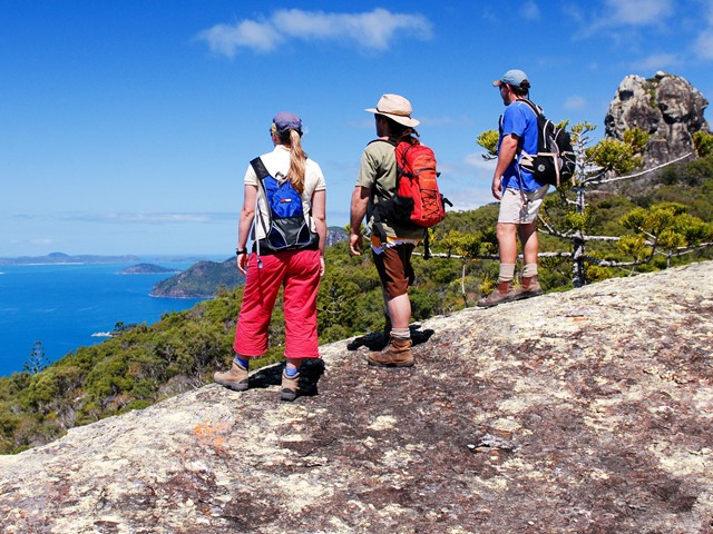
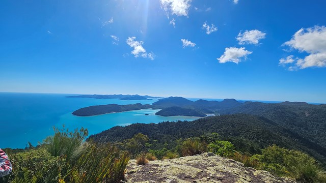
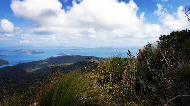
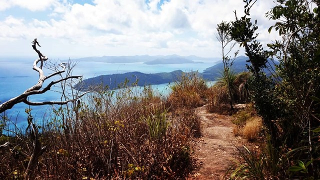
Whitsunday Cairn Track
Explore the steep slopes of Whitsunday Cairn—a towering volcanic mass perfect for those looking for an uphill hiking challenge.
 5
km
return
4
hrs
5
km
return
4
hrs
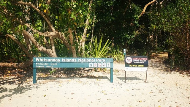
Whitsunday Peak
Whitsunday Peak is a 5km, Return hike located in Whitsunday Islands National Park Queensland. The hike should take approximately 4hrs to complete. Awesome view at the top
 1.7
km
return
30
mins
1.7
km
return
30
mins
Wishing Pool Circuit
A short walk through rainforest along calm river pools
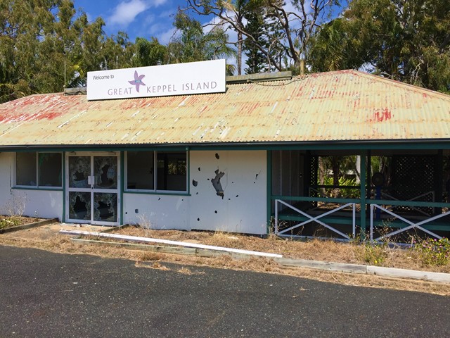
Walks in Great Keppel Island
1
km
one-way
20
mins
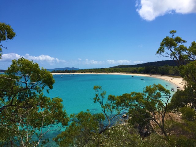
Fisherman's Beach to Shelving Beach
Shortest walk to a snorkelling beach on Great Keppel Island
5
km
return
3
hrs
Fisherman's to Long then Monkey and Shelving
From Fishermans Beach make your way to the old runway behind the resort which you can follow to Long Beach. Then you can head over the head land past an aboriginal shell midden to Monkey Beach then to shelving and back to Fishermans.
 20
km
return
1
days
20
km
return
1
days
Great Southern Figure of Eight Loop
Start at the western end of Putneys Beach climb over headland to Leekes Beach then inland along a path running to the west of the lagoon. Then turn west then south and go to 2nd Lookout then to Mt Wyndham then continue to clam bay through Butterfly Gully. Then to Coconut point and over to Red Beach then up to the lighthouse. Then along the lighthouse track which follows the ridge line back to the lagoon and historical homesteads. Then past the dam then onto 1st lookout then continue out to Fishermans Beach and then north to the starting point.
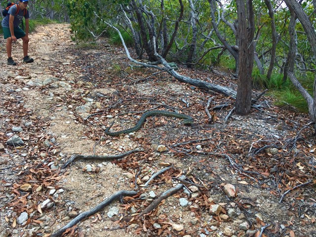
Animals: peacocks, snakes, goats, butterflys, sharks and more
Not an official walk but an amalgamation of a few.
Most enjoyable walk i've done followed it with the Northern Beaches Walk also an amalgamation of self design the next day great place to visit worth wish listing.