
Saddle Mountain
Far North Queensland


Menu
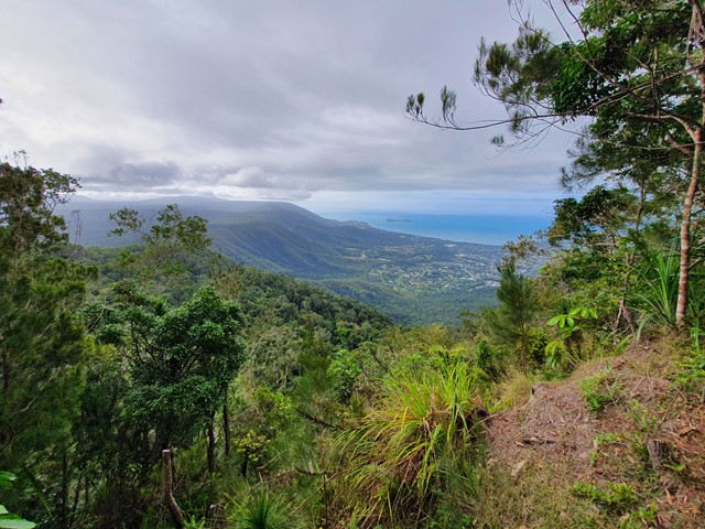
A steep walk up to the top of Saddle Mountain where you will get great coastal views from the radar station that sits at its summit.

Getting there
Drive to the James Cook University and park in the northern carpark. You will see a dirt bike track that leads into a large open field just below the mountain range.
Route/Trail notes
Follow the bike track/fire trail over the bridge and into the bushland. Once there the road will begin veering off to the left and you will follow until you see another firetrail on your right that ascends the range. The majority of the walk will be along this fire-trail. You will see a BMX bicycle track that runs parallel to the dirt road most of the way up. Eventually you will reach a small clearing (that looks a bit like a mini roundabout) where you will find a footpad cut into the rainforest - this is the track that will lead you to the summit. The track is very easy to follow but does become quite steep. In wet conditions prepare for this track to be very muddy and slippery. Upon reaching the summit you will find a fenced off Radar Station that you will need to walk to the right of to get to some outcrops where you can enjoy the view from. Don't go any further (towards Kuranda) as there are lots of signs indicating it is private property beyond the summit.
Permits/Costs
Free
Other References
GPS Tracks
- No GPS available for this walk yet.
 9.3
9.3 4
4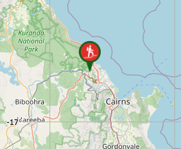
Comments