
Devils Thumb
Far North Queensland


Menu


A long, steep and tiring ascent up and over a mountain to get to the enormous granite rock feature that overlooks Port Douglas and beyond. Quite possibly the best lookout in North Queensland!!

Getting there
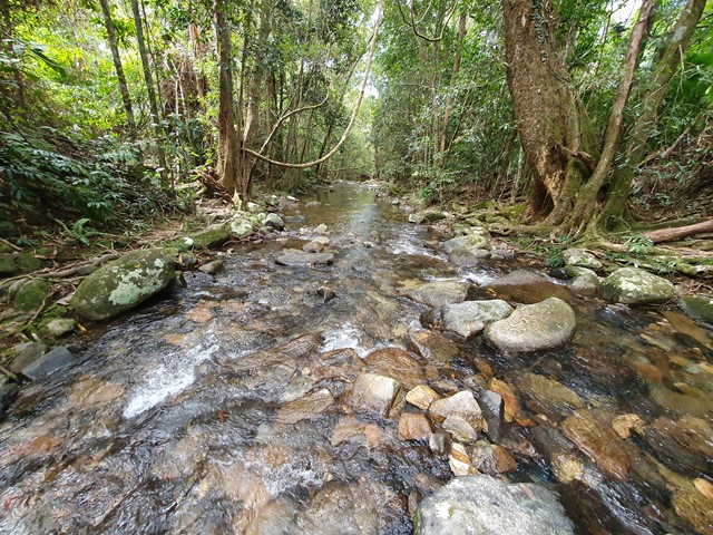
Drive to the end of Karnak Road - Whyanbeel. There you will see an obvious trailhead with a few spots to park.
Route/Trail notes
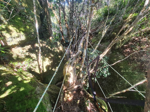
The start of the walk actually crosses private property, however the landowners have nicely allowed National Parks to mark the track through their land into National Park territory. Make sure to show respect, as everything before the creek crossing is privately owned. From the creek crossing the track begins to steeply ascend the range. Get used to the incline, because it's roughly 950 meters of relentless uphill until you get your first break. Upon reaching this elevation you will enter the Coral Fern Patch which is open enough to allow you to get some sensational views of the coastline. From here follow the muddy track cut into the ferns into the next rainforest section. This section is a bit trickier to navigate so definitely keep an eye out for ribbons. After reaching the high point (where there is nothing of any interest) you will descend to a section of massive boulders. The final part of this adventure involves climbing up a boulder using tree roots, then crossing a fallen tree from one boulder to another (ropes are in place to support this crossing), and then climbing up to the top of the Devils Thumb. Here you will be rewarded with breath-taking views - so long as you go on a day with perfect weather forecast.
Permits/Costs
No cost
Other References
https://www.weseektravel.com/devils-thumb-hike-mossman/
GPS Tracks
- No GPS available for this walk yet.
 10.6
10.6 8
8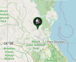
Comments