
Quart Pot Creek Trails
Darling Downs South West


Menu


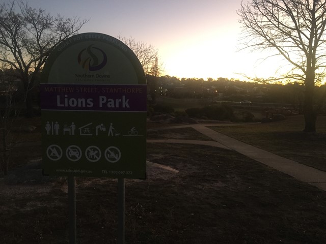
Trails around Quart Pot Creek in the Quart Pot Creek Parklands in the centre of Stanthorpe.
Picnic Facilities
Toilets
Dogs Permitted
No Camping Permitted

Getting there:
From any entrance point to Quart Pot Creek Parkland, Stanthorpe.
Maps:
None found.
Route/Trail notes:
The paths loop around both sides of Quart Pot Creek.
Permits/Costs:
None.
Other References/Comments:
None provided.
GPS Tracks
- No GPS available for this walk yet.
 5
5 1
1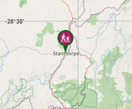
Comments