
Uresan 宇連山 (Aichi Prefecture)
Japan


Menu
GPS Tracks
An okay walk out in the deep sticks of Aichi. Not particularly worth going out of one's way to hike.

Getting there
Get to this hike by first going to the Aichi Prefectural Forest (Moritopia) or in Japanese 愛知県民の森(モリトピア). I believe there are infrequent buses but will be much easier to drive.
Maps
Good luck finding any maps. Best bet are the GPX I uploaded or some of the paper maps available at the campsite.
Route/Trail notes
Warning: navigationally this hike is very difficult. The signs do not point to the mountain peaks, they merely tell you which trail leads to which ridgeline based on compass points. This is very annoying and makes it hard to tell where you even are without a map. Please use the GPX map I have included as to be honest, I did this hike and actually have no idea about the exact path I followed.
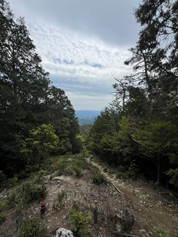
The basic outline for the hike is starting at the campground. It is a massive campground that extends for ages. You walk along a river for quite a while until you reach a sign that says that you have entered the quasi-national park area. Here you walk upwards for a while and make some turnoffs which I am not confident about. Please refer to the GPX which I have included in the downloads for this hike.
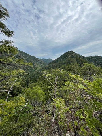
the best part of this walk is the semi-exposed part (beyond the tree line) where you get great views over the forest and the surrounding mountains. The peak has practically no views and is quite dull.
Permits/Costs
Nada dog. Carpark is free too
 Mt Ure (GPX)
 11
11 6
6
Comments