


 14.57
14.57 7
7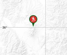
Aussie Bushwalking can keep track of your bushwalks.
Login/signup to tick this walk off.Mt. Aka 赤岳 (Nagano Prefecture)
Japan
Menu
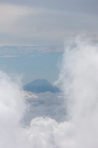
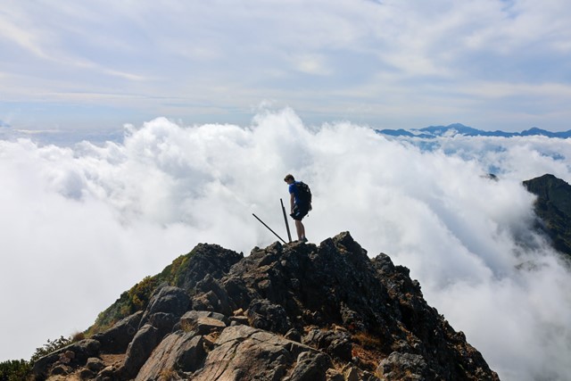
Mt. Aka is a popular day trip that has fantastic views over the surrounding alps and on a good day, even Mt. Fuji. There are plenty of options to extend the hike with many great surrounding peaks and abundant mountain huts and camp grounds.
Toilets
Public Transport
Dogs Permitted
Alpine
2899m
Maximum Elevation
Getting there
Getting to the beginning of this hike is the hardest part of the whole journey. As a disclaimer there is little to not information about all of this on any other website so going into the hike, I had no idea what to look out for.
If coming via public transport there is a bus from Chino station that you can catch to 美濃戸, this is where you can begin the hike from. However, starting from this bus stop will add 4 kilometres to your hike one way (total of 8 kilometres) up an unlovable unpaved road.
For those who have cars, it is possible to start the hike instead from the mountain hut at 美濃戸山荘; however, be warned that this genuinely one of the worst roads I have ever driven on in Japan. It is uneven, unpaved and only just doable in a regular car. There are some point that my car genuienly struggled to get up the hills and the car rolled back a few times against particularly slippery rocks. On the way back, I smashed by bumper and scraped the bottom of my car on multiple jagged rocks. If you care about your car or are worried about destroying a rental please instead park at the bus stop and do not attempt the drive up to the lodge.
Also note that we left our place at 4 a.m. and made it to the mountain hut at just past 6 am. At this point, most of the car park spaces had been entirely filled and we only just managed to snag something. If arriving after 6:30 am on a weekend by car, don't even bother as you will not have anywhere to park.
Maps
Nada.
Route/Trail notes
Begin the hike by walking up an unpaved old service road until you reach a fork in the road. Here there are two options both written in Japanese, 北沢 and 南沢. It doesn't matter which path you take as they both lead to the same destination. I personally took 北沢 up and 南沢 down. It is up to you.
Once at the mountain hut that both paths lead to, follow the path past the hut toilet and it will snake upwards. Keep following this one path upwards until you reach another fork in the road. Note that most of this path is through forest but as you get higher up, it becomes more challenging with stairs of questionable stability and some sections that are pretty much ladders. Nothing technical is required, there were literal children doing this hike, but note that it is not a walk in the park.
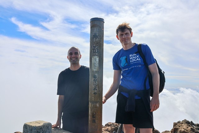
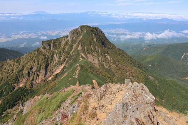
Once you reach the second fork there will be a signpost, one pointing towards Iodake and one pointing towards Akadake. Iodake is the jagged peak that looks pretty sick, Akadake is the green one with a mountain hut right at the base of the peak. Take the right path up to Akadake and follow the path to the peak.
Once you've summitted it is up to you whether you continue onwards to another peak, go back and summit Iodake or just go home. Honestly, is a super cool mountain range and there is lots of stuff to do.
Permits/Costs
Parking costs 1000 yen.
Other References
Good luck finding anything more detailed than this in English.
GPS Tracks
- No GPS available for this walk yet.
Comments
Nobody has commented on this walk yet. If you've done it then tick it off and add a comment.