
Red Cedar Walk
New South Wales


Menu
A walk through rainforest which highlights the trees in the area by identifying them.
Bird Watching
Picnic Facilities
BBQ
Toilets
Rainforest

Getting there
From Taree, travel to Wingham and from there follow the signs toward Tapin Tops. Follow the road to the Dingo Tops Rest Area.
Maps
Which maps cover the area?
Route/Trail notes
This walk begins on the right hand side of the road and descends steeply into the valley below, taking you through thick dark rainforest before coming back up the hill to the road.
Permits/Costs
No cost
Other References
How can I find more info? Any guide books?
GPS Tracks
- No GPS available for this walk yet.
 1.3
1.3 30
30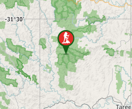
Comments