
Salisbury Waters Track
Oxley Wild Rivers National Park


Menu


A walk from Dangars Falls in Oxley Wild Rivers National Park to a water hole downstream.

Getting there
The walk begins at the Dangars Falls Picnic Area. The picnic area is reached by taking the Waterfall Way near Armidale and following the signs. The signs for this part of Oxley Wild Rivers National Park is quite close to Armidale and is the first signed turnoff.
Maps
Which maps cover the area?
Route/Trail notes
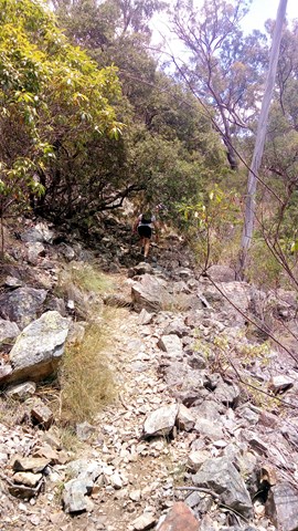
The Salisbury Waters track is the main track through this part of the park and most of the other walks here branch off from this track. Begin the walk above the falls and follow the track through woodland for 5km before the track takes a steep descend to the bottom of the gorge. This is a really tough part of the track. the last 800 metres is the hardest. The track surface here is loose in places. Make sure that you take plenty of water and don't leave it too late to make your ascent back up the side of the gorge.
Permits/Costs
There are no costs for this walk.
Other References
How can I find more info? Any guide books?
GPS Tracks
- No GPS available for this walk yet.
 7.2
7.2 7
7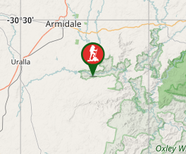
Comments