
Manly Dam
New South Wales


Menu
Best Bushwalking trail, around Manly Dam.
Waterfalls
Lookouts
Swimming
Bird Watching
Heritage Sites
Picnic Facilities
BBQ
Toilets
Public Transport
Cycling Permitted
Swamp or Wetland
30m
Maximum Elevation
10m
Total Climb

Getting there
How do you get to the start of the walk?
Drive or take bus 145 to 112 King Street, Manly Vale, NSW
Maps
Which maps cover the area?
Google map for Manly Vale, NSW
or
https://files.northernbeaches.nsw.gov.au/sites/default/files/documents/general-information/bushwalking/manlydamtrackandtrailmap.pdf
Route/Trail notes
A detailed description of the walk!
Permits/Costs
just car park fee. Or free if you park on king street.
Do you need any permits? What's the cost?
Other References
How can I find more info? Any guide books?
GPS Tracks
- No GPS available for this walk yet.
 7
7 3
3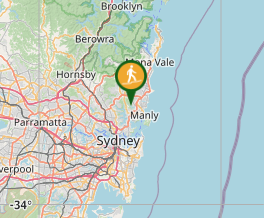
Comments