
Hooker Valley Track
South Island NZ


Menu
GPS Tracks
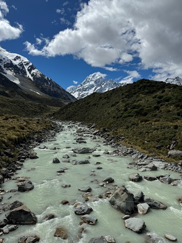
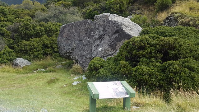
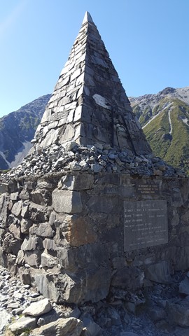

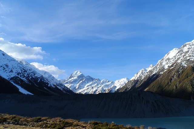
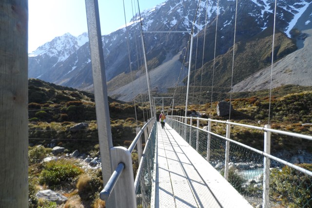
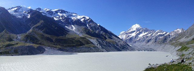
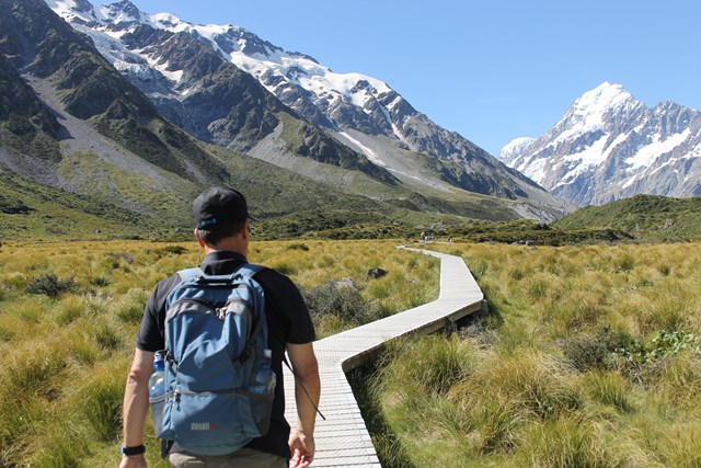

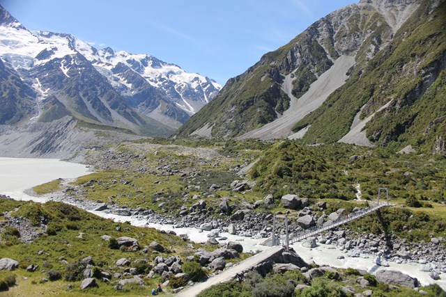
One of the most popular walks in the park with its picturesque icebergs, glaciers and majestic mountains; it will have you reaching for your camera at every turn. The track leads up the Hooker Valley towards Aoraki/Mount Cook and passes close to Freda's Rock and the Alpine Memorial before coming to the viewing platform of the Mueller Glacier and the first of three swing bridges.
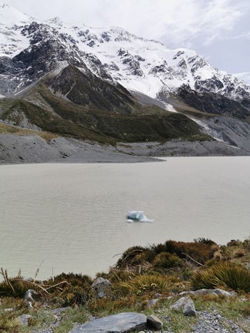
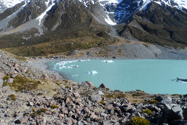
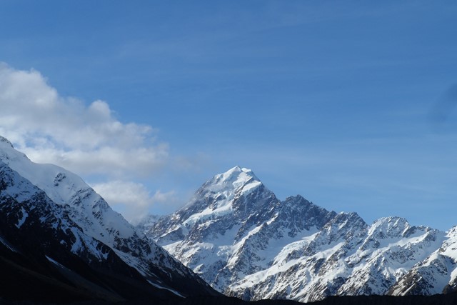
The track ends with an amazing view over the iceberg-speckled Hooker Lake and up to majestic Aoraki/Mount Cook and the Southern Alps.
Listen for the rumbling of avalanches from the distant Mount Sefton and try to spot them before they crash into the Mueller Glacier below.

Getting there:
From Mt Cook Village, take Hooker Valley Road up to the DOC White Horse Hill Campground and car parks. Alternatively, you can pick up a track to the campground from opposite the entrance of the Hermitage Hotel on Terrace Road, which will increase the walk by an extra 3km return.
Maps:
Aoraki - Mt Cook Walking Tracks
Route/Trail notes:
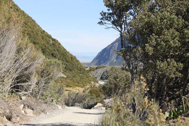
Start at the Visitor Centre or White Horse Hill Campground car parks. The signposted track leads up the Hooker Valley past Freda's Rock and the Alpine Memorial to the first swing bridge. From here, you walk between old moraine ridges and humps to the second bridge. Past this point, the vegetation changes to more open tussock and a wider valley floor. A third swing bridge leads to the East Hooker and the source of the Hooker River. The track ends at the glacier lake, where there are amazing views to be had of Aoraki/Mount Cook, Hooker Glacier and the Southern Alps.
The Hooker Valley track is mostly flat and well formed but some sections are rocky or muddy, and there are three swing bridges to cross. Be prepared for changeable weather conditions. There are a number of clear water streams that allow you to refill your water bottles along the way.
Return by the same route, enjoying more views down the valley and across to the Sealy Range.
Other References/Comments:
The best time to walk this stunning track is at dawn when the first rays of sun creep over the Southern Alps, including over New Zealand’s highest peak, Aoraki/ Mount Cook, and there are fewer walkers.
As with most South Island towns, there are always numerous tracks in and around the area. In this case most notably are Red Tarns, Kea Point and Blue Lakes.
 307 Hooker Valley Track (GPX)
 10.3
10.3 3
3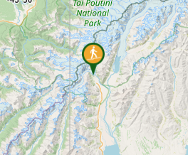
Comments