
Menu

 7.1
km
return
7.1
km
return
 3
hrs
3
hrs
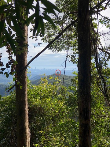
Trachyte and Tibrogargan Circuit
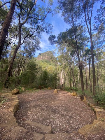
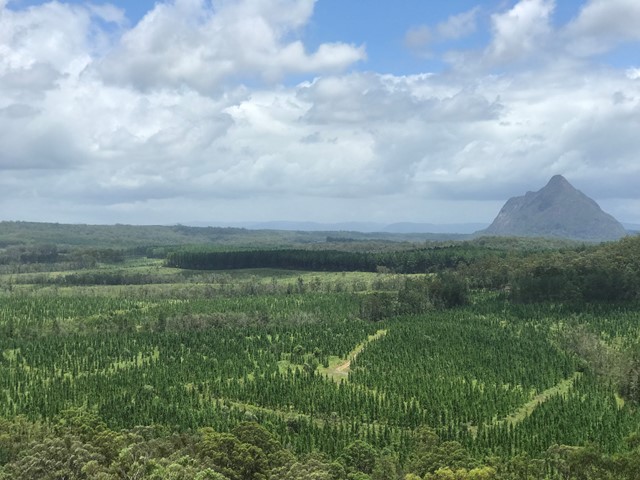
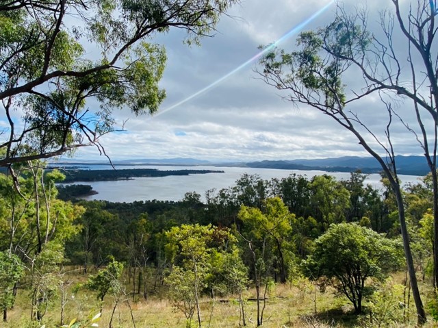
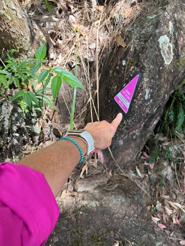
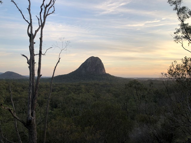
A nice, easy walk with nothing too strenuous. Leading from the car park, begin the Tibrogargan Circuit. At the first fork take a right (sign post and map at the fork). The circuit winds through open eucalypti, casuarina and native flora alongside Mount Tibrogargan and Mount Tibberoowuccum. Signage along the track provide information about the area's flora and fauna. The trail then ascends to the Jack Ferris lookout which is atop Trachyte Ridge and affords walkers a panoramic view of surrounding peaks and pine forest plantation. Interestingly, the Glasshouse Mountains themselves are volcanic plugs formed largely of rhyolite and trachyte which remain after the surrounding sandstone eroded over 25 million years.
 10
km
one-way
3.5
hrs
10
km
one-way
3.5
hrs
Cambroon Lane to Charlie Moreland Camping Area
A walk through the Imbil State forest on wide dirt tracks with the last section on Sunday creek road.
3.5
km
return
1
hr
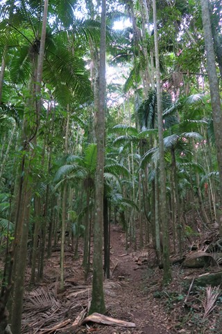
Piccabeen Circuit
Located at Charlie Moreland campgrounds, Imbil State Forest. Nice walk through open eucalypt and piccabeen palm grove. Nice day use area to have a picnic / bbq. Part of the circuit is along side a small creek.
 2
km
return
30
mins
2
km
return
30
mins
Veresdale Walk
King Coolum Reserve - A short walk with a few steep hills leading to a picnic area, with nice views over the scenic rim.
 3.4
km
return
45
mins
3.4
km
return
45
mins
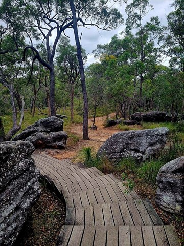
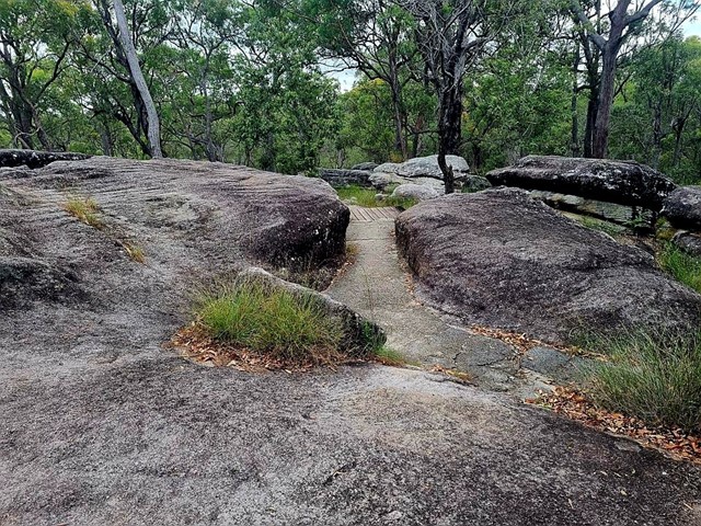
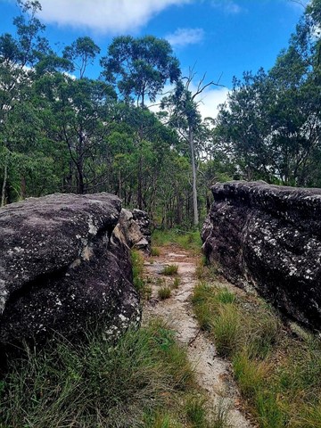
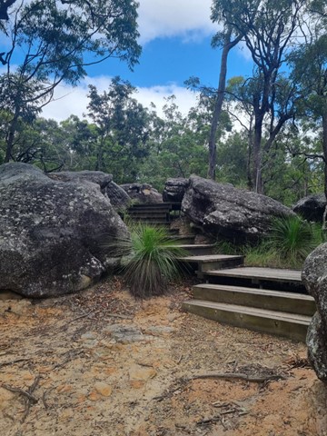
Rocks Circuit
A good circuit walk. Great view over the bushland. Includes stairs.
 13
km
return
13
km
return
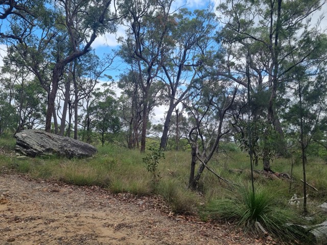
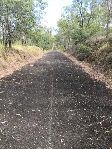
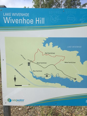
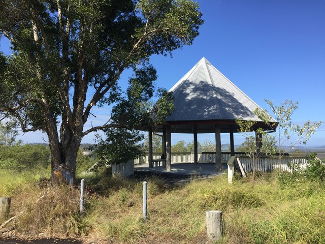
Wivenhoe Hill
A 13km walk along/around a section of the Wivenhoe dam. Scenery changes, from water views, open grassland, bush and rocky outcrops over undulating ground. Opportunity to see Whiptail Wallabies, Koalas, Red Wren and other bird species.
 8
km
return
4
hrs
8
km
return
4
hrs
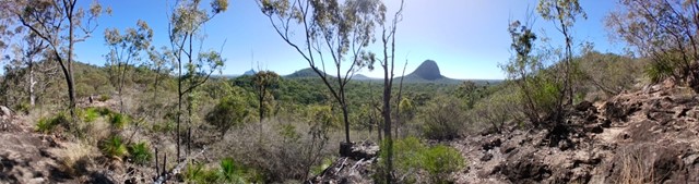
Yul-yan-man Track
Breathtaking views of the surrounding mountains, rock scrambling challenges and diverse plant communities await you are you skirt Mt Beerburrum and then transverse the Trachyte Ridge, before reaching a heath covered bluff and descending into the open eucalypt forest below.
 18
km
return
6
hrs
18
km
return
6
hrs
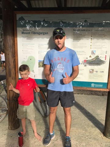
Beerburrum to Tibrogargan circuit via Soldier Settlers, Trachyte, Tibrogargan loop and Yul-yan-man track
This circuit will take you on all four trails between Beerburrum and Tibrogargan. It starts off easy but the last 5km is the hardest. The reward is an awesome hike!
 2.4
km
return
1
hr
2.4
km
return
1
hr
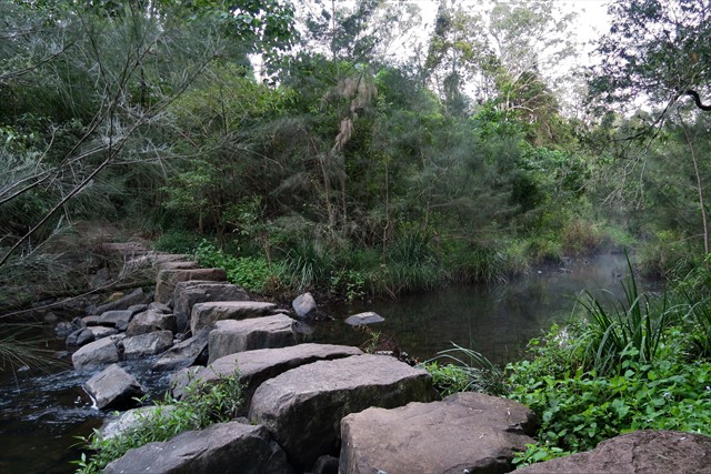
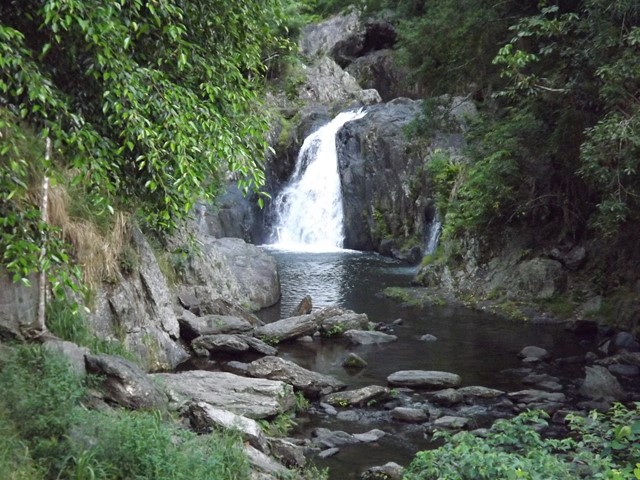
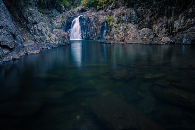
Crystal Cascades
Crystal cascades is popular freshwater swimming hole surrounded by a tropical rainforest, it has a series of small waterfalls that flow into large pools, This short easy walk takes you to popular swimming holes and with a waterfall at the last swimming hole
 3.97
km
return
3.97
km
return
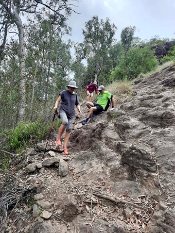
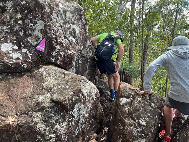
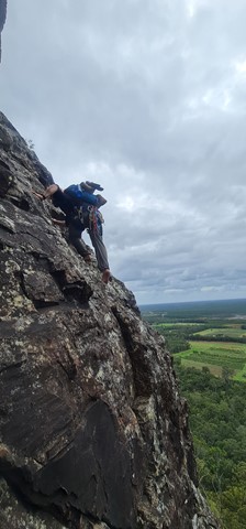
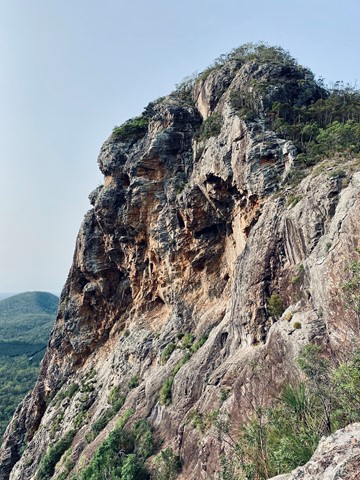
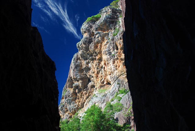
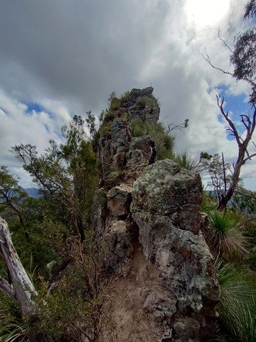
Mt. Tibrogargan summit - Caves Route
Could be also classified as a very hard bushwalk or an easy rock climb. Either way this is a short but classic scramble that displays the complexity of Tibro's majestic east face, on a series of unforgettable pitches, each with their own character and style.
Some parties prefer a roped ascent when some climbers think the solo effort is the way to fully enjoy the tremendous exposure this route delivers.
Route finding is easy and straightforward but falling is not an option on most parts. Some fixed abseiling/belay station are present at convenient spots to either retreat safely or bring following climbers up on a rope.
Each pitch of the whole route can be abseiled with a 60m rope and the experience is equal to the climb.
The hardest climbing move is below the big chimney, basic rock climbing skills are required to make a couple of grade 14/15 moves to build a belay or install an aid point.
Descent can be made safely via tourist track (very busy at times) or as mentioned, abseiling back (5 abseils).
Helmet and grippy shoes are mandatory and the route shouldn't be attempted when wet or downclimbed by the novice.
 36
km
return
1
days
36
km
return
1
days
Historic Nightcap Walking Track
Historic Nightcap walking track leads through World Heritage-listed rainforest, offering scenic views across Nightcap National Park and Whian Whian State Conservation Area, near Byron Bay.
 1.2
km
return
30
mins
1.2
km
return
30
mins
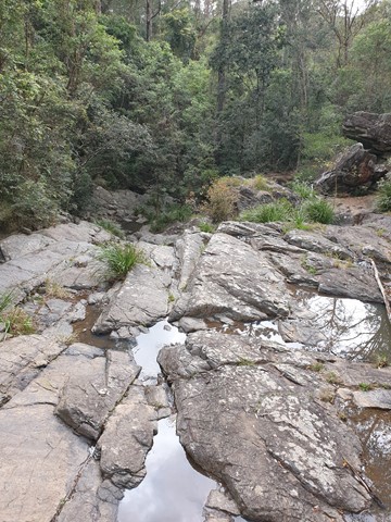
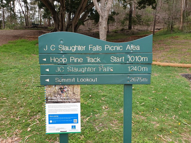
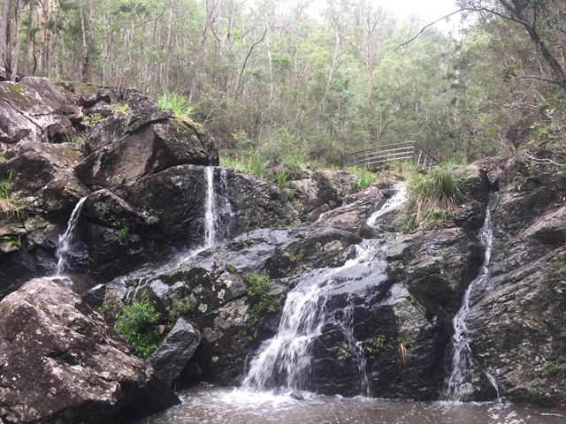
JC Slaughter Falls
The walk begins at the far end of the JC Slaughter Falls Picnic area and follows for about 600m way one. Only about 200m on the walk has a steep rocky incline but it isn't very difficult. The falls are non-existent unless there has been some rain.
 15
km
return
8
hrs
15
km
return
8
hrs
Mt Razorback
A full days walk to the summit of Mt Razorback will test your fitness and scrambling abilities. It starts as a steep uphill walk then as you join the ridgeline you will carefully traverse a razor sharp ridge with drop offs on either side followed by some precarious scrambling up loose cliffs. Not one for beginners but with enough care it is very achievable.
 5.5
km
return
2
hrs
5.5
km
return
2
hrs
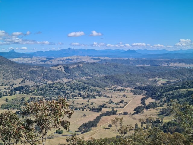
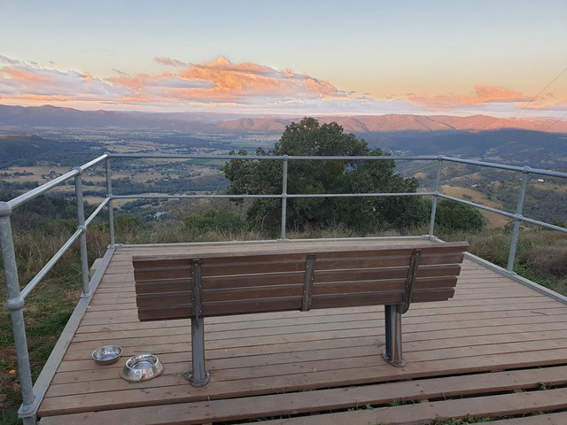
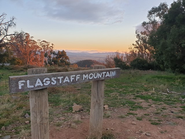
Flagstaff Mountain Lookout (Kamilaroi Walking Track)
This 5.5km return track will take you to the flagstone mountain lookout next to the city of tamworth.
You will see views of the city and surrounding areas and is worth a look if you are in the area.
You can drive to the oxley lookout car park which is the start of the kamilaroi walking track. The track has alternate routes that can be taken but the 5.5km return distance is for the direct route.
 2.6
km
one-way
40
mins
2.6
km
one-way
40
mins
Mahogany Trail
An alternate track to the Summit Trail at Mt Cootha Brisbane that is shared with bikes and horse riders
 2.5
km
return
1
hr
2.5
km
return
1
hr
Themeda Track
A great starter walk for those looking to get into hiking. About 2.5kms in length.
4
km
return
90
mins
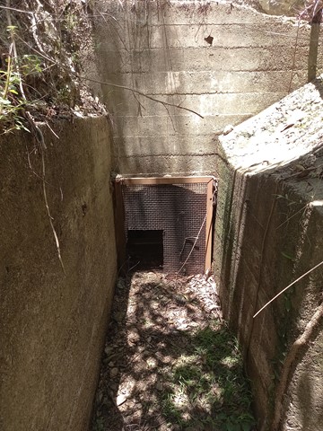
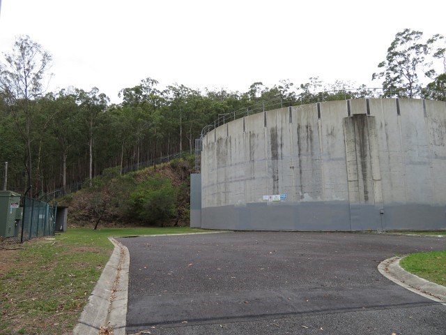
Enoggera Reservoir Tunnel
A short but rewarding walk to a piece of Brisbane's history. Built in 1928, along with an open viaduct, this tunnel moved water from Gold Creek Reservoir to Enoggera Reservoir. See https://historyoutthere.com/2018/09/23/the-secret-tunnel-to-australias-past/ for history.
 10
km
one-way
3
hrs
10
km
one-way
3
hrs
Gap Creek to Mt Coot-tha Botanic Gardens
This walk will use several tracks in the Mount Coot-tha area to take you from Gap Creek to Mt Coot-tha Botanic Gardens
 20
km
return
7
hrs
20
km
return
7
hrs
Springbrook Pinnacle
This walk takes you to the Springbrook Pinnacle via the Warrie Circuit. The Pinnacle requires scrambling but offers 360 panoramic views. The Warrie Circuit goes through rainforest with many waterfalls to see and go under.
 4.6
km
return
2
hrs
4.6
km
return
2
hrs
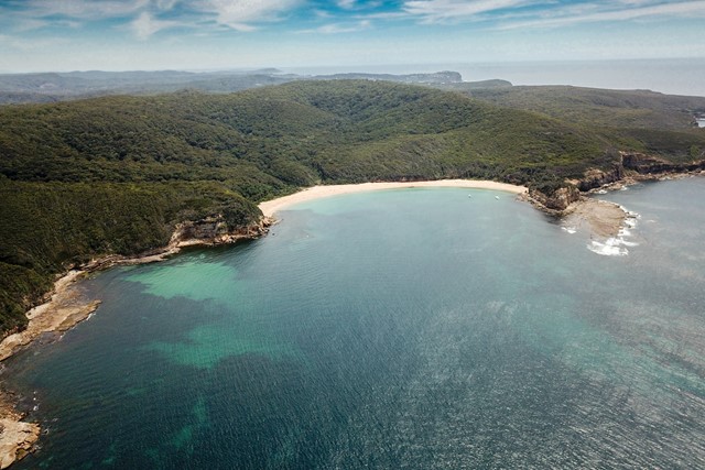
Bullimah Spur Track (Bouddi NP)
A short and very picturesque circuit in Bouddi National Park, with some of the best views in the park and a stop at beautiful Maitland Bay.