
Menu

 20
km
one-way
20
km
one-way
 6
hrs
6
hrs
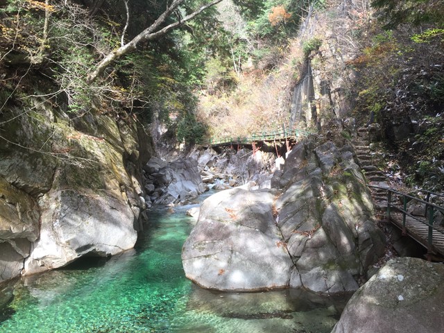
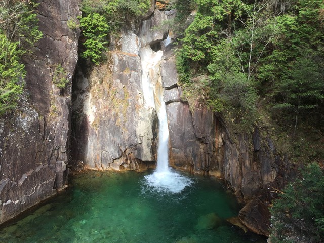
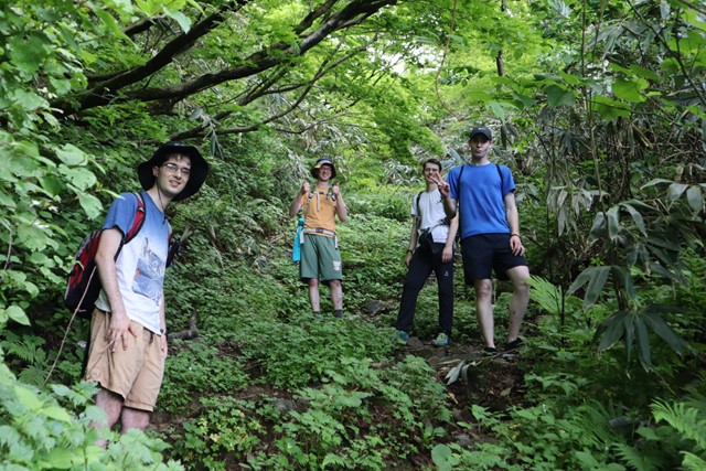
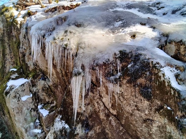
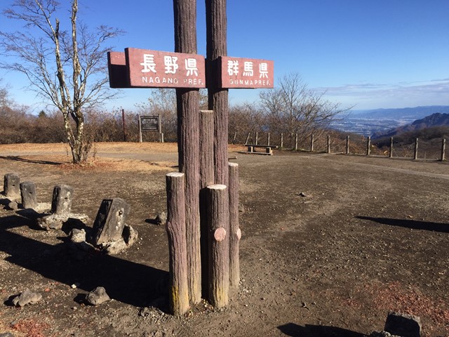
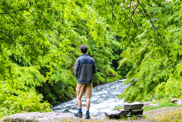
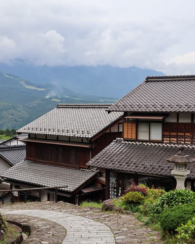
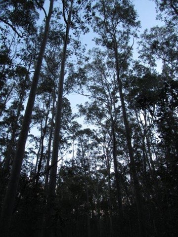
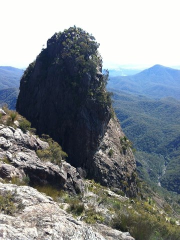
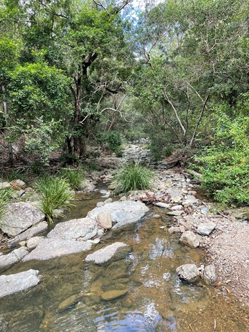
Kakizore Gorge (Junikane to Nojiri walk, Nagano Prefecture)
Scenic Gorge with suspension bridge, emerald waters, huge granite bolders and the majestic Ushigataki Fall, accessed by board walks along the river. Further exploration into the valley offers evens more waterfalls, lookouts and rock pools. 9km return walk from Junikane (Ushigataki Fall only) or 20km point to point walk that offers all the highlights and ends up in Nojiri with the option of an Onsen soak in Atera Fore Spa.
 12.6
km
return
6
hrs
12.6
km
return
6
hrs
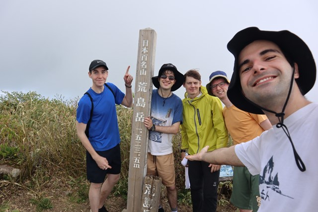
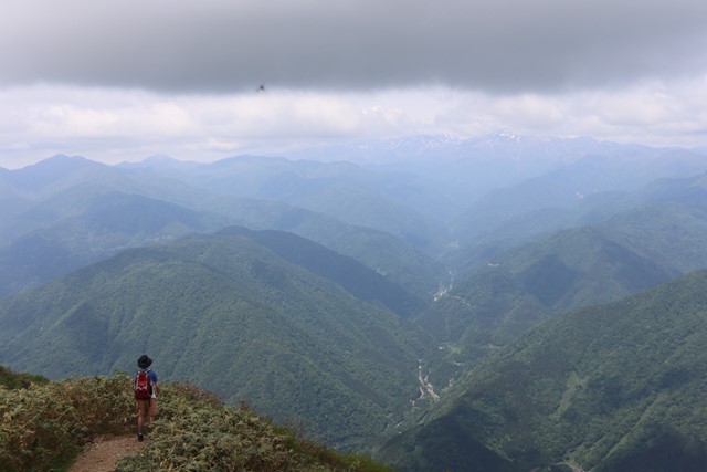
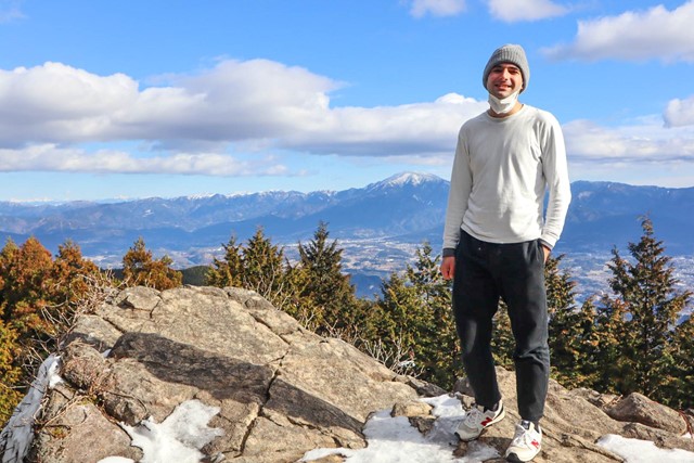
Arashimadake 荒島岳 (Fukui Prefecture)
Arashimadake is one of the 100 famous mountains of Japan. It is a long hike that takes you through luscious forest and provides sweeping 360 views over the surrounding mountains and Mount Hakusan.
 3.6
km
return
3
hrs
3.6
km
return
3
hrs
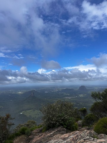
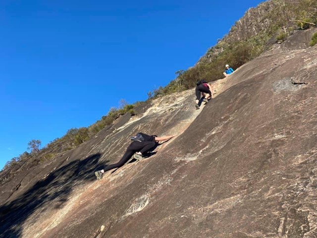
Mount Beerwah
Best to do this walk early before the heat of the day. From the base it's a steep rock climb/scramble up that seems to go on forever. Once past this initial climb, you reach the Organ Pipes. From here it's a moderate walk/scramble to the top. Views are amazing from the summit. Take your time coming down, use your feet and hands to control your descent as it's steep. If you're willing to sacrifice your pants to the rock, a crab walk/butt scoot down is effective for grip and won't make you slide Take water and some energy food as you'll be tired and need to get some energy, especially in the warmer months. Approx 3hrs. Great if you like a challenge.
Take care with this walk/climb, but go soon. A small group of Australians calling themselves the "Jinibara" have Non-Exclusive native title to the national park and want to prevent others paying homage to this wonderful mountain by climbing it. Be proud of your achievement if you reach the summit, but only if you feel confident on the steep rock.
 4
km
return
2
hrs
4
km
return
2
hrs
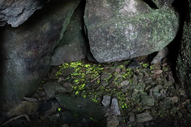
Kasagiyama 笠置山 (Gifu Prefecture )
Kasagiyama is an easy walk located in rural Ena with great views. Kasagiyama is famous for its rock climbing scene and glowing moss. The glowing moss has been designated as an important site as it is a rare natural phenomenon. Kasagiyama is a must for those making a trip out to Ena.
 17
km
one-way
6
hrs
17
km
one-way
6
hrs
Nakasendo Trail (Yokokawa to Karuizawa section, Gunma/ Nagano Prefecture)
Traverse a section of the old road between Tokyo and Kyoto, dating back to the Edo Period.
Enjoy villages and landscapes in their natural beauty.
This section of the Nakasendo Trail crosses the Usui pass (1200m), marking the border between Gunma and Nagano.
 16
km
one-way
6
hrs
16
km
one-way
6
hrs
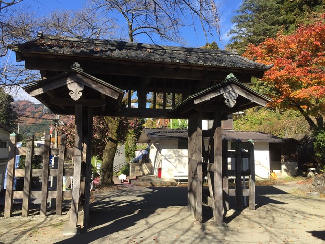
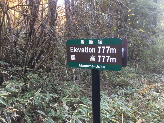
Nakasendo Trail (Nakatsugawa to Nagiso section-Gifu/ Nagano Prefecture)
Traverse a section of the old road between Tokyo and Kyoto, dating back to the Edo Period.
Enjoy villages and landscapes in their natural beauty.
This section of the Nakasendo Trail includes the villages of Magome and Tsumago, known for their meticulous restauration.
 15
km
one-way
5
hrs
15
km
one-way
5
hrs
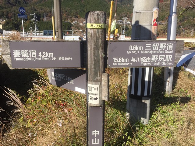
Nakasendo Trail (Nagiso to Nojiri section, Nagano Prefecture)
Traverse a section of the old road between Tokyo and Kyoto, dating back to the Edo Period.
Enjoy villages and landscapes in their natural beauty.
This section of the Nakasendo Trail was used when the more direct route along the Kiso river was flooded.
 1.3
km
one-way
20
mins
1.3
km
one-way
20
mins
Kakusenki Gorge 鶴仙渓 (Yamanaka Onsen-Ishikawa Prefecture)
Kakusenki Gorge is located along the Daishoji River near the village of Yamanaka Onsen. The 1.3km Gorge runs from Korogi Bridge to Kuratani Bridge.
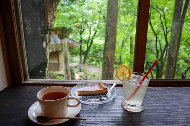
This is a luscious, serene walk in Ishikawa Prefecture. It is very easy and anyone can do it. Follow the river and take in the sights. There are some cool bridges along the way and some cute cafes in the forest.
 7.4
km
one-way
2
hrs
7.4
km
one-way
2
hrs
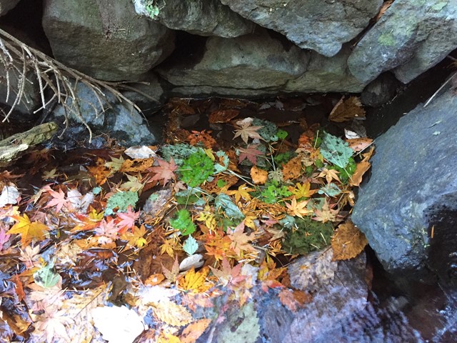
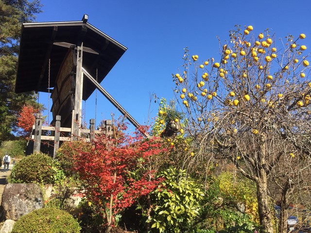
Nakasendo Trail 馬籠宿から妻籠宿まで (Magome to Tsumago section, Gifu/Nagano Prefecture)
Traverse a section of the ancient road between Tokyo and Kyoto.
Absorb the history of the stunning post towns (historic rest places) and beautiful waterfalls.
 10.4
km
return
4
hrs
10.4
km
return
4
hrs
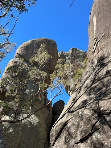
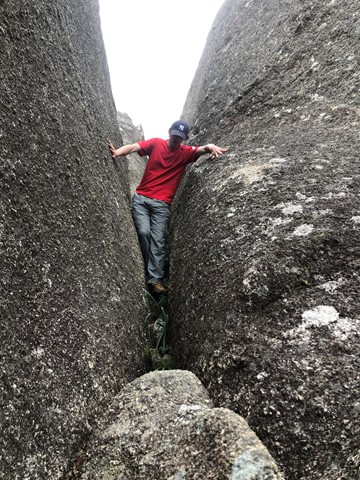
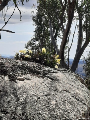
Mt Norman
The highest point in Girraween - Mt Norman provides some great views of the park and also visits the Eye of the Needle.
 1.6
km
return
30
mins
1.6
km
return
30
mins
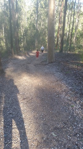
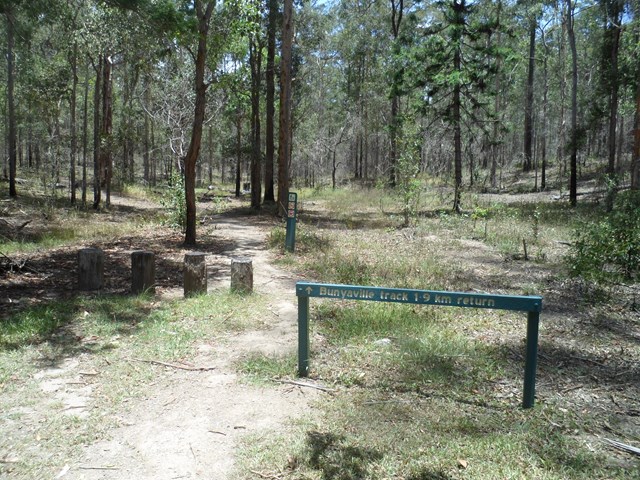
Bunyaville Track
This track leaves from the northern end of the day-use area and leads through open eucalyptus forest to the southern end of the day-use area. You may be lucky enough to see a carpet python basking in the sun or a large grass-yellow butterfly Eurema hecabe flutter by. Watch and listen for the pied currawong and laughing kookaburra.
 2
km
return
45
mins
2
km
return
45
mins
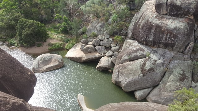
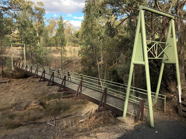
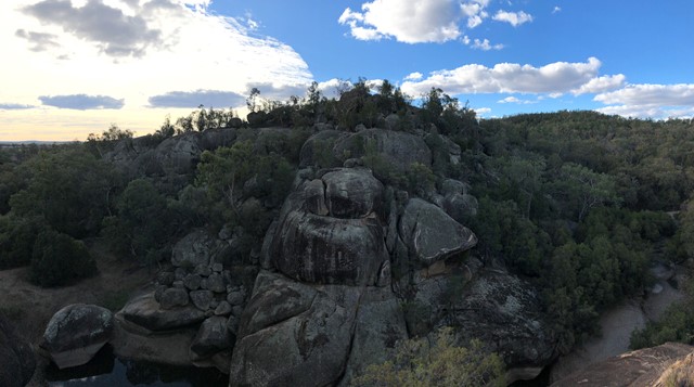
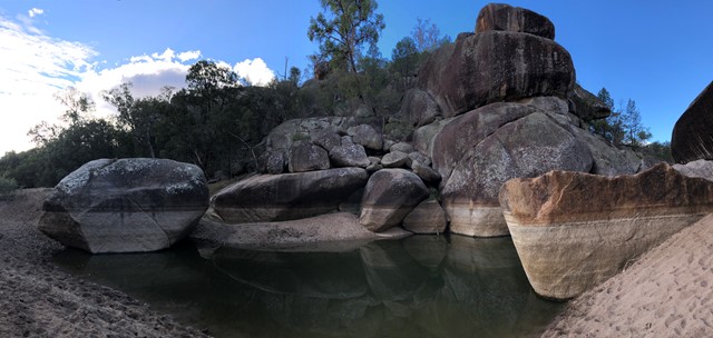
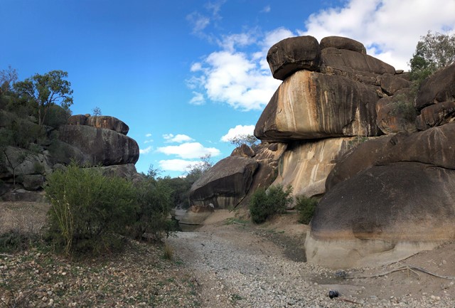
Cranky Rock
From the car park you walk over a short suspension bridge. From there you can either walk down to the creek or up through the massive boulders to the lookout. There is also a cave to explore and you can explore some of the creek.
 16
km
one-way
1
days
16
km
one-way
1
days
Mt Barney East Peak via SE Ridge, traverse North Pinnacle to Leaning Peak, descend to Barney Gorge and Lower Portals
We did this as a day walk, starting at Yellow Pinch carpark around 7AM and arriving at Lower Portals about 4PM. We were told by a professional guide we bumped into at Yellow Pinch carpark that we wouldn't be able to complete our planned route in 1 day. We completed it easily in about 9 hours and taking plenty of stops, but we're experienced hikers and you need to hold a good pace. Most people would probably prefer to break it up into a 2-day walk.
A couple things you need to know first up:
1. This route starts at Yellow Pinch Carpark but finishes at Lower Portals Carpark, so you either need to pre-arrange a way to get back to your car or you have an extra walk at the end from Lower Portals back to Yellow Pinch.
2. A rope is needed to descend a couple short sections of the couloir on the western side of Leaning Peak. This is a very steep scramble through thick grass and over a few small cliffs, so only attempt if you are comfortable with doing this, as once you pass the first cliff you're pretty much committed to continuing the descent because it's difficult to get back up.
 4.5
km
return
2
hrs
4.5
km
return
2
hrs
Mount Campbell
A short but steep walk to a broad summit with uninterrupted 360 degree views of the area.
2.5
km
return
30
mins
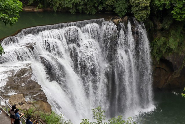
Shifen Waterfall 十分瀑布 (New Taipei City)
This is not much of a hike. There is a solid concrete path and road that takes you directly from the train station at Shifen to the waterfall. The viewpoints around the waterfall are incredibly crowded and can somewhat disrupt the view. I recommend going early to beat the tourists.
 4.6
km
90
mins
4.6
km
90
mins
Jacksonia Trail, Bellbird Trail, and Kokoda Trail Circuit
This walk is a great workout training. A lot of people along this track are training for possibly Kokoda and carry large packs. It is very steep, you some times see mountain bikers ride up and down.
 1.8
km
1
hr
1.8
km
1
hr
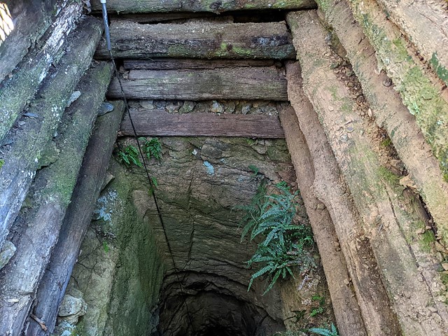
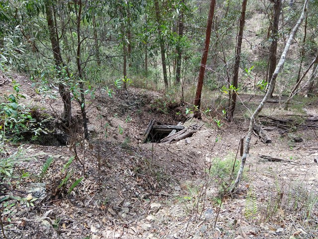
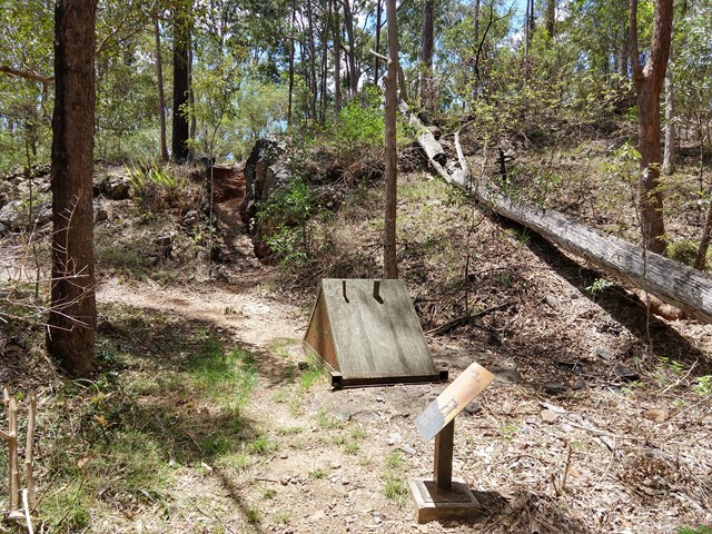
Golden Boulder Track
Cross the road and continue to the track shelter showing some history of the area then onto a plaque and continue along the track to a caged mine shaft. A worthwhile walk
 1.7
km
1
hr
1.7
km
1
hr
Turrbal Circuit
A walk through open bushland to the creek beds. Very enjoyable short walk.
 2
km
return
1
hr
2
km
return
1
hr
Punchbowl Lookout Walk
A new trail opened in Spring 2017 as part of the Government of South Australia’s $10 million upgrade of the Adelaide’s national parks.
The 1km (2km return) trail visits a new lookout above The Punchbowl, where you can see spectacular views into the Onkaparinga Gorge. The trail is a consistent one metre wide and made of compacted gravel, and with gentle contoured gradients, so as such is suitable suitable for people of all abilities, including those with mobility access issues, wheelchairs and prams. There is some seating mid-way along the trail.
Some people using wheelchairs may require assistance on the way back up the trail to the car park.
The Hike begins from the new carpark constructed in 2017, between gates 8 and 9 on Piggott Range Road. There are toilets at the nearby Sundews Carpark, near Gate 11 on Piggott Range Road.
5.8
km
return
4
hrs
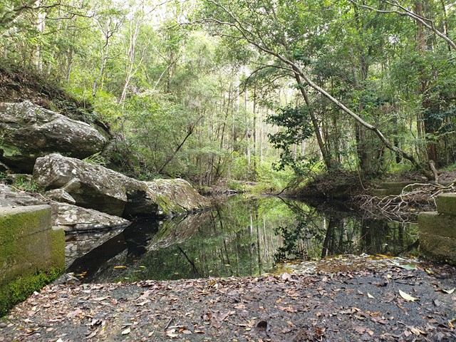
Gorge Hike
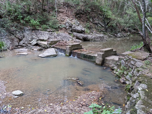
This trail descends from the Sundews Lookout along a contoured walking trail to the bottom of the gorge, and then follows the river downstream for 1.6km before returning via a steep fire track to the ridge and the car park.
The walk takes in two perennial waterholes, and a lookout. There are numerous glimpses into the river gorge from various parts of the trail.
The 1.6km of trail along the river is not well-formed, and involves some short rock scrambling. Current water levels and recent rainfall can impact on how hard this river section of trail is to follow. The trail is easiest to navigate when walking clockwise, as the fire trail exit is easily spotted, whereas when walking anticlockwise the walking trail exit may be harder to find.
Begins from the carpark at Gate 11 on Piggott Range Road (near junction of Upper Penneys Hill Road).