
Menu

 2.8
km
return
2.8
km
return
 45
mins
45
mins
Coucal Trail
An easy walk along the river. Known for its Pheasant Coucal bird population.
 4.4
km
return
90
mins
4.4
km
return
90
mins
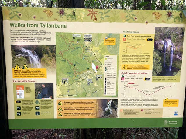
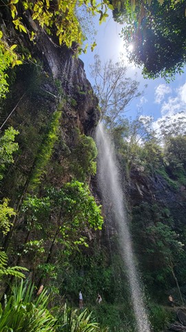
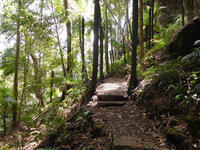
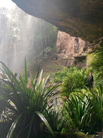
Goomoolahra Falls and Rainbow Falls
No need to complete the full 14 kilometre Warrie circuit, but instead walk 3 kilometres (of the 17 km track) and see at least 3 waterfalls. You are walking along the side of the cliff with sheer drops below and rock faces above.
Very picturesque and one of the nicest walks in Springbrook National Park. Not to be confused with the view of the Goomoolahra Falls from above.
 13
km
return
5
hrs
13
km
return
5
hrs
Waterfall Creek Trail
What starts out as ordinary walk leads to some great rock hopping, swimming and gorge exploring
 14.5
km
return
6
hrs
14.5
km
return
6
hrs
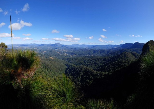
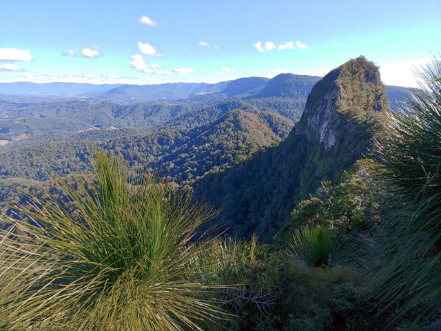
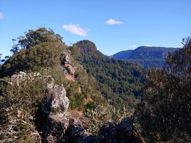
Cougal Cascades to Boyd’s Butte and Mt Cougal East Peak
A circuit walk from Cougal Cascades to Boyd's Butte and Mt Cougal. Includes views from both peaks.
 1.2
km
return
20
mins
1.2
km
return
20
mins
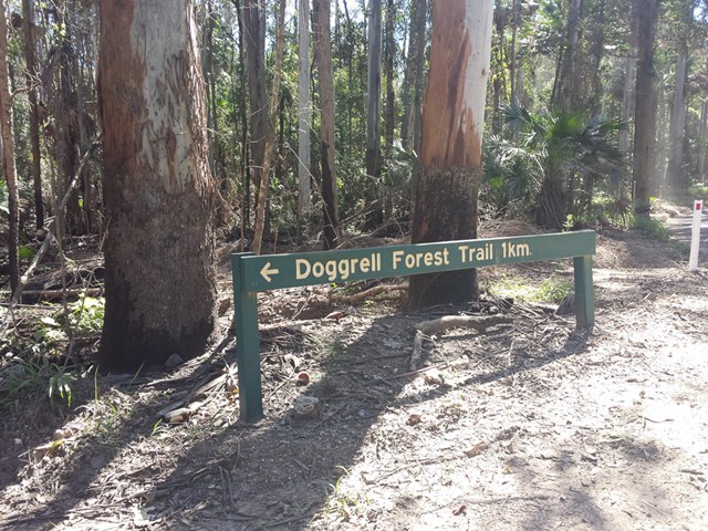
Doggrell Forest
This is a short relaxing walk through the Dogrell Forrest.
Worth it if you are traveling along the Pomona Kin Kin road and need to stretch your legs.
 13.7
km
return
10
hrs
13.7
km
return
10
hrs
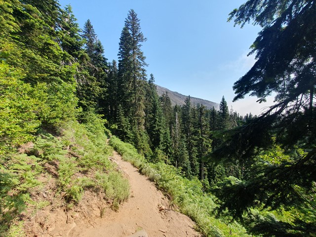
Mt St Helens
A long and progressively steep day walk up the smoldering husk of what remains of Mt St Helens after the 1980 eruption.
 24
km
return
2
days
24
km
return
2
days
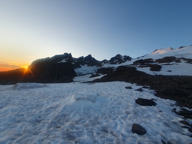
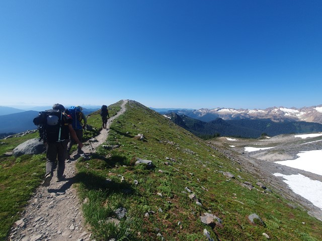
Mt Baker
A challenging alpine ascent to the summit of the stratovolcano Mt Baker - a perfect mountain to learn basic alpining techniques.
 3
km
return
45
mins
3
km
return
45
mins
Beryl Roberts Park
Accessible toilet, barbecue (electric), bikeway network, dog off leash area (Arrunga Street), fitness station (Barham Street), picnic area (Barham Street), playground (Barham Street, Perina Street), public toilet (Barham Street), water (bubbler/tap)
 2.8
km
return
40
mins
2.8
km
return
40
mins
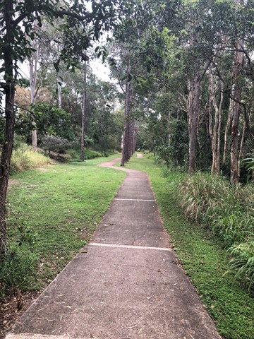
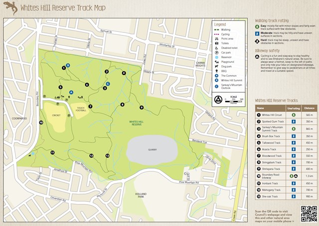
She-Oak Track (Whites Hill Reserve)
Enter via Pine Mountain Road, Follow the signs to the summit and look at the views over South Brisbane
3.4
km
return
1
hr
Bloodwood, She-oak, Mahogany and Ironbark Loop (Whites Hill Reserve)
Lovely Aussie scrub bush walk. Keep your eye out for koalas.
 2
km
40
mins
2
km
40
mins
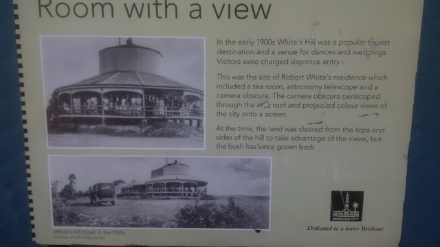
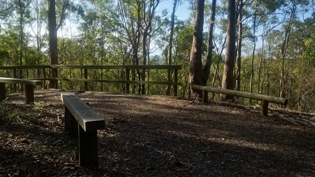
Whites Hill Circuit
A nice urban bushland walk to a peak and lookout to Brisbane's CBD. A few tracks that can be combined to a loop.
 3.5
km
return
1
hr
3.5
km
return
1
hr
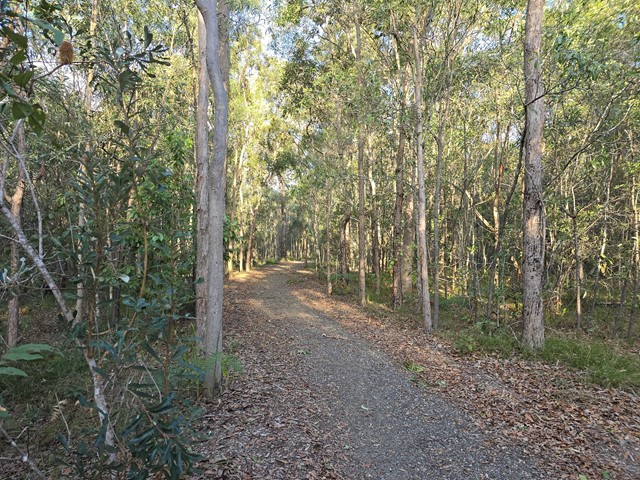
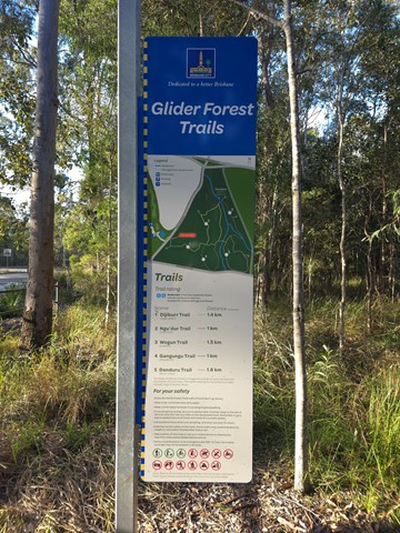
Glider Forest Trails
One of five signed recreational trails within Glider Forest allowing users to access and experience a range of different landscapes, including open eucalypt woodlands and paperbark groves surrounded by small stream-fed billabongs.
 4.5
km
return
4.5
km
return
Mount Petrie
This walk is unfortunately inaccessible as it traverses the Belmont shooting complex.
 3.7
km
return
2
hrs
3.7
km
return
2
hrs
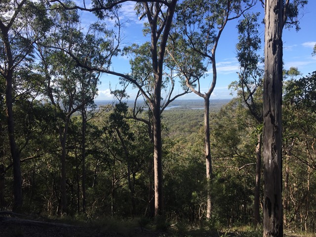
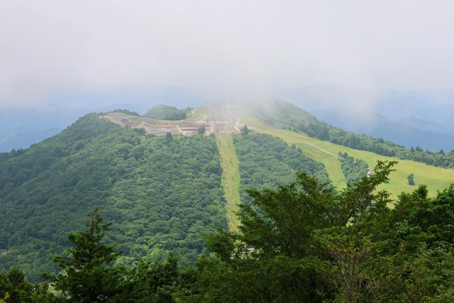
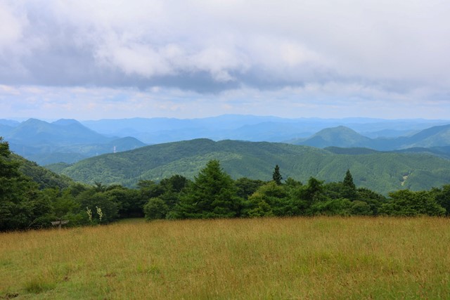
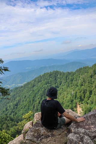
Mt. Chausuyama 茶臼山 (Aichi Prefecture)
Mt. Chausuyama is the tallest mountain in Aichi prefecture, part of a Quasi-national park. It is very easy and can be smashed out with the neighbouring mountain in probably less than two hours. There are some good mountain biking opportunities if you are of that persuasion, maybe good for trail running as well. In winter, the mountain becomes a ski field.
 6
km
return
2
hrs
6
km
return
2
hrs
Morelia Track
This track takes walkers from the Manorina car park to Mount Nebo lookout. Trek through wet eucalypt forest containing groves of cabbage tree palms, recognised by their huge, fan-shaped leaves. At Mount Nebo lookout, enjoy spectacular views over the Samford Valley to Moreton Bay. The track is well defined and gently-sloping. Keep your eyes peeled for a few of the old track markers with distances marked in miles.
 1.6
km
return
30
mins
1.6
km
return
30
mins
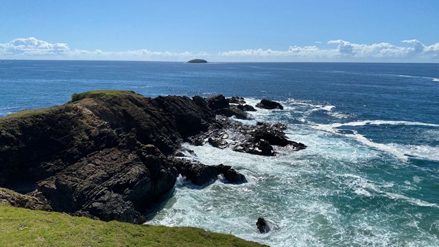
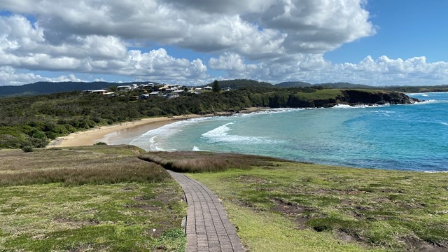
Look at me now Headland walk
A section of the Solitary Islands Coastal Walk at Emerald Beach walking around the headlands with lovely views of surrounding beaches and headlands to the north and south as well as views of the Solitary Islands to the east.
 8
km
return
2.5
hrs
8
km
return
2.5
hrs
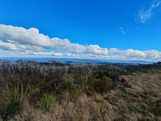
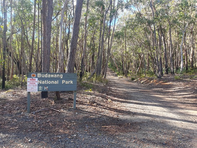
Mt Budawang
A moderate steady ascent up to the highest mountain in the Budawang range.
 6.8
km
return
5
hrs
6.8
km
return
5
hrs
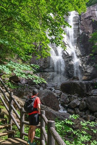
Tadachi Falls 田立の滝 (Nagano Prefecture)
An underated hike out in the middle of nowhere in Nagano prefecture. Mind-blowing waterfalls and epic adventure over suspension bridges.