


Menu
A walk across Bodmin Moor visiting the highest point of Cornwall (Brown Willy 420m).

Getting there
How do you get to the start of the walk?
From Roughtor Plantation Carpark at the end of Roughtor Road or alternatively you could start at the Jamaica Inn in Bolventor.
Maps
Which maps cover the area?
Maps of Bodmin Moor
Route/Trail notes
A detailed description of the walk!
Follow the trail to Showery Tor, then Little Rough Tor, then Rough Tor before crossing over to and up Brown Willy. Then head down the Eastern side and onto Catshole Tor and then Tolborough Tor. Then make your way down to Codda's A30 access road where you will cross under the highway and up to the famous Jamaica Inn in Bolventor. This walk is described as a one-way journey if you wanted to not do a car shuttle you could have lunch at the inn then return the way you came skipping some of the tors you have already summited for a walk of just under 20kms. Alternatively, you can return via following the road back under the A30 and all the way to Codda and then up Codda Tor and back that way.
Permits/Costs
Do you need any permits? What's the cost?
Free
Other References
How can I find more info? Any guide books?
N/a
GPS Tracks
- No GPS available for this walk yet.

 10.15km one-way
 3hrs
Where
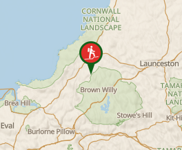 Map data © OpenStreetMap contributors. Terrain: © Geoscience Australia.
Comments
Nobody has commented on this walk yet. If you've done it then tick it off and add a comment.