


Menu
A walk out to an iconic chalk cliff formation on the Jurassic Coast and then back along the downs.

Getting there
How do you get to the start of the walk?
The corner of Watery Lane & Manor Road.
Maps
Which maps cover the area?
Maps of Studland & Swanage.
Route/Trail notes
A detailed description of the walk!
From the toilets at the junction of the two roads follow the coast path East out to the point where you will find yourself looking over Old Harry Rocks and across to Bournemouth and the Isle of Wight. Next follow the coast along then start heading up Ballard Down rather than down to Swanage. Get to the summit of Ballard Down then backtrack to the main track junction and continue Northeast down to a road which will continue North back to Watery Lane which you follow back to the start.
Permits/Costs
Do you need any permits? What's the cost?
Free
Other References
How can I find more info? Any guide books?
N/a
GPS Tracks
- No GPS available for this walk yet.

 8km return
 3hrs
Where
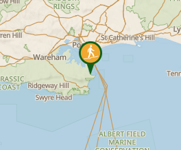 Map data © OpenStreetMap contributors. Terrain: © Geoscience Australia.
Comments
Nobody has commented on this walk yet. If you've done it then tick it off and add a comment.