


Menu
A trail to the top of Challow Hill (East Hill) with good views over Corfe Castle and a visit to the historic town with an option to visit the castle itself.

Getting there
How do you get to the start of the walk?
From Challow Walkers Car Park on Sandy Hill Lane.
Maps
Which maps cover the area?
Maps of Corfe Castle
Route/Trail notes
A detailed description of the walk!
Start from the walker's carpark and turn left on Sandy Hill Lane and shortly after on your left again will be the start of the walking track. Follow the Purbeck way to a saddle at the top of the down then switch back West to the top of Challow Hill (East Hill). From here you will have great views of Corfe Castle. Then take the steps that descend steeply to the town. You will pop out on Sandy Hill Lane just before the junction with East Street on the other side of the railway line. Follow East Street into town crossing the square onto West Street here you have the option to visit the castle or at least walk up to the front gates before continuing down West St until a footpath appears on your left that takes you through a park and back out onto East St. Follow East St until a lane appears on your left between the primary school and the castle inn. Follow this lane where at the end there is a footpad which takes you through a field across the train line and a creek and through another field until you pop out back on Sandy Hill Lane just down from the carpark.
Permits/Costs
Do you need any permits? What's the cost?
Free unless entering the castle then castle fees apply.
Other References
How can I find more info? Any guide books?
N/a
GPS Tracks
- No GPS available for this walk yet.

 3.6km return
 3hrs
Where
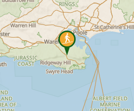 Map data © OpenStreetMap contributors. Terrain: © Geoscience Australia.
Comments
Nobody has commented on this walk yet. If you've done it then tick it off and add a comment.