


Menu
Enjoy the scenic headland with its wide sweeping views and historic forts as well as Brean Beach as featured in the TV show Sanditon.

Getting there
How do you get to the start of the walk?
Carpark at the end of Brean Down Road
Maps
Which maps cover the area?
Maps of Brean
Route/Trail notes
A detailed description of the walk!
From the carpark head straight up the steps up the down. Make your way along the crest of the down to its highest point. Then follow it to the military fort at the end. Then return along the Northern side of the down with views to Weston-super-Mare. You will soon arrive back near where you originally came up the steps. Although before you head back down a quick detour should be made to the iron age hillfort. Once back down have a wander along the beach then return to the car.
Permits/Costs
Do you need any permits? What's the cost?
Carpark Fees
Other References
How can I find more info? Any guide books?
N/a
GPS Tracks
- No GPS available for this walk yet.

 4.95km return
 2hrs
Where
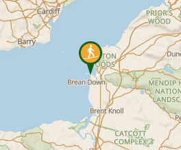 Map data © OpenStreetMap contributors. Terrain: © Geoscience Australia.
Comments
Nobody has commented on this walk yet. If you've done it then tick it off and add a comment.