


 18
18 7
7- Little Hugel (Cradle Mountain-Lake St Clair National Park)
- Fergy's Paddock Loop (Cradle Mountain-Lake St Clair National Park)
- Platypus Bay (Cradle Mountain-Lake St Clair National Park)
- Narcissus Hut to Cynthia Bay (Lakeside Walk) (Cradle Mountain-Lake St Clair National Park)
- Pine Valley (Cradle Mountain-Lake St Clair National Park)
Menu
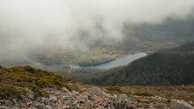
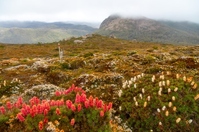
Climbs up from Lake St Clair to Mt Rufus, which provides sweeping views over Lake St Clair, Mt Olympus, Frenchmans Cap and the headwaters of the Franklin River. You can return the same way, or do a circuit which takes you back past Shadow Lake (a large alpine tarn). Incredible displays of flowering heath (scoparia) in summer. A well marked track with boardwalks in sections.
Lookouts
Bird Watching
Picnic Facilities
Toilets
Rainforest
Swamp or Wetland
1416m
Maximum Elevation
700m
Total Climb
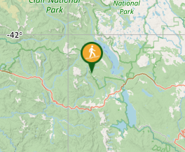
Getting there
Starts/finishes at Lake St Clair Lodge (Cynthia Bay). Approx 2:15hrs from Launceston and 2:30hrs from Hobart.
Maps
4233 Rufus 1:25K (south end of lake)
TASMAP Lake St Clair Day Walk Map (print & digital options)
Route/Trail notes
From the Lake St Clair Visitor Centre take the Watersmeet Nature Walk through the peppermint gum forest (Eucalyptus amygdalina) until you come to the Mt Rufus summit track junction. From here it is about 7.5 km to the summit. Return the same way, or continue down the ridge line that tracks north towards Mt Hugel, and then through the valley below the saddle between Mt Rufus and Mt Hugel (known as the Richea Valley for for the pandani andscoparia plants that grow here). Descend through rainforest, buttongrass moorlands and snow gum forest to Shadow Lake and follow the track back down to Cynthia Bay
Permits/Costs
National Park entry fee payable.
Other References
https://hikingtheworld.blog/2019/01/06/mt-rufus-and-little-hugel/
Official webpage has good detail for the above: https://www.parks.tas.gov.au/?base=1558
GPS Tracks
- No GPS available for this walk yet.
Where
Click here to load this map.
Comments