
Meander Falls Circuit
Tasmania


Menu
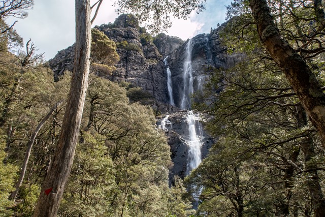
One of Tasmania’s 60 Great Short Walks, the hike to Meander Falls can be done as a circular walk, taking in a variety of terrain and a number of smaller (but equally impressive) falls by taking the Split Rock Track back.

Getting there
30km south-west of Deloraine. Take C167 from Deloraine to Meander, then follow signs to Meander Forest Reserve. Last few kilometres of road is unsealed and rough, but OK for 2WD vehicles
Maps
- 4637 Breona (1:25,000)
- 4638 Quamby Bluff (1:25,000)
Route/Trail notes
The track follows the Meander River upstream. It ascends fairly steadily but not steeply at the start, with a steep section after about 3km before it levels out for the last kilometre to the Falls. Return the same way, or take the signposted "Split Rock Track" that descends and crosses the Meander River before traversing a large scree field. This alternate track returns via a number of picturesque waterfalls.
Permits/Costs
National Parks Pass required.
Other References
https://hikingtheworld.blog/2018/09/22/meander-falls-and-split-rock-circuit-western-tiers/
GPS Tracks
- No GPS available for this walk yet.
 10.6
10.6 6
6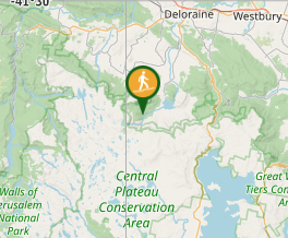
Comments