


 28
28 2
2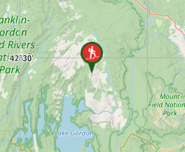
Aussie Bushwalking can keep track of your bushwalks.
Login/signup to tick this walk off.Lake Rhona (via Rasselas Track)
Franklin-Gordon Wild Rivers National Park
Menu
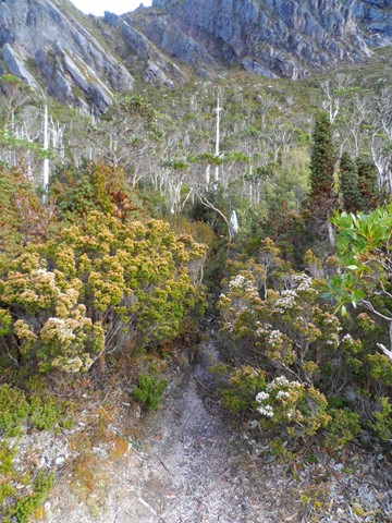
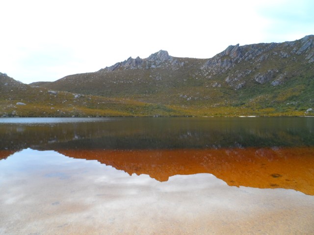
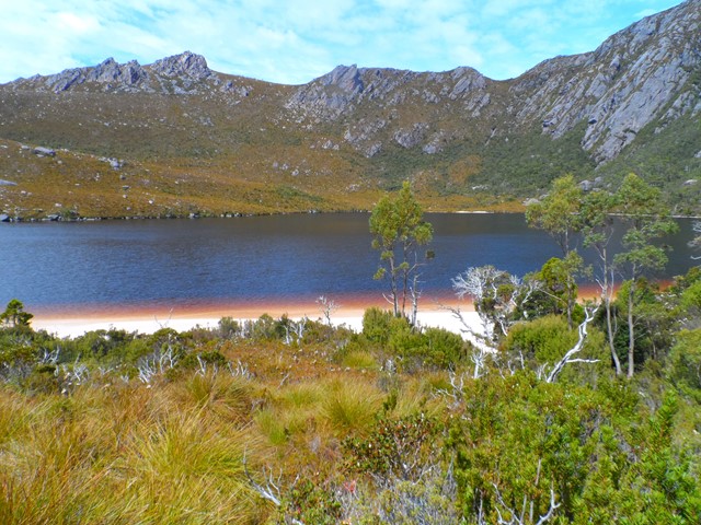
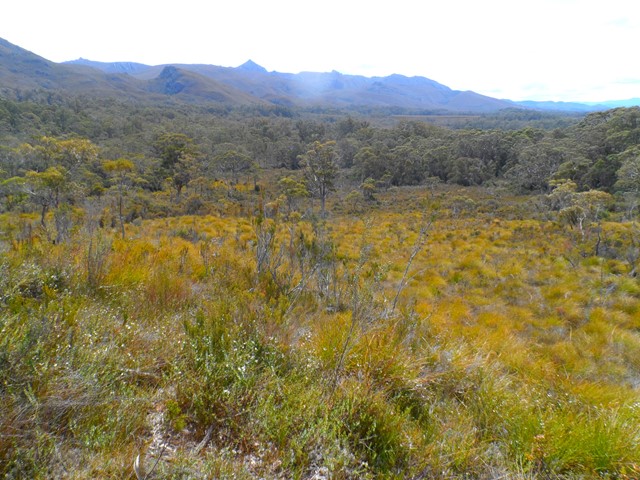
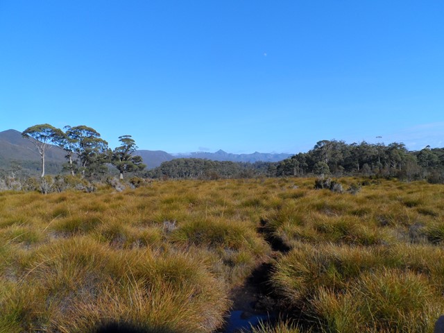
Lake Rhona is classified as a "hung lake" which is 900 meters above sea level and is the result of Ice Age Glaciers. This a hard 2 day 28km hike within the Wild Rivers National Park in the South West wilderness area of Tasmania. Situated in the midst of the Denison Ranges, the Lake’s beautiful pink/white quartzite sands surrounded by dominate ridges make it a truly unique Lake. The track follows flat button grass marshland for a majority of the way before a short hard climb of 400m to the final section below the Lake. This is your typical Tasmanian bush bashing walk. You will be muddy, scratched, bruised and weary at the end of each day. The track is exposed for most of the way.
Lookouts
Swimming
Bird Watching
Scrambling or Climbing
Navigation Required
Swamp or Wetland
Eucalypt Forest
920m
Maximum Elevation
550m
Total Climb
Getting there
Allow two and a half hours from Hobart to get to the start of the walk. From Hobart travel via the Brooker Highway (A10) to New Norfolk. At New Norfolk, follow the B61/B62 road past Mt Field and Maydena. 2km west of Maydena turn right onto Florentine Road. This is a gravel road that goes for 27km before forking left on to Tiger Road. The road is a foresty road and is usually accessible by 2WD vehicles. After about 3.5km later turn left onto Range Road and follow it for another 3.5km before turning left onto Terry Walch Road. Follow Terry Walch Road for 3km before taking the G03 spur to the right. The car park for Lake Rhona is located 200m down this road at the end of the road.
Maps
Denison Range 1:50,000 Topographic Map
Route/Trail notes
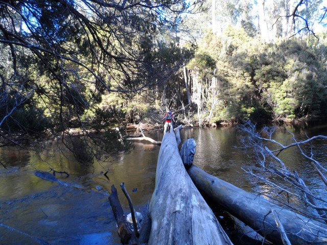
The Richea Track leads from the southern end of the car park directly into the Gordon Range. About 40 minutes from the start you should reach the Gordon River. This part of the walk gently descends downhill through Myrtle forest. At the Gordon River a large fallen tree provides a bridge to cross the river, or alternatively the river can be waded slightly upstream of this fallen tree. Only attempt to wade across the river when the river is at it's normal flow. Rain can cause flash flooding. There is a campsite situated in the forest on the other side.
From this side of the river, the track goes straight on for a short distance (about 15 - 20 mins) and then comes to a T junction. Turn north here and you are now on the Rasselas Track. For the next 3km or so the track changes between muddy button grass swamp, dry sclerophyll forest and stands of Tea Trees before you arrive at Gordonvale. This is a lovely place to stop and have a break and/or explore the old area.
From Gordonvale the track gradually climbs for approximately 4km and returns to the marsh plains, crossing many small creeks with some sections of heavy mud. As you make your way along the track Reids Peak can be seen in the distance. Reids Peak is directly above and behind Lake Rhona, but Lake Rhona is not visible from here.
After 4kms or so, the final section of the hike is reached and this is the hardest part. The track climbs steeply 400m up and over glacial merrains. There are many false peaks in this part of the track and you honestly start to think you will never get there as you still cannot see the Lake and it is one false peak after another. The last ridge is the steepest of all and you will be puffing and sweating when you reach the top. At the top of this ridge you will see Lake Rhona in the distance. You forget your aches and pains as you are take in the beauty of the Lake and Reids Peak behind it. It’s a very special place and most people are awe struck. From the top of this ridge you go downhill a little and around the lake to the camp grounds on the northern side.
The total distance is approximately 14km and should take 6 to 7 hours each way.
Permits/Costs
A Parks Permit is required and is available from "Parks and Wildlife Services Tasmania"
Other References
John Chapman has a series of books covering walks in Tasmania.
GPS Tracks
- No GPS available for this walk yet.
Comments