
Cape Tourville Circuit
Freycinet National Park


Menu
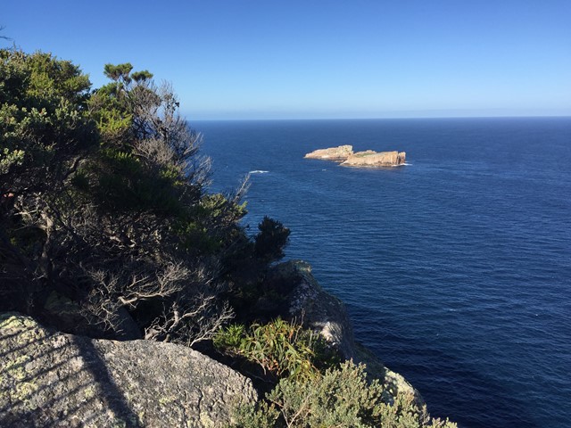
Headland walk with expansive ocean views, Freycinet coastline and Cape Tourville lighthouse.
Lookouts
Bird Watching
Heritage Sites
Wheelchair Accessibility
Coastal
120m
Maximum Elevation
25m
Total Climb

Getting there:
Take the Cape Tourville Road exit nearby township of Coles Bay.
Maps:
TasMap NPFREY FREYCINET NP (1:50K)
6033 COLES BAY (1:25K)
Route/Trail notes:
A boardwalk along the rugged Freycinet coastline and around the Cape Tourville Lighthouse offers spectacular coastal views.
Permits/Costs:
None.
Other References/Comments:
https://hikingtheworld.blog/2019/01/12/cape-tourville-freycinet/
GPS Tracks
- No GPS available for this walk yet.
 600
600 20
20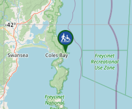
Comments