
Lobethal Bushland Park - Purple Trail
South Australia


Menu
GPS Tracks
The purple trail is the longest walk in Lobethal Bushland Park and parses both the lower and upper dams. The walk is scattered with gums showing signs of regrowth after bushfires in 2020. This walk is a good way to see all the park has to offer. The purple trail has an optional extension which ads approximately 1km to the journey. This extension is included in the measurements and maps provided.
Lookouts
Picnic Facilities
BBQ
Eucalypt Forest
535m
Maximum Elevation
250m
Total Climb

Getting there
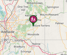
The park entrance is located on Kentron Valley Rd just outside of Lobethal. Here is a Google Maps link.
Maps
No maps are required for this walk as trails are clearly marked.
Route/Trail notes
There are four colour coded trails in the park.
Permits/Costs
There are no fees or permits to enter the park.
Other References
Visit the the Friends of Lobethal Bushland Park website.
 Lobethal - Purple Walk (GPX)
 5.3
5.3 ??
??
Comments