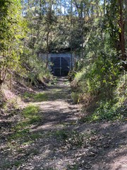
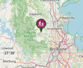
This track is part of the disused rail line which went from Ferny Grove to Dayboro. Ends at Yugar rail tunnel. Memorial stone with info on top of tunnel.
Getting there
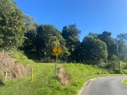
From Samford Village travel north along Main Street and then Mount Samson Rd towards Dayboro. Turn left into Gibbons Rd and then right onto Currawong Rd. Carry on straight on Currawong Rd - don't take the turn when the road veers left. The track begins just before the turning circle at the end of Currawong Rd, on the left hand side beside some cycle trail signage. Walk up the bank and there are two tracks at right angles. Take the one that heads off to the right.
Maps
Which maps cover the area?
Route/Trail notes
This is a nice straight mostly level track following where the train line once was. There is nothing to show of its history until the end where you come to the tunnel. The tunnel is home to bats which are studied by UQ and is blocked off by a large grate. There is only one gully to cross and the track is grassy.
Permits/Costs
No cost.
Other References
How can I find more info? Any guide books?
GPS Tracks
- No GPS available for this walk yet.


 2
2 30
30
Comments