
Kureelpa Falls
Mapleton National Park


Menu
GPS Tracks
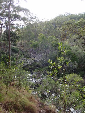
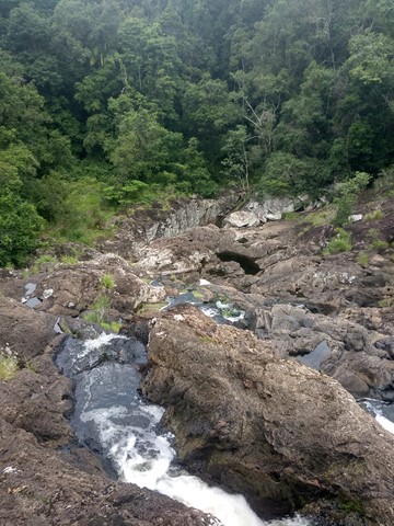
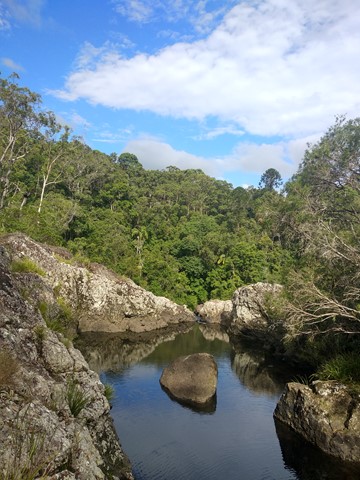
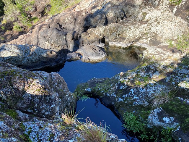
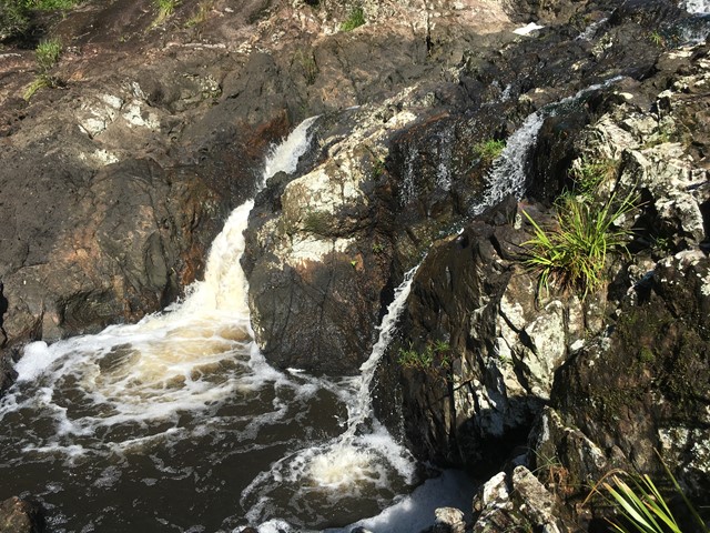
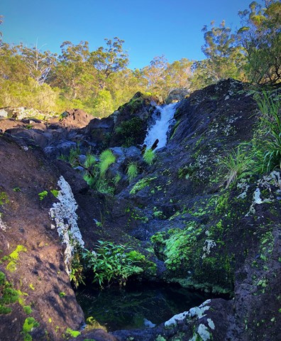
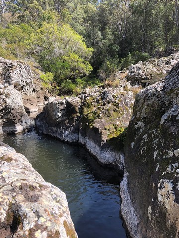
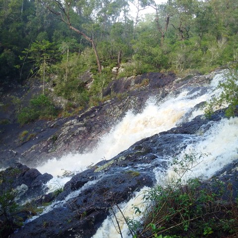


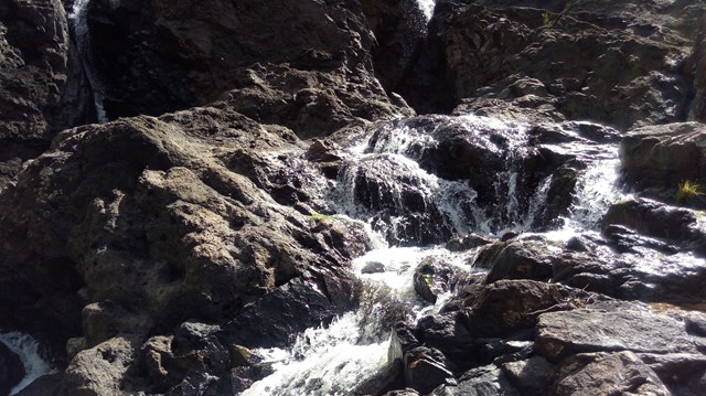
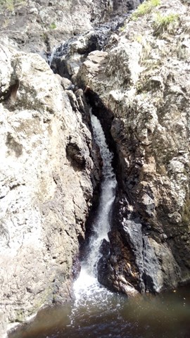
A hidden gem in the Mapleton National Park, with water from the South Maroochy River cascading over boulders before falling 30m into a hidden gorge.

Getting there:
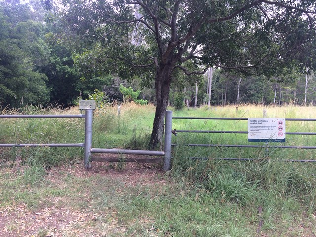
Take the Mapleton Road from either Nambour or Mapleton and opposite the Dulong Lookout at Kanyana Park turn into Kureelpa Falls Road. Follow the road along the ridge (great views) to its far end (last section is on gravel) where there is room to park before the gated access to the Park.
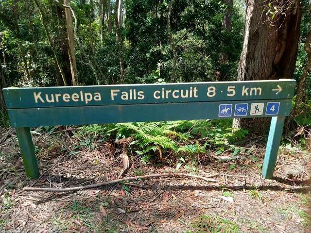
Alternatively, the falls can be reached via an 8.5km circuit starting from Mapleton NP Day Use Area. From Mapleton take Obi Obi Road then right turn into Delicia Road then right again into Mapleton Forest Road. The Day Use Area is clearly marked, as is the starting point for the walk. The last approx 2km to the Day Use Area is unsealed road but any vehicle will be OK. Beyond the Day Use Area Mapleton Forest Road deteriorates, the "high clearance 4WD only" warning sign should be taken seriously.
Maps:
None found.
Route/Trail notes:
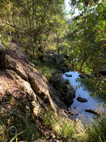
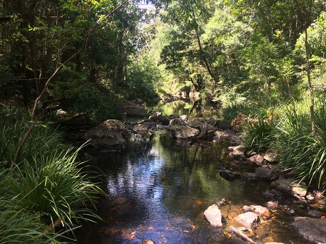
From the gate, follow the faint trail know as River Break through the long grass and after 600m you will come to a creek crossing, which would likely be well flooded after heavy rain. When dry, there are stepping stones to help you across. Follow up the far side until you reach the more defined track and turn right. Shortly you will see a sign down to the falls on your right, which you follow for 400m.
The alternative, longer walk from Mapleton Day Use Area is very clearly marked, just follow the route markings for walk number 4. It's down hill pretty much all the way to the falls so no surprise it's up hill pretty much all the way back, though not overly steep. Fine for those of moderate fitness, take your time and stop for a breather if necessary. This is a park management trail, vehicle width all the way other than the 200m side-track to the falls. Unlike the shorter route which has a creek crossing that could be flooded after rain, the longer route has drainage culverts at all creeks so the track will be passable even after rain.
Permits/Costs:
None.
Other References/Comments:
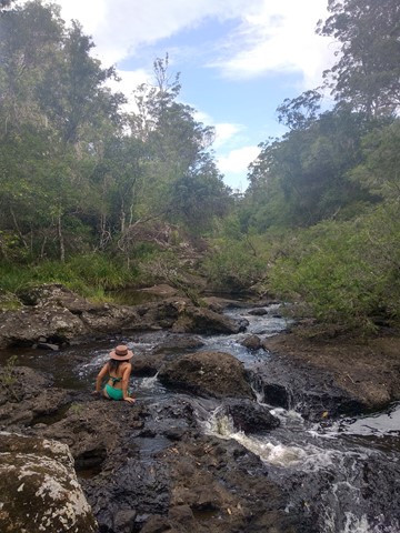
The return walk is only an hour, but given the 'adventure' you can have while you are there, allow two!
 111 Kureelpa Falls (GPX)
 2.5
2.5 1
1
Comments