Nice night walk. Good workout. Should do this one regularly.
Rod Hewins on 12 Oct, 2022
Easy walk but steep up Pinnacle then Powerful Owl. Down via Simpson Falls a pleasant walk.
Bruce on Sep, 2021
This is definitely a strenuous walk. Be parked at the entrance to JC Slaughter falls and walked up to the start of the walk at the Silky Oak picnic area and returned via the Simpson Falls track which was definitely a nicer walk. The Powerful Owl track is a wider track and looks like a service road. The Simpson Falls track has been upgraded since we last walked it and is a really nice walking track with stairs, a lookout and bridges. The Powerful Owl walk isn't actually a circuit, and we were happy to have done that one first so that we could enjoy the much nicer Simpsons Falls track.
Ian and Sue on 22 Aug, 2020
This is definitely a strenuous walk. Be parked at the entrance to JC Slaughter falls and walked up to the start of the walk at the Silky Oak picnic area and returned via the Simpson Falls track which was definitely a nicer walk. The Powerful Owl track is a wider track and looks like a service road. The Simpson Falls track has been upgraded since we last walked it and is a really nice walking track with stairs, a lookout and bridges. The Powerful Owl walk isn't actually a circuit, and we were happy to have done that one first so that we could enjoy the much nicer Simpsons Falls track.
Ian and Sue on 22 Aug, 2020
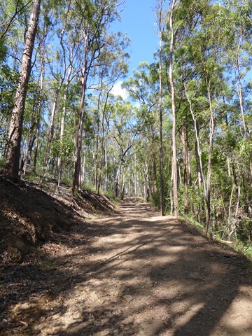
Started at the Silky Oak picnic area so began with the relatively steep incline, definitely gets the blood pumping. After you reach the top it's a fairly smooth walk to the finish. Well defined and wide track.
boots_n_all on 1 Mar, 2020
Good track to do. Be prepared for hills and some loose stones but otherwise a great track to include in a circuit.
Anoogle on 20 Jul, 2019
Completed this as track part of a 9km circuit - started with the Litchfield track, then the Ghost Hole Track, Powerful Owl Trail, Hovea Track and the Summit Track.
S K on 20 Jul, 2019
Great walking right in our city
drewmac on 28 Oct, 2017
This is a very steep trail at the beginning which makes for a great heart starter but overall it's not a very long walk and it was easily completed in 45 mins without pushing hard. A nice short walk if you don't have much time but want a bit of outdoor exercise.
Bobbe on 29 Jan, 2017
Steep section is great for training
Kay on 2 Jul, 2016
Connected to this track via the Eugenia circuit and found another track leading down to the Slaughter Falls picnic area.
Michael Martin on Jul, 2015
i ride up it very good walk
Max Hobson on 5 May, 2015
It's a good work out but not as interesting as Simpson's Falls
Kristian on 15 Mar, 2015
This was a good walk for pack training. We branched off just before the Channel 9 Station and returned to the car park via the Simpsons Falls track. Not much scenery but we spotted a few pale headed rosellas.
Alice on 15 Feb, 2015
Not a very scenic route. Follows 4X4 fire management trail up ridgeline towards Channel 9 tower before branching left and returning to carpark. Reasonably steep in places.
Grumps on 3 Feb, 2014
There are better tracks on Mt Coot-tha
Thom on 18 Oct, 2012
Another of my regular walks
asterope on 2011
A great walk.
Laurence Hallam on 2 Aug, 2010
From the carpark the walk doesn't seem all that bad until you round the first corner approx 50m in then the walk becomes incredibly steep. At this point have a little rest a mouthful of water and just tackle it.
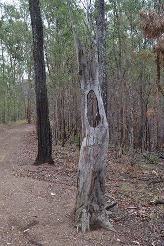
When you get to the top there is a little green walking track marker post turn left here. Don't follow the track straight ahead. Around 500-700m there is a slight track leading to the right where an old tree has fallen down. It is a good little lookout.
When back on track keep following track to the left. The numerous track shooting off to the right go down to JC Slaughter Falls area.
Soon you reach a second high point and then the track starts to drop steeply following this down will take you back to the park approx 100m from the carpark its a short walk back to the carpark.
http://www.youtube.com/user/TheKendo72
Navigation to some bushwalks can be difficult. Automated navigation using Google Maps or Apple Maps may not be accurate. Additionally, Aussie Bushwalking doesn't always have accurate positions for where to park for a walk.
Please read the walk description for special directions and take extra care.
Comments