


 1
1 30
30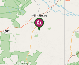
Aussie Bushwalking can keep track of your bushwalks.
Login/signup to tick this walk off.Mt Basalt
Darling Downs South West
Menu


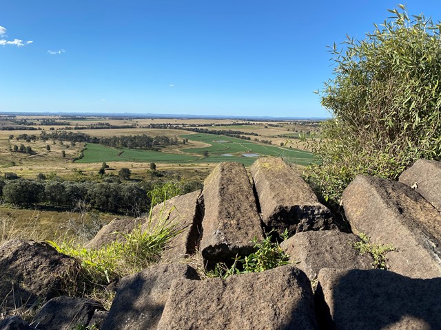
This unique geological and environmental area features rare volcanic formations and a few walking tracks that including rock-scrambling and lookouts with spectacular views.
Note: Officially listed as Grade 4/Hard (steep incline + scrambling + loose surface), this trail can still be a fun adventure for the whole family - please take caution near cliff-edges and wear suitable footwear.
Lookouts
Bird Watching
Picnic Facilities
Scrambling or Climbing
Getting there
Mount Basalt Reserve is just 19 km south of Millmerran. From Toowoomba, travel south west on the Gore Highway to the town of Millmerran. From there, take the Millmerran-Inglewood Road and turn left onto Kooroongarra Road until you reach the turnoff to Mount Basalt Environmental Park.
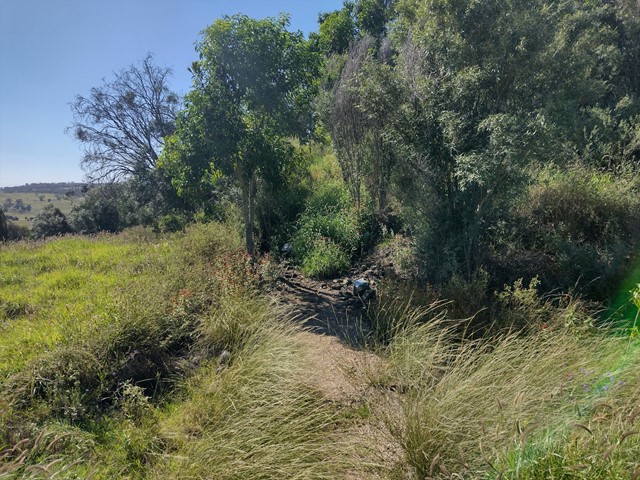
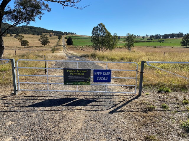
You will need to get out of your car and manually open (then close) a metal gate, before continuing up a well-graded dirt driveway to access the carpark. Suitable for 2WD.
Route/Trail notes
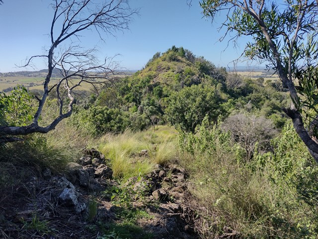
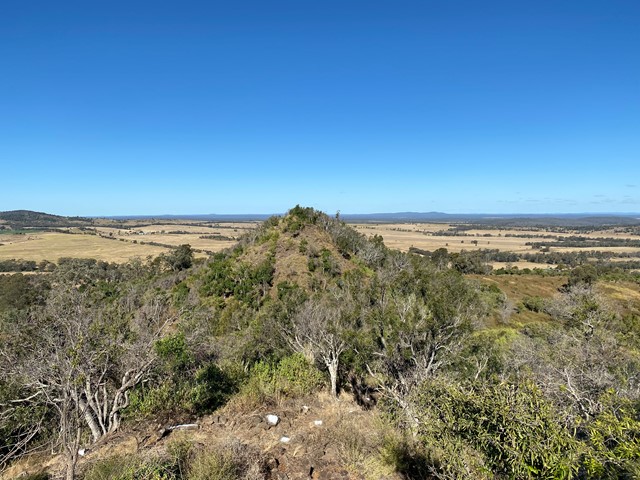
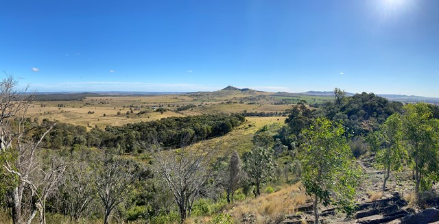
Mount Basalt is made up of two small peaks with a saddle inbetween. The trail itself is a short loop over the first peak, with a optional add-on scramble to the second summit.
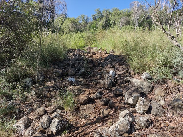
Starting from the carpark, set out on the circuit in an anti-clockwise direction. This begins with a steep, step-like rocky incline, which can be difficult to follow if overgrown - look for the white paint markers. Views are not spectacular from this first summit, so complete the decscent with care (many loose rocks here) and cross the grassy saddle to begin climb to the second summit.
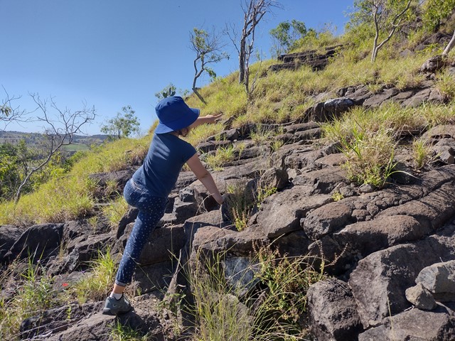
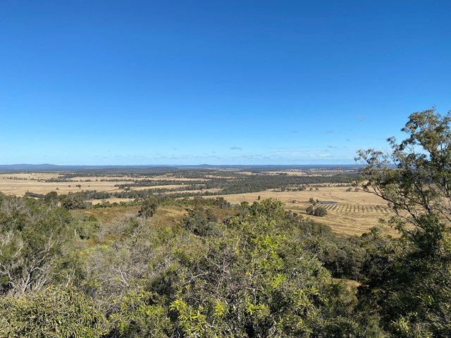
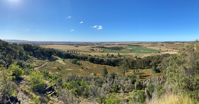
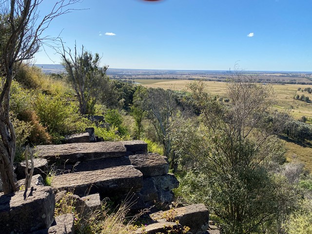
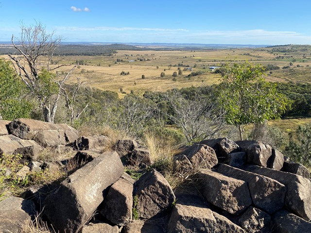
The track to the second summit is extremely narrow, with many trip-hazards and a fairly steep drop-off - proceed with caution and wear appropriate footwear. Once you reach the open rock face, the trail becomes easier to follow (again, look for the white paint markers). From here it is a fun scramble to the top, where you can explore the large basalt columns and enjoy panoramic views over the surrounding countryside.
Return to the saddle then continue along the clear, well-graded trail to return to the carpark.
GPS Tracks
- No GPS available for this walk yet.
Comments