


 Mount Petrie (GPX)
 3
3 90
90- Belmont Hills Reserve (Brisbane City Council Local Walks)
- Brisbane Koala Bushlands (Stockyard Creek Walking Trail) (Brisbane City Council Local Walks)
- Minnippi Parkland Circuit (Brisbane City Council Local Walks)
- Summit Street Reserve (Brisbane City Council Local Walks)
- She-Oak Track (Whites Hill) (Brisbane City Council Local Walks)
Mount Petrie
Brisbane City Council Local Walks
Menu
GPS Tracks


A short but steep walk from Prout Rd over the south peak then down into the saddle and up the other side over the next peak before reaching the highest peak Mount Petrie itself with it's impressive trig.
Lookouts
Bird Watching
Scrambling or Climbing
Cycling Permitted
180m
Maximum Elevation
100m
Total Climb
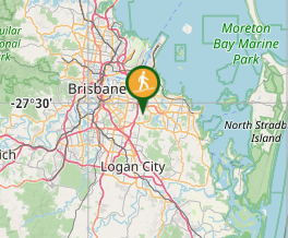
Getting there
Park at the end of Prout Rd (near #148)
Maps
Openstreetmap has the best coverage of this area
https://www.openstreetmap.org/#map=16/-27.5321/153.1451
Route/Trail notes
Park at the end of the street and walk through the council gate and follow the paved road. The road eventually becomes gravel and you walk north.
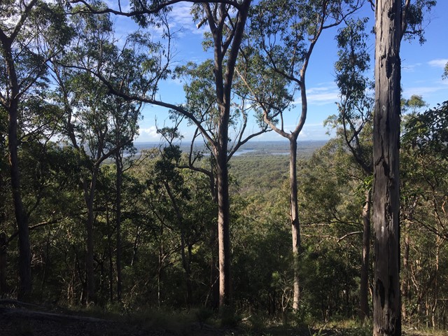
Climb over the vehicle access gate and continue to the top of the first hill. You can get glimpses of Tingalpa Dam to the east.
From here you decend to the north west (careful, its a bit scrabbley) - once you get to the bottom you start to climb the second (taller) part of the mountain.
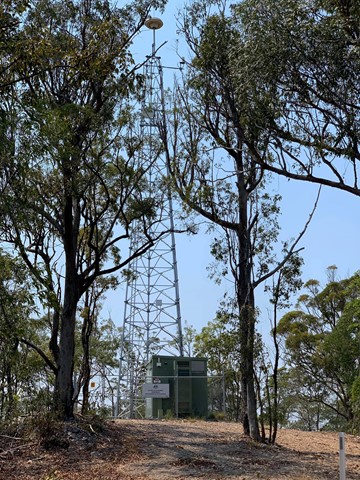
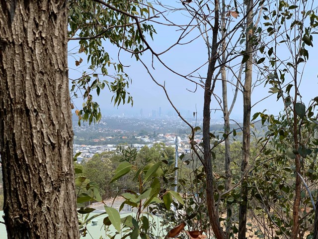
The elevation reaches approx 180 metres near the radio tower (pass this on your left). There is a 2.5m high survey marker on the path, continue around this and follow the track to the end where the water tank is. From here you can get views over Carindale to the CBD.
DON'T WANDER OFF THE TRACKS AS THERE ARE ACTIVE RIFLE RANGES ON BOTH SIDES OF THE RESERVE
Permits/Costs
No cost
Interesting fact
In February 1942 a Qantas de Havilland 86 plane, VH-USE "Sydney" crashed into the mountain killing all 9 people on board (source: wikipedia)
GPS Tracks
Where
Click here to load this map.
Comments