


 32
32 4
4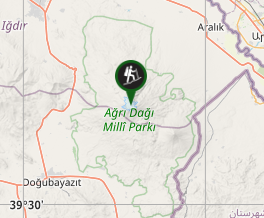
Aussie Bushwalking can keep track of your bushwalks.
Login/signup to tick this walk off.Mt Ararat
Turkey
Menu
A long difficult multi-day ascent of the highest mountain in Turkey and the supposed final resting place of Noah's Ark.
Lookouts
Toilets
Camping Permitted
Arid or Desert
5197m
Maximum Elevation
Getting there
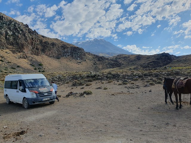
To do this trip there is a mandatory requirement to book a guide. You can fly into either Agri or Igdir where your transport will be waiting. From there you are driven to Dogubeyazit where you will spend the first night. The next morning you will be driven to the trailhead to start your hike.
Route/Trail notes
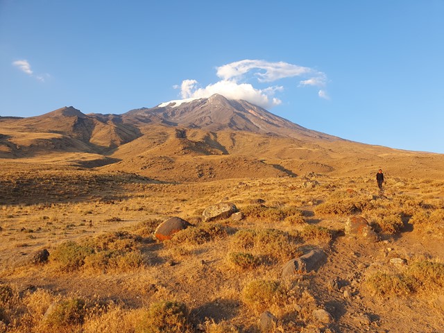
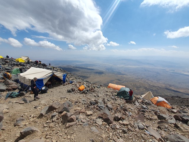
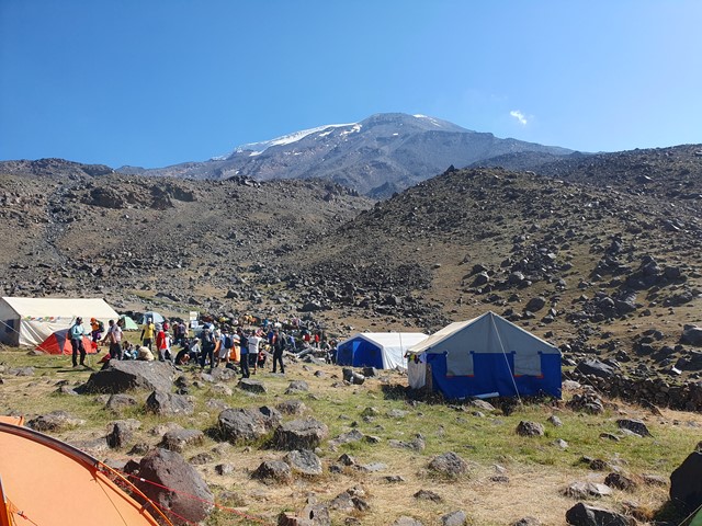
Mt Ararat, or in Turkish - Agri Dagi (which roughly translates to Mountain of Pain) lives up to its name. The first day of hiking is 7.3kms and commences at 2200m and finishes at camp 1 at 3300m. Day 1 is pretty straight forward with a relatively shallow incline. Views are good right from the get go given the sparse vegetation and the fact the transportation drops you off at 2200m which is already around 600m higher than Dogubeyazit. You will only carry only your bare necessities as long lines of mules will carry the vast majority of the food, and your equipment up to camp 1. Camp 1 has some large dining tents, personal tents, and a fairly grim squat toilet.
Day 2 is the acclimatisation hike up to near camp 2. This is purely to adjust your body to the altitude and you will return to camp 1 afterwards. The walk from camp 1 up to camp 2 is a lot steeper and the well graded track begins to switch to a lot of loose rock sections on scree slopes.
Day 3 is the push to camp 2 from camp 1. The mules again will carry the vast majority of the heavy gear but camp 2 will be as high as they go. Camp 2 is located at 4200m and though you cover less horizontal distance than day 1 you will cover roughly the same vertical distance. Camp 2 is a more basic camp than the first camp, it is also perched right on the side of a scree slope so it takes a long time to move a short distance - for example from your tent to the dining tent.
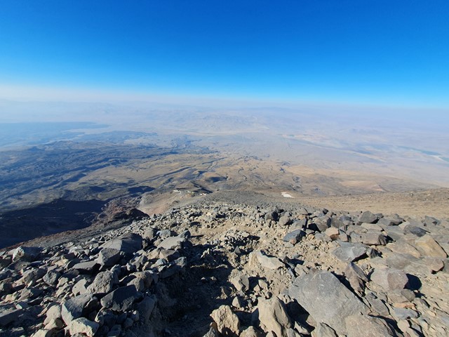
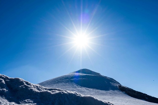
Day 4 is the summit day, it starts at around 2am, you will have a small breakfast, pack your gear and cold weather gear then head for the top. This section is by far the steepest and it doesn't relent until you make it to the glacier - nearly 1000m vertically. At the glacier you will fit your crampons and make the final 45min dash across the glacier up the final peak where you will reach the summit. From here you can either push right back to the base in one day or take it easy and spend another night at camp 1.
Permits/Costs
You will need to book a guide in advance, there are quite a few companies who oragnise packages but in general you should budget somewhere between 400 and 500 Euro and expect 4-5 days - some packages are longer or shorter.
Other References
https://www.araratadventures.com/climb-ararat.html
GPS Tracks
- No GPS available for this walk yet.
Comments