


 14.7
14.7 9
9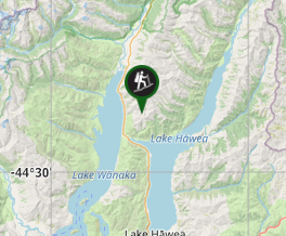
Aussie Bushwalking can keep track of your bushwalks.
Login/signup to tick this walk off.Sentinel Peak
South Island NZ
Menu

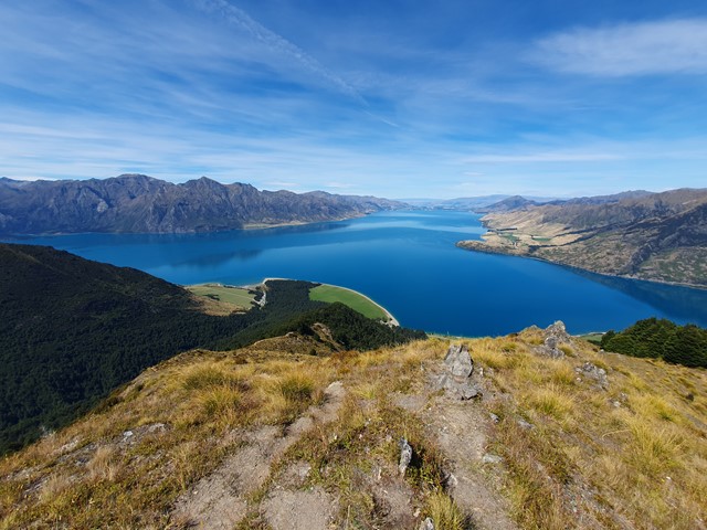
A full day hike and scramble up a lesser known mountain overlooking the scenic Lake Hawea. Unlike more popular walks like Ben Lomond and Roys Peak, this mountain doesn't have an overly clear path and it will require some navigation.
Bird Watching
Scrambling or Climbing
Navigation Required
Alpine
1814m
Maximum Elevation
Getting there
Set your GPS to the Kidds Bush campsite on Meads Rd. It is a dirt road but any 2wd should be fine along it. Once there you will find ample parking and a camping area. The walk starts across the road from the campsite.
Route/Trail notes
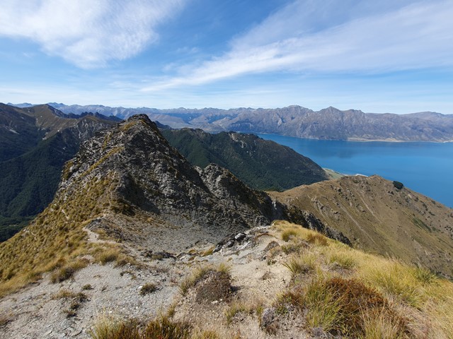
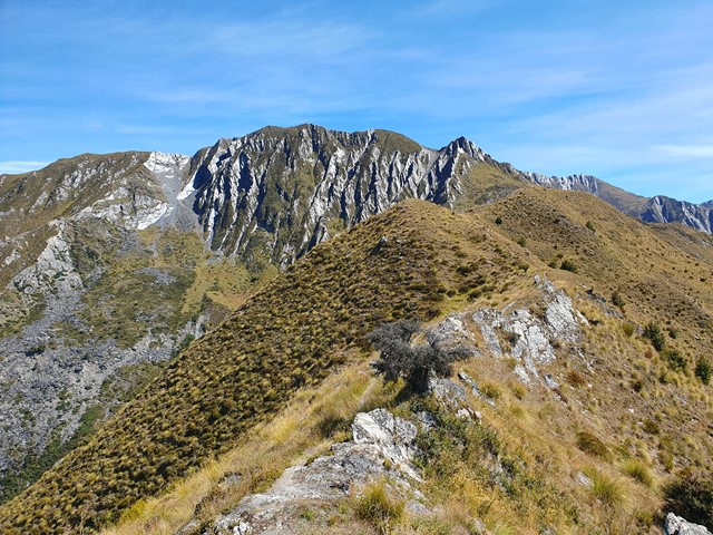
The walk starts off simply enough. A steep graded track named the Sawyer Burn Track. You'll ascend up this track for roughly an hour. Once you emerge from the forest the graded track will crest and you will see a pole marker indicating where the official track continues to the hut. This is where you will leave the track and head off up an increasingly rough track towards the peak. At the start it is super easy to follow - it follows the ridgeline and because of the open alpine terrain you can see it follow the ridge way off into the distance. It is only when you start entering the hilly sections with long grass that it becomes a bit more challenging to follow. You will eventually reach a section where you will divert off the ridgeline (because the ridge becomes a sheer cliff) and skirt around to the right along a reasonably easy to follow trail. This trail is a bit challenging as it requires you to skirt along a scree slope on the side of a cliff with a fairly sheer drop off. This is probably the most dangerous part of the track however with a bit of care it's quite achievable.
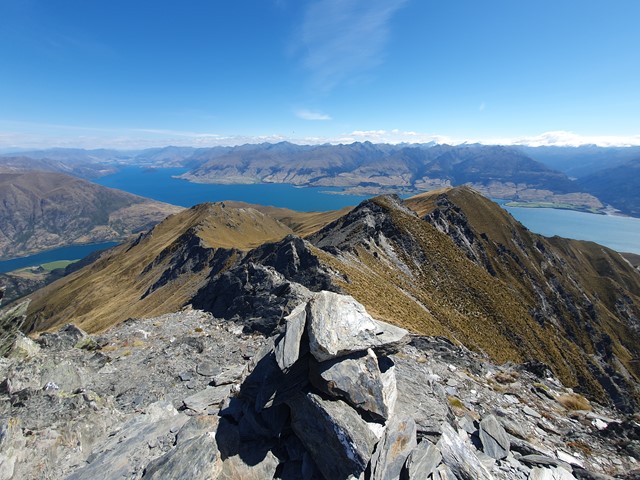
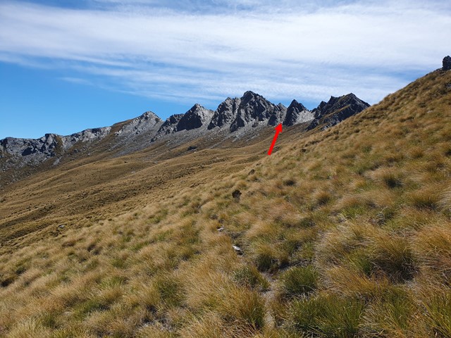
After you make it up to the ridgeline pay attention to where you emerge because it is quite tricky to find on the way back. Continue along the trail which descends and ascends a few times before skirting around the left of a minor peak (that you will be thankful you don't have to climb and descend). Around this time Sentinel Peak will finally come into view being completely obstructed up to this point. Due to the knee high vegetation the track becomes a bit faint from here but not to worry because you can see what you are aiming for so just head towards it. The peak requires a final scrambly approach up one of the scree slopes. There is a pile of rocks marking the first scree slope but do not go up this one, it is rather sketchy and would require some fairly dangerous climbing on crumbly rock. The second scree slope is very easy, you can almost walk up it. Once you reach the top of it there is an easy scramble/walk to the summit where you will finally be rewarded for all your hard work with 360 degree views. Descend via the same trail but be aware - there are a lot of tracks up in those mountains that head down different ridgelines, would be very easy to get lost coming down so be vigilant. If you have a GPS save the route you ascended with and then simply follow it back down.
Permits/Costs
Free
Other References
https://hikingscenery.com/sentinel-peak-lake-hawea/
GPS Tracks
- No GPS available for this walk yet.
Comments