
Mt. Kisokomagatake 木曽駒ケ岳 + Mt. Houkendake 宝剣岳 (Central Alps, Nagano Prefecture)
Japan


Menu

One of the most underated parts of the Japanese alps. The central alps is unbelieviably beautiful, if someone blindfolded you and told you were somewhere in Europe, it would be entirely believable. The hike is very straight forward, it can be combined with a multiday hike and other nearby peaks such as Houkendake.

Getting there
Getting to the hike is a bit of a puzzle as there is essentially no information about this in English, so luckily I am writing it here for you. To get to this hike, first you must drive to the Suginodai Bus Centre Car Park (菅の台バスセンター駐車場). Put this into Google Maps. When driving along the highway take the Komagane 駒ヶ根 exit, it will then be a short drive to the car park where you will be chaperoned into a car park. Parking is not free, you must pay 800 yen per day for parking.
From the carpark, take a bus. Right across from the carpark there will be an unmissable bus stop that says bus + ropeway. Go to the information centre and buy the combined bus and ropeway ticket. This will set you back about 4000 yen so be prepared to dish out some cash. The ticket is both ways.
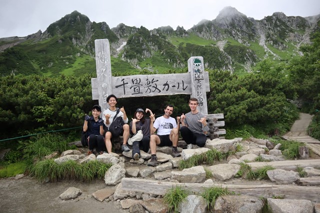
Wait at the bus stop until the bus arrives and board. The bus ride should take approximately 30 minutes. Get off at the ropeway station which is the last stop on the bus and where everyone else will get off too. At the ropeway station, board the ropeway which will take you to Senjokiji Cirque where you begin the hike. Show the ropeway attendant your bus ticket and you will be on the way. 7.5 minutes and you will ascend about 1000 metres.
Also note that this hike can only be attempted in summer and autumn. Rest of the year, the mountain is covered in snow.
Maps
If you want a good map, I reccommend the Japan Alps and Mt. Fuji Book.
Route/Trail notes
Begin the hike from the ropeway station. There will be a wooden sign that says 木曾駒ケ岳, there is no English on the signs. Continue to follow signs that say this. The path is very obvious. Basically everyone will be going the same way, so if in doubt, just follow the crowd.
Follow the path up the mountain. There will be stairs. The incline is not particularly steep, but because of the high altitude, oxygen is thin and you may be out of breath. Be careful of altutude sickness when ascending.
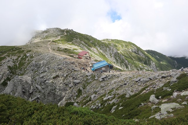
You will pass some mountain huts selling things at exobiant prices. They have a toilet if you need to use it, but beware that it is 200 yen. After the huts, the first peak you will pass is Nakadake 中岳. Continue past Nakadake, first descending down the mountian before ascending onto Mt. Kisokomagatake 木曾駒ケ岳. This is the tallest peak in the central alps and you will feel on top of the world.
On the way back from Kisokomagatake, follow the same path. But for something more exciting and a bit of a challenge take a right turn at the mountain huts. Right next to the mountain hut, you will see a very defined rocky peak. This is Mt. Houken. Be warned that it will require some scrambling. There are chains to assist you, so don't worry. Take it slowly and you will be fine.
Once having summited Mt. Houken, continue back same way and descend back to the ropeway. From there, take the ropeway back to the bus stop and then the bus back to the carpark.
GPS Tracks
- No GPS available for this walk yet.
 5.5
5.5 5
5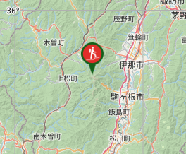
Comments
Nobody has commented on this walk yet. If you've done it then tick it off and add a comment.