


 gozaisho (GPX)
 7
7 5.5
5.5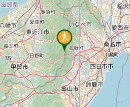
Aussie Bushwalking can keep track of your bushwalks.
Login/signup to tick this walk off.Gozaisho 御在所 (Mie Prefecture)
Japan
Menu
GPS Tracks
Gozaisho is a beautiful mountain tucked away in rural Mie, near the border of Aichi and Gifu. It has a collection of unqiue rock formations and is the starting point for some great hikes across the Suzuka Mountain range. For those who are too lazy to do the hike or are using it as a base to do something a bit longer, you can take the ropeway to the top. During winter, the peak turns into a mini ski field.
Lookouts
Toilets
Public Transport
1212m
Maximum Elevation
Getting there
You can get to this mountain by either bus or by driving.
If driving, drive to the 中登山口駐車場 (put this in Google maps), this will take you to the trail head.
If taking the bus, you can take the bus for Yunoyama onsen which should drop you somewhere nearby the trailhead or at least in the onsen town where you can walk to the trailhead (there is also a train station at Yunoyama).
Maps
Yamap
Route/Trail notes
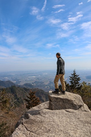
Begin the hike by taking the Naka tozanguchi. It will be a gentle incline with some ragged rocks along the path. Almost immediately, the path will open up with some nice views. There should be views along the whole way.
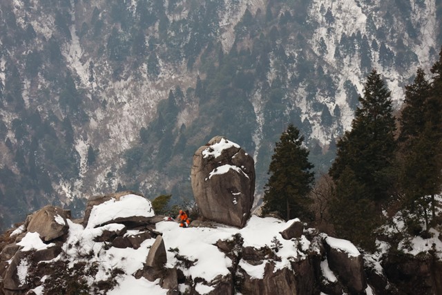
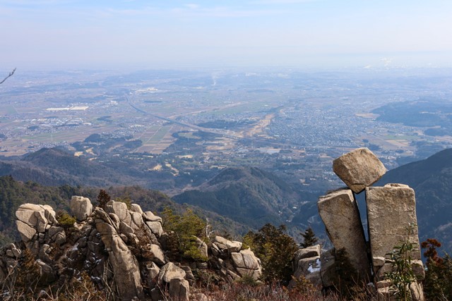
The path up to the top is quite obvious and difficult to get lost. Along the way, there are some interesting boulders, including one with a massive crack running through the middle of it. There are also some cool balancing rocks, similar to something you might see in Girraween / Bald rock national park.
Once you reach the ridgeline, the hike becomes more difficult. First you will make a dramatic descent (not exposed) and then rise up to the other side of the ridge. The rise up can be quite steep and requires some scrambling. There are ropes and chains in place to help with the effort, but be warned that some of the walks can be very narrow and are not for the faint-hearted. Although not dangerous and requiring no techinical climbing skill, may force some to turn back.
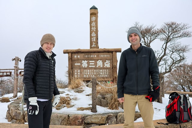
From here, it is an easy climb to the top where there are hundreds of people waiting (who took the ropeway). Once reaching the shopping centre part of the summit, it is a relatively flat walk to the peak. Look out for the wooden signs that are written in Japanese (御在所岳山頂), this will take you to the true peak.
On the way back, if you are feeling adventurous, take an alternate path down the mountain, 裏登山口. This will take you along a river and give you sweeping views over the Suzuka mountain range. You will cross the river numerous times and go through forest (and a construction site!)
Permits/Costs
free unless you take the ropeway.
Other References
Good luck!
Comments
Nobody has commented on this walk yet. If you've done it then tick it off and add a comment.