
Thornleigh to Berowra (Great North Walk)
New South Wales


Menu
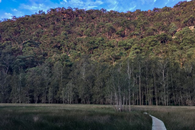
One of the more popular and varied sections of the Great North Walk, which traverses the Berowra Valley Regional Park. It can be done in sections from around 7km to 30km, over 1-2 days.

Getting there
Start (or finish) at Thornleigh (Bellamy St trackhead) to Mt-Ku-ring-gai or Berowra station, to the north of Sydney. Public transport (train) available at both ends of the walk.
Maps
Hornsby 9130-4S topographical map (1:25k). You can also use the Great North Walk official route map (1:32k)
Route/Trail notes
Goes through the length of Berowra Valley Regional Park. Can be done in one day, an overnight walk or two day-walks. See reference Web sites for detailed track notes
Permits/Costs
Nil
Other References
https://hikingtheworld.blog/2017/05/06/thornleigh-to-berowra-gnw/
For overview of all Great North Walk sections: https://hikingtheworld.blog/index-of-hikes/overnight-walks-near-sydney/#GNW
http://www.wildwalks.com/bushwalking-and-hiking-in-nsw/berowra-valley-regional-park/thornleigh-to-mt-kuring-gai.html (covers most of the route, but ends in Mt Ku-ring-gai rather thn Berowra)
GPS Tracks
- No GPS available for this walk yet.
 29
29 7
7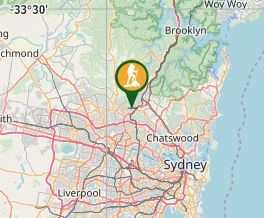
Comments
Nobody has commented on this walk yet. If you've done it then tick it off and add a comment.