


 4.9
4.9 4
4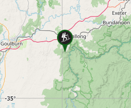
Aussie Bushwalking can keep track of your bushwalks.
Login/signup to tick this walk off.Bungonia Gorge Red Circuit
New South Wales
Menu
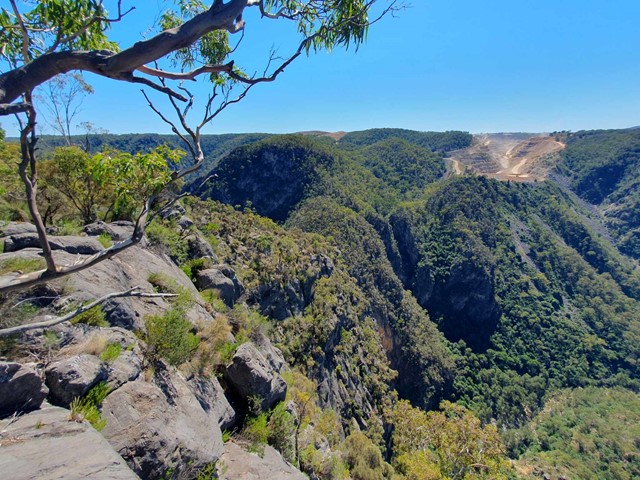
A steep descent into the Bungonia Gorge going into a trackless scramble through the boulder field followed by a steep ascent back out of the gorge with a sidetrip to the top of the nearby Mt Ayre.
Lookouts
Bird Watching
Picnic Facilities
Toilets
Scrambling or Climbing
Navigation Required
Eucalypt Forest
547m
Maximum Elevation
Getting there
Set your GPS to the Bungonia State Recreation Area at the end of 'The Lookdown Rd'. There is a big carpark with toilets and lots of signage.
Route/Trail notes
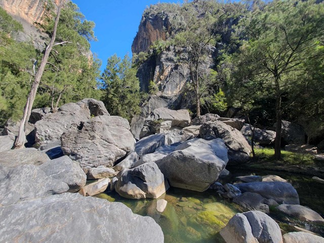
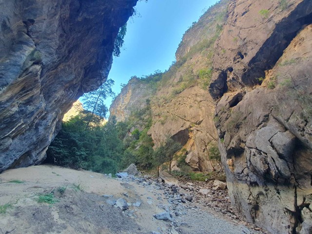
There are a multitude of walks and caves you can do in the National Park. The most popular hikes are the Green, White and Red tracks. The Red track being the hardest of the 3 - you can extend this track by joining onto the white or green track depending how much time you have to spare. It is best to tackle the Red track in a clockwise direction from the carpark so as to move downhill through the gorge rather than uphill. There is quite a bit of scrambling down large boulders and it is significantly easier to scramble down them rather than up them. Also it is easier to find the best route through the boulders moving in a clockwise direction.
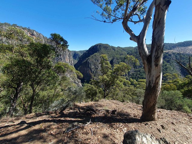
The walk starts with a steep descent into the gorge along a well marked trail. Upon entering the gorge the track will becoming fainter or non existent - but all you really need to do is follow the gorge downhill. It starts off fairly open with some light boulder hopping but becomes more technical as you go along. Eventually you will need to do quite a bit of scrambling and ducking over and beneath boulders to follow the gorge. A good rule of thumb is not to descend anywhere you don't think you could climb back out of i.e. you have to be careful not to descend into a dead-end. If you take your time and follow that rule you will find your way out of the boulder field relatively quickly and get back into a more open section of the gorge where you can walk along the rocks. Soon you will see a signpost on the right side marking the trail back out of the gorge. Follow this steep trail back to the top of the gorge, then turning right to head back to the carpark, or left to make a short detour to Mt Ayre for some bonus views.
Permits/Costs
$8 per vehicle per day. There is an automated ticket booth not far from the carpark next to the Ranger Station.
Other References
https://www.alltrails.com/explore/trail/australia/new-south-wales/bungonia-gorge-green-and-red-track
GPS Tracks
- No GPS available for this walk yet.
Comments