
Swanson Falls
Border Ranges National Park


Menu
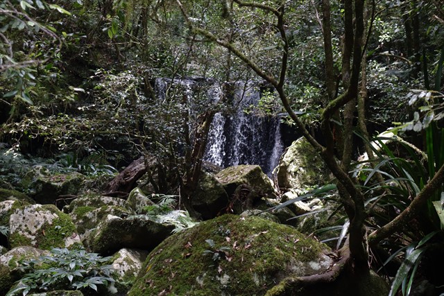
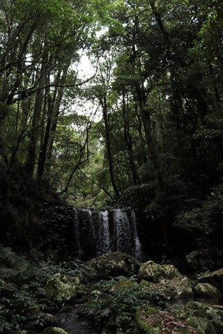
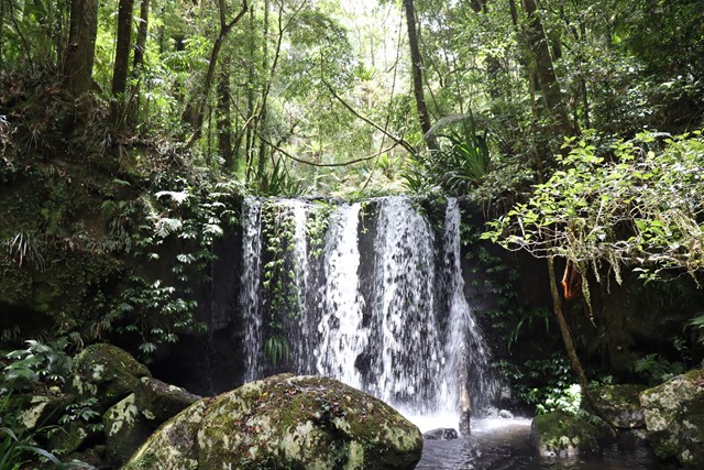
Off trail to Swanson Falls on Brindle Creek. This waterfall appears to have once been along the Brindle Creek walking trail though the trail to the falls is mostly lost to the rainforest. A combination of using the old trail and bush bashing can be used or by wading / rock hopping up the creek itself. Bring a dry bag to make your life easier.

Getting there
How do you get to the start of the walk?
From the Brindle Creek walking trail which is acessed from Brindle Creek Picnic Area or from Antarctic Beech Picnic Area. At the furthest upstream point of Brindle Creek that is reached by the Brindle Creek walking trail before it leaves the creek heading uphill and North if heading from Brindle Creek picnic area.
Maps
Which maps cover the area?
Map of Border Ranges National Park.
Route/Trail notes
A detailed description of the walk!
Navigation is easy as you just follow the creek. Though the walk is short the going is slow through rainforest terrain or through the creek itself. Only 500 meters each way though depending on your pace and on the current water levels and how choked up the creek is the time taken to get to the falls can be around 40 minutes.
Permits/Costs
Do you need any permits? What's the cost?
Border Ranges Park Fees Apply.
Other References
How can I find more info? Any guide books?
GPS Tracks
- No GPS available for this walk yet.
 1
1 80
80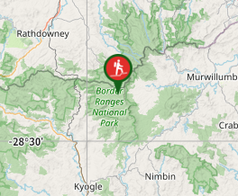
Comments