


 400
400 15
15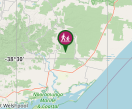
Aussie Bushwalking can keep track of your bushwalks.
Login/signup to tick this walk off.White Woman's Waterhole Walk
Victoria
Menu
Grade 2, 15 minutes, 0.4km loop, formed Track with directional signage.
A short loop on a well formed track this walk makes its way around the unique waterhole from which the adjacent campsite takes its name.
Picnic Facilities
Toilets
Dogs Permitted
Cycling Permitted
Camping Permitted
Swamp or Wetland
Eucalypt Forest
0m
Maximum Elevation
0m
Total Climb
Getting there
Napier Rd (off Hyland Hwy (C482), Won Wron
Maps
Co-ordinates: -38.48131758967577, 146.77141063667145
Route/Trail notes
A short loop on a well formed track this walk makes its way around the unique waterhole from which the adjacent campsite takes its name. The White Woman’s Waterhole Walking Track trailhead can be found at the North Western end of the White Woman’s Waterhole camping grounds. The track connects with the larger “Forest Walk” trail of which a small section completes the loop around the waterhole. This track was created by staff at “Forest Fire Management Victoria,” a division of the Department of Environment, Land, Water & Planning (DELWP) in the early 2000’s.
The first inhabitants of the area were the Brataualung people of the Gunaikurnai nation. For thousands of years, they gathered fish and shellfish from the nearby coastal waters and used the timber and game from this forest as a source of food and building materials for shelters, canoes and various tools. Local legend has it that in the 1840s, a young woman, the sole survivor of a shipwreck off the nearby 90 Mile Beach was taken and held captive by the local tribe of Brataualung, who inhabited this part of Gippsland. It is believed Angus McMillan, an explorer who later squatted on land in Gippsland for his own pastoral requirements, started this story in the 1840’s with a letter to the Sydney Press. McMillan claimed he had come across a deserted Gunaikurnai camp strewn with an array of items, including female clothing and a dead baby, said by a Dr. Alexander Arbuckle to be a white child. The story of the captive white woman developed a life of its own, spawning numerous myths, with various versions even claiming a sighting of a white woman being hurried away. This led to search parties consisting of Angus McMillan’s men and Native Police pursuing Gunaikurnai people to try to rescue her. The woman, if she ever existed, was never found. A ship’s figurehead however, was recovered, leading to speculation that it may have been mistaken for the white woman. This White Woman of Gippsland story is believed to have been used to justify the killings of many Aboriginal people, particularly the Gunaikurnai. Massacres of the Gunaikurnai led by McMillan occurred at Nuntin, Boney Point, Butchers Creek, Maffra and at other unspecified locations throughout Gippsland. A massacre at nearby Warrigal Creek is recognised as one of the worst in Australian settlement history.
White Woman’s Waterhole and its associated walking track commemorates the tragedy of this story.
Permits/Costs
Free
Other References
"More to Explore" App
GPS Tracks
- No GPS available for this walk yet.
Comments
Nobody has commented on this walk yet. If you've done it then tick it off and add a comment.