


Aussie Bushwalking can keep track of your bushwalks.
Login/signup to tick this walk off.Menu
Explore the ridgeline of the Valley of the Rocks as well as the secrets of Hollerday Hill and the charms of Lynton.
Lookouts
Picnic Facilities
Toilets
Scrambling or Climbing
Coastal
243m
Maximum Elevation
294m
Total Climb
Getting there
How do you get to the start of the walk?
From the Valley of The Rocks Carpark
Maps
Which maps cover the area?
Maps of the Valley of The Rocks and Lynton
Route/Trail notes
A detailed description of the walk!
Head down to Castle Rock (The White Lady) and then up the ridgeline to Rugged Jack and along to the saddle then follow the North Walk section of the South West Coast Path into Lynton. Once you have explored the town head up Hollerday Hill from the trail behind the town hall. Loop your way up to the summit then come back down and continue your way around the hill on the Northern (seaward side). Then when you back around to just above the saddle follow the switchbacks down to the road and the carpark.
Permits/Costs
Do you need any permits? What's the cost?
Carparking Fees
Other References
How can I find more info? Any guide books?
N/a
GPS Tracks
- No GPS available for this walk yet.

Medium
 6.5km return
 3hrs
Lookouts
Picnic Facilities
Toilets
Scrambling or Climbing
Coastal
Where
Click here to load this map.
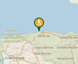 Map data © OpenStreetMap contributors. Terrain: © Geoscience Australia.
Comments
Nobody has commented on this walk yet. If you've done it then tick it off and add a comment.