


Menu
A short loop up to the top of Maiden Castle one of the largest Iron age hillforts in Europe.
Lookouts
Heritage Sites
137m
Maximum Elevation
88m
Total Climb

Getting there
How do you get to the start of the walk?
The end of Maiden Castle Road.
Maps
Which maps cover the area?
Maps of Maiden Castle / Dorchester & surrounds.
Route/Trail notes
A detailed description of the walk!
From the carpark head straight up the main track to the main gates of the old hill fort. Then continue making a loop of the far side of the hill fort. When you reach about the location of the old temple building ruins there is a short cut track back down to the carpark.
Permits/Costs
Do you need any permits? What's the cost?
Free
Other References
How can I find more info? Any guide books?
N/a
GPS Tracks
- No GPS available for this walk yet.

Easy
 2.16km return
 1hr
Lookouts
Heritage Sites
Where
Click here to load this map.
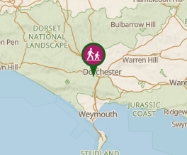 Map data © OpenStreetMap contributors. Terrain: © Geoscience Australia.
Comments
Nobody has commented on this walk yet. If you've done it then tick it off and add a comment.