


Menu
A walk to the highest points of Dartmoor National Park.

Getting there
How do you get to the start of the walk?
From the Meldon Reservoir Carpark.
Maps
Which maps cover the area?
Maps of Northern Dartmoor National Park.
Route/Trail notes
A detailed description of the walk!
From the carpark head down to the reservoir and across the dam wall. Follow the shores of the reservoir upstream before then following the West Okement River upstream until Black-a-tor Copse one of the three ancient forests of Dartmoor. After looking head up hill to Black Tor, then onto Fordsland Ledge then up to High Willhays. Then follow the ridge to Hampster Tor then Yes Tor then down to Little Tor and West Mill Tor. From here head down Black Down Road and up to the top of Black Down. Then down past the quarry and back along the dam wall.
Permits/Costs
Do you need any permits? What's the cost?
Carpark fees.
Other References
How can I find more info? Any guide books?
N/a
GPS Tracks
- No GPS available for this walk yet.

 14.17km return
 5hrs
Where
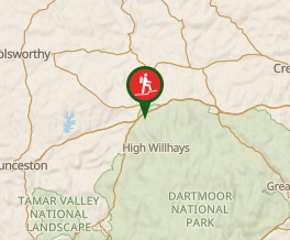 Map data © OpenStreetMap contributors. Terrain: © Geoscience Australia.
Comments
Nobody has commented on this walk yet. If you've done it then tick it off and add a comment.