
Menu
Popular Walks
-
3 Capes Track
(21 ticks) -
Cape Raoul
(18 ticks) -
Bicheno Foreshore Footwalk
(13 ticks) -
The Gardens - Bay of Fires
(11 ticks) -
Whalers Lookout
(11 ticks)
Parent Regions
Popular Walks
-
3 Capes Track
(21 ticks) -
Cape Raoul
(18 ticks) -
Bicheno Foreshore Footwalk
(13 ticks) -
The Gardens - Bay of Fires
(11 ticks) -
Whalers Lookout
(11 ticks)
Parent Regions
Walks in East Coast Tasmania

 48
km
one-way
48
km
one-way
 4
days
4
days
3 Capes Track
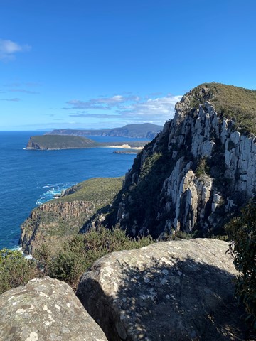
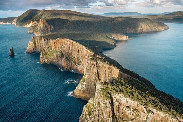
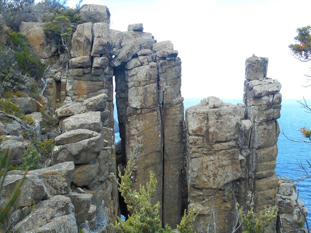
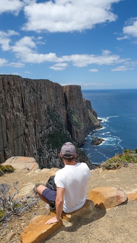
You, a pack, and 48 kilometres of cliff-hugging wildness in Australia's far south-east. The next stop is Antarctica. Tasmania's Three Capes Track is not about getting from point A to point B. It’s about the journey. Few places on Earth remain that feel so remote, so raw, so removed from the ordinary.
Tasmania Parks and Wildlife Service’s ambitious track is an artwork rivalled only by the landscape.
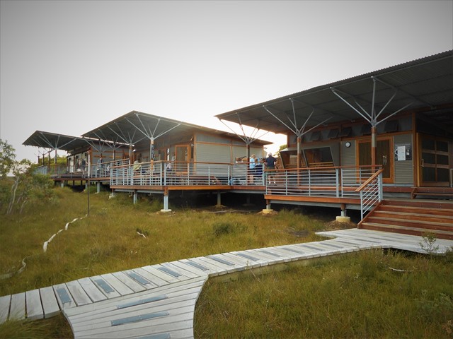
World Heritage-listed Port Arthur Historic Site is your start and end point. A purpose-built Pennicott Wilderness Journeys' boat delivers you to the track start. Any migratory whales, dolphins or fur seals are complimentary. Pack light; the overnight stops are equipped with gas cooktops, comfy mattresses and generous dining tables where new friendships may forge.
They say walking can be transformative and this is Tasmania's natural pathway. Four days and three nights on a track so meticulously crafted you’re free to enjoy your experience rather than watching every step. Look up, look out, look within.
Walk side by side up mosaic stone steps and let nature’s drama unfold. Here, your senses will be refreshed and your heart will skip a beat (regularly). Stand on nature’s edge. Hear the silence and be overcome with awe. Move through shadows of tall eucalypt forest and colourful coastal heath. The Tasman Sea is your constant.
 7
km
return
3
hrs
7
km
return
3
hrs
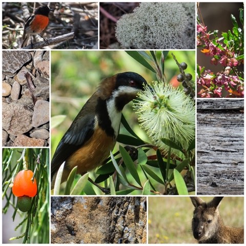
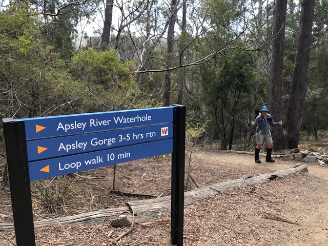
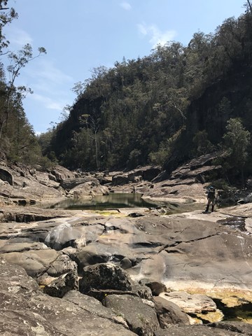
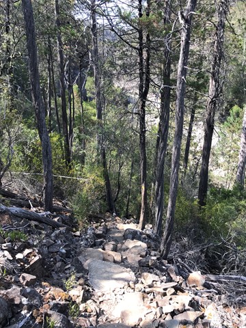
Apsley River Waterhole and Gorge
Just over a 7km loop through the Douglas-Apsley National Park to see beautiful waterholes and the gorge.
 4.5
km
one-way
2
mins
4.5
km
one-way
2
mins
Bicheno Foreshore Footwalk
A walk along the foreshore at Bicheno Tasmania
 14
km
return
5
hrs
14
km
return
5
hrs
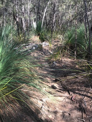
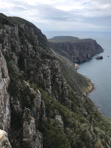
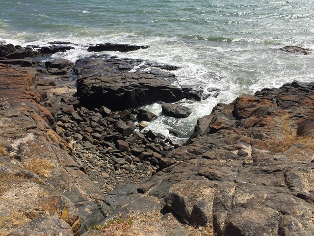
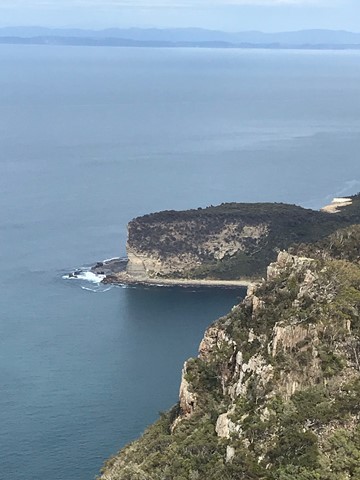
Cape Raoul
This walk is part of the Three Capes walk. This is day one of the three capes. It took the group 5 hours to do 14 Klm's. There is hills, steps and great views.
 5
km
return
90
mins
5
km
return
90
mins
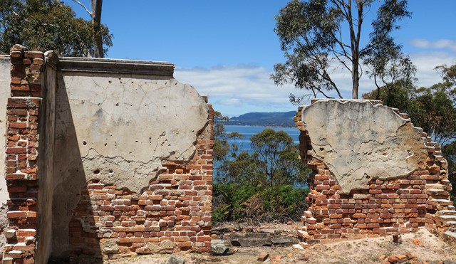
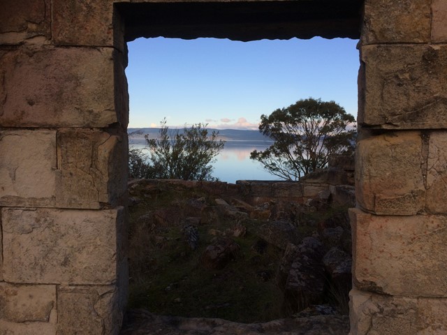
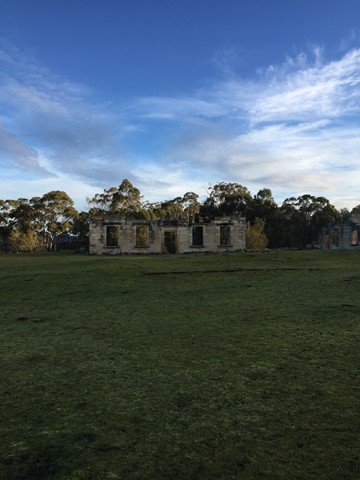
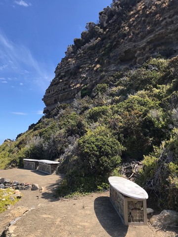
Coal Mines Historic Site
Lesser known than Port Arthur though arguable a more authentic experience and its free. While Port Arthur has been rebuilt quite a bit the coal mines is a more untouched ruin. When we were there we were also the only people.
 300
m
one-way
10
mins
300
m
one-way
10
mins
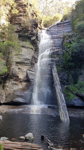
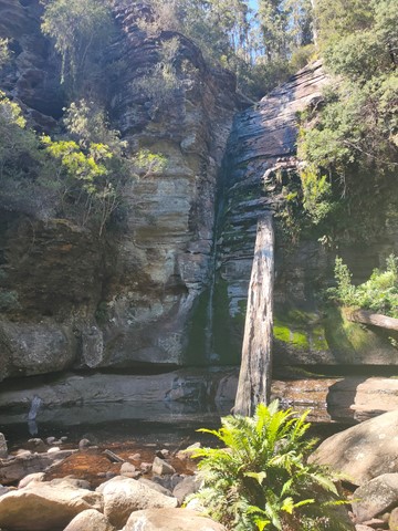
Gray Mare’s Tale Waterfall
A seasonal waterfall just outside of St Marys, Tasmania
2.3
km
return
45
mins
Loontitetermairrelehoiner Track
Named after the local band of Aboriginal people, this track leads around a rocky headland. Grand vista over Great Oyster Bay with the Freycinet peninsula as a backdrop. Shearwaters are nesting along the trail in summer.
 8
km
return
3
hrs
8
km
return
3
hrs
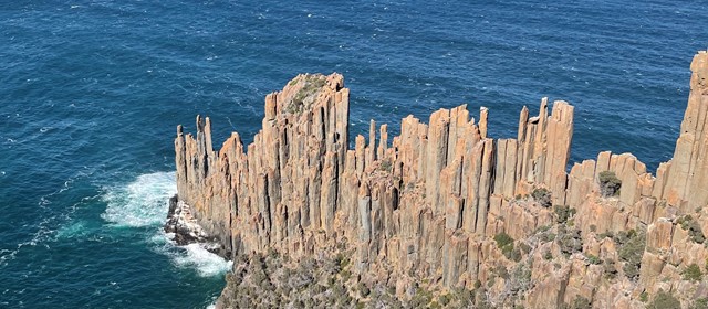
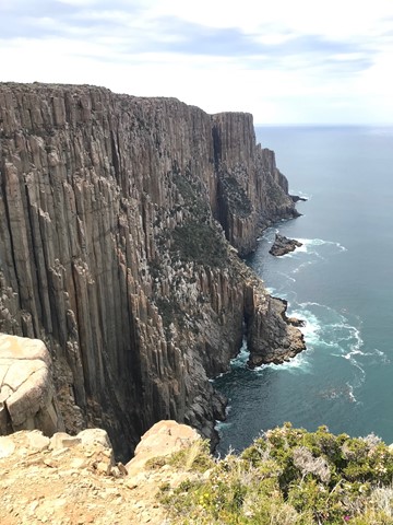
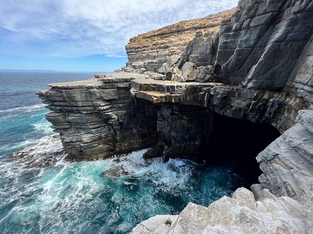
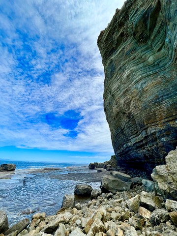
Shipstern Bluff
Shipstern Bluff is known for its big waves. This is a great walk - under 10km - through varying landscapes which takes you right down to the ocean from Cape Raoul.
 4
km
return
1
hr
4
km
return
1
hr
Snug Falls
One way walk there and back to see Snug Falls. Easy, well maintained trail. Start is at elevation 270m, Snug Falls at elevation 190m.
Access via Snug Falls Road (branching left from Snug Tiers Road), with the trailhead just up the hill slightly from the designated parking area.