


 4.42
4.42 5
5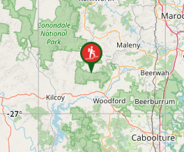
Aussie Bushwalking can keep track of your bushwalks.
Login/signup to tick this walk off.Branch Creek
Bellthorpe National Park
Menu
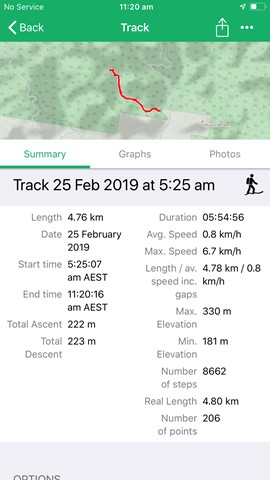
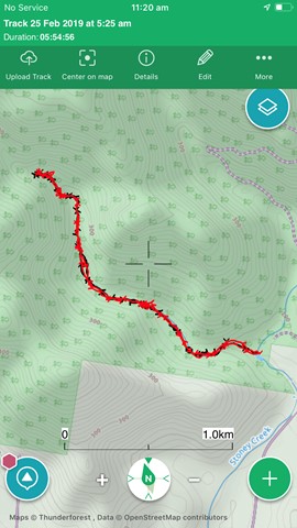
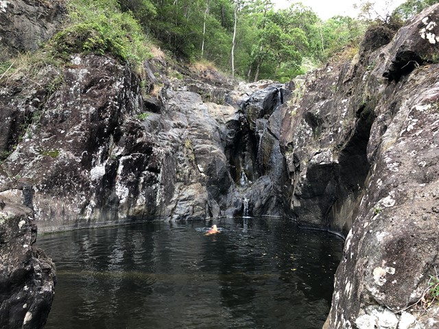
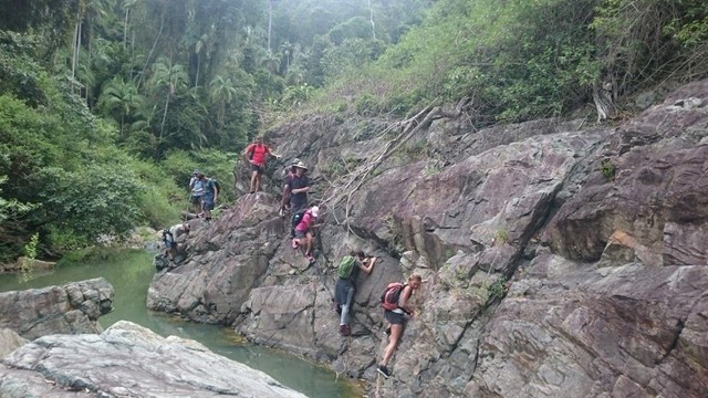
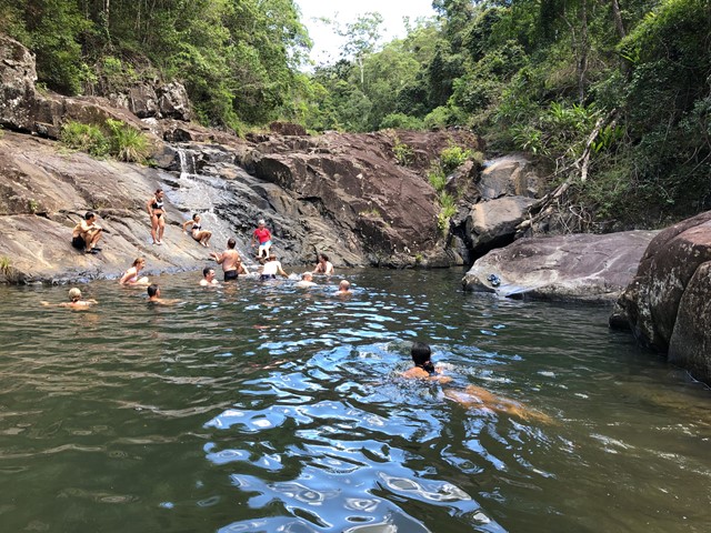
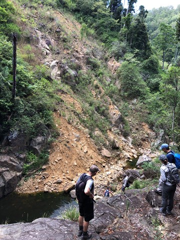
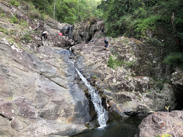
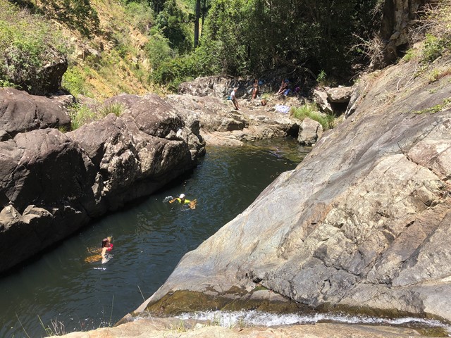
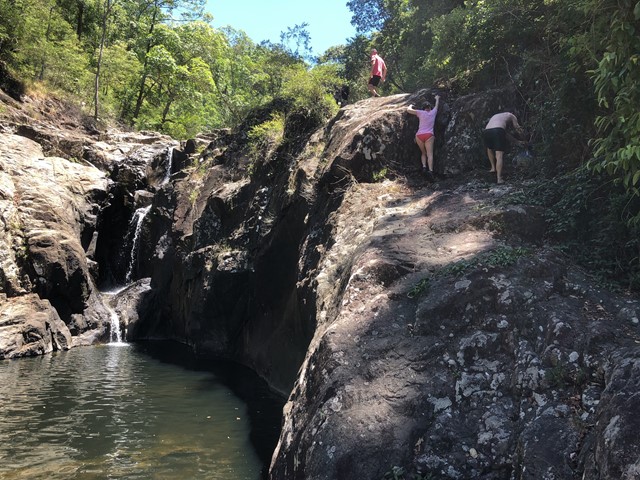
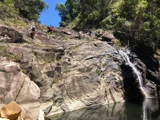
From the Stony Creek day use area, the junction of Branch Creek with Stony Creek is at the main swimming hole. Branch Creek goes west from here. Can be very slippery after wet weather. Lots of rock hopping, and a few places to climb waterfalls.
Waterfalls
Swimming
BBQ
Toilets
Scrambling or Climbing
No Dogs Permitted
No Camping Permitted
Eucalypt Forest
335m
Maximum Elevation
240m
Total Climb
Getting there:
Go to Stony Creek Day Use Area Fletcher Road Bellthorpe -26.879, 152.731
Maps:
None provided.
Route/Trail notes
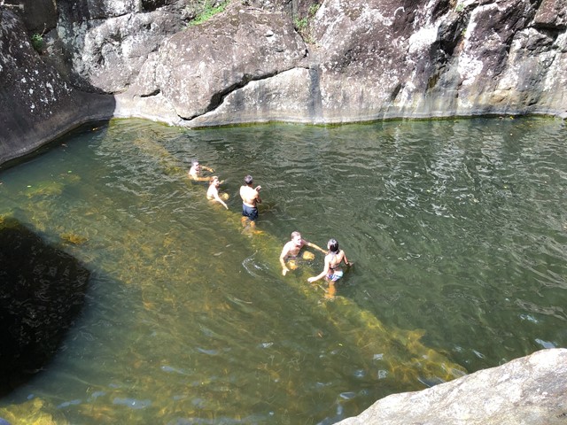
Lots of rock hopping and climbing waterfalls. Just over 2 km up the creek you come to a waterfall with a steep climb to a few great swimming holes.
Permits/Costs:
None.
Other References/Comments:
None provided.
GPS Tracks
- No GPS available for this walk yet.
Comments