


 12.4
12.4 10
10- Mt. Barney - Short Leaning Ridge (Mt Barney National Park)
- Mt Barney North Peak (Mt Barney National Park)
- Mt Barney East Peak via SE Ridge, traverse North Pinnacle to Leaning Peak, descend to Barney Gorge and Lower Portals (Mt Barney National Park)
- Mt Barney East Peak - South-East Ridge up and South Ridge down (Mt Barney National Park)
- Mt Barney - East Peak - Up Logan's - Down South (Mt Barney National Park)
Isolated Peak and Toms Tom
Mt Barney National Park
Menu

This walk is mostly off track and has some very exposed and challenging descents. The views are spectacular on clear days. A rope is almost obligatory (I didn't take one but I certainly would have used it to descend from Toms Tum if I had one). I would not recommend tackling this route in wet weather as there is a lot of rock scrambling and some sections of almost vertical rock climbing (descending). I had mobile phone reception on the top of Isolated Peak and Toms Tum.
Getting there
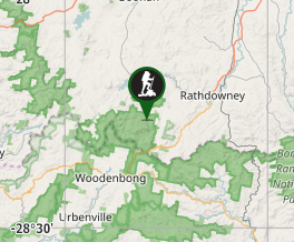
How do you get to the start of the walk? From Brisbane travel along Mt Lindsey Highway past Beaudesert and 1km beyond Rathdowney. Turn right into Boonah - Rathdowney Rd. Travel for seven kilometres to Barney View -Upper Logan Road turn off. Turn left and travel for 11.7km to the Yellow Pinch picnic ground. There is no camping at Yellow Pinch Picnic Ground. Camping is available at Mt Barney Lodge as are homesteads and cabins. To save a 6km walk back to Yellow Pinch carpark a car shuttle is recommended leaving a car at Lower Portals Carpark.
Maps
Which maps cover the area? Mt Lindesay Topographic 1:25 000 scale. This map is essential for this walk, as is a compass and detailed track notes. Mt Barney is notorious for low level clouds moving in and creating whiteout conditions which make navigation extremely challenging.
Route/Trail notes
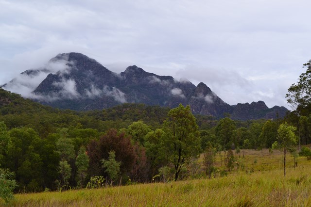
A detailed description of the walk! Leave carpark and return 600m along Upper Logan Rd to Barney Lodge turnoff. Head west across the grassy paddock to an old gravel logging road and follow it southwest and west uphill to a gate. Continue west then north west along the road following the crest of a ridge. Head through a second gate and continue downhill to a third gate and the national park boundary. The road continues uphill in a westerly direction and narrows to a footpad. Upon reaching a small rock cairn at GR 715 722 turn right away from Logan's ridge and contour north-west, then west. Cross a gully and a low ridge before descending into Rocky Creek below a small cascade. There are views here straight up the creek to North Peak. This is the last water until reaching Barney Creek so fill up here. I carried 4 litres for personal use and had one mouthful left by the time I arrived at Barney Creek.
Climb the opposite bank to the crest of North Ridge and contour northwards, then northwest to the top of the next ridge at GR711725. This ridge is hidden from view due to the dense undergrowth and may require some descending before climbing depending on how far northwest you have contoured. Contour westwards around this ridge close to the edge of a cliff. Cross a shallow gully and head towards the saddle between North Peak and Isolated Peak (North West Rock). There are extensive views east and west here with good views south to North and East Peaks and south west to Leaning & Bipoh Peaks.
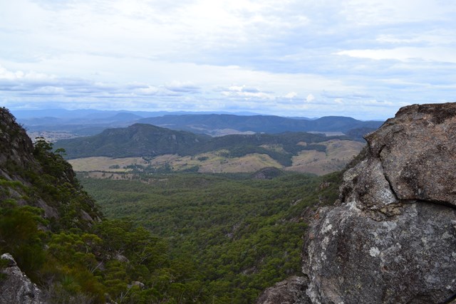
Travel north along this saddle up and down until reaching the final cliffs to Isolated Peak. Veer right until reaching a gully ignoring a false lead up a cleft in the rock. Climb this gully up to a saddle just below the peak. This climb is quite exposed particularly at the start. The views from this saddle are better than at the summit.
Continue uphill to the summit. Head north towards the next prominent peak of Toms Tum. You will need to veer left and right and left again to avoid the cliffs. This is a very steep descent but if you pick the right path should not present any real difficulties. There were places here I found it easier to slide down on my backside.
On reaching the saddle between Isolated Peak and Toms Tum continue north and start to climb. You will reach a narrow cleft which you will use to ascend this knoll. There are 4 knolls on Toms Tum to climb and descend. The last descent is extremely steep and exposed rock and a rope would be very useful here. I tried to descend in the middle, then to the right and eventually I descended to the next saddle on the left side. I did not find any easy route down this knoll.
From this saddle there is another knoll to climb at GR705740. Due to the steepness of this knoll I found it easier to veer around the right and to scale it from the east side heading north and then doubling back south west to the summit. From here the route heads north along Eagles Ridge descending steeply and eventually nor nor west to join the Lower Portals track just before it crosses Barney Creek.
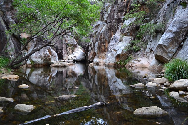
If you still have energy it is worth an 800m detour return to the Lower Portals for a swim. This detour is included in the total trip distance above. The track back to the Lower Portals Carpark is almost a highway after what you have just completed.
Permits/Costs
Do you need any permits? What's the cost? Nil unless camping.
Other References
How can I find more info? Any guide books? Take a Walk in South East Queensland by John & Lyn Daly (Logans Ridge and Eagles Ridge Walk).
GPS Tracks
- No GPS available for this walk yet.
Where
Click here to load this map.
Comments